Country:

 City:
City:


The starting point for this walk is at the roundabout in front of the Etxalar hotel. To get to this starting point by car, see the ‘Practical information’ section below.
(S/E) From the car park, retrace part of the road you have just come along and take the first wide dirt track on the right: this is known as the ‘Napoleon Trail’ and is signposted as the access route to two ‘ventas’. In the past, this path was used by Napoleon’s troops during their retreat in the Spanish War of Independence. When you reach a three-way junction, turn left and walk for a few dozen metres.
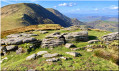
(1) Take the path to the right signposted ‘Aritzakun’. A little further on, go through the gate and head slightly to the left to reach the summit of the large rocky outcrop (you can see the upper part of the path). The final ascent is via a fairly wide, grassy passage between the rocks. Reach the summit of Antsestegiko Harria at an altitude of 824 m. There are no specific markings, as the summit is a very large rock.
(2) Retrace your steps just a tiny bit, then continue straight down to pass the Baratzabaleko Pass (783 m), before climbing gently straight up to reach the summit of Ansestegi, at an altitude of 806 m. It is marked by a cylindrical postbox. In the past, there was an axe stuck into the cylinder. The postbox is marked ‘Lizartzu’, but this is a mistake. Lizartzu is the peak you can see opposite, with its three military tunnels.
(3) Descend down the western slope (with no clearly defined path), heading towards several large trees further down, then continue almost straight on towards a brand-new hunting lodge.
(4) Walk past this wooden hunting lodge and, a few metres further on, take the faint path on the right. When you reach the last small tree where several paths branch off, take the path that descends to the left, along the mountainside, before coming out onto a wide track.
(5) Follow this track, keeping in the same direction.
(6) Just past the farm, leave the track and take a path on the right; a little further on, go through a gate. Continue along this path until you reach a small clearing:the shortcut shown as a dotted line on the maps has completely disappeared, overgrown with vegetation.
(7) Carry on to the left. Leave the track and take a barely visible path branching off to the right. Then, a few metres further on, at the fork, take the path on the right again. Continue for quite some time along this winding path through the middle of the forest until you reach a bridge.
(8) Cross the bridge, follow another stream heading due south-west, then cross it via another bridge. You’ll arrive at the village hall in the abandoned village of Aritzakun.
(9) Take the opportunity to have a stroll around the houses. Then resume your walk, cross the stream once more, and you’ll come out onto a tarmac road; follow this to the right.
(10) Leave this road shortly afterwards and turn left. Walk through the woodland, then out into the open to reach another tarmac road.
(11) Take this road on the left, pass close to Kantaneko Borda, and walk a good hundred metres.
(12) Be careful: leave the road and take the path on the right.
(13) From this point onwards, the climb is really very steep and very long. Take your time and admire the beautiful rocky outcrops alongside the path. You’ll come to a wider path and pass a building on your left.
(14) Navigate the bend to the right and follow the path until it joins the NA-9301.
(15) Turn right. This marks the end of the tough climb.
(16) Leave the road to the left, at a post marked with a white and yellow sign. Head towards the fence, then towards the wide path lined with tall trees on the right. Continue along this path, then head down towards two hunting hides and walk past them. Return to the road you left earlier at a fenced-off field on the left.
(17) Use the step-over to enter this field. Follow the fence, which is now on your right, and walk down the length of the field. At the bottom, you’ll come to a gate; leave the field using the step-over to the left of it. Return to the road and follow it to the left, skirting the hilltop known as Urlegi.
(18) Leave the road again by turning right onto a wide track: signposts are to the left of the road. Follow this track, which passes beside a large boulder, and you will return to the car park where you started (S/E).
 Association / Club / Walk leader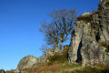

 Visorando Member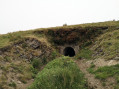
 Difficult