Country:
 City:
City:


The starting point for this walk is in the Partida del Figueral area, near Carrer Balcon de Biar in the village of Biar.
To get to this starting point by car, see the ‘Practical Information’ section below.
(S/E) From the car park, continue along the tarmac road which climbs up to the junction.
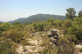
(1) Take the path on the right. It is locally known as the PR®-CV 155 and is marked in white and yellow. It is a botanical trail featuring small signs with the names of each plant you come across. You’ll need to follow it for a while, so simply follow the white and yellow markings. You’ll come to a Fork in the road.
(2) Take the path on the left until you reach the next junction.
(3) Turn left towards the sign.
(4) Continue straight ahead, following the direction of the red ‘Sender Botanic’ sign, until you reach a junction.
(5) Turn right.
(6) You’ll come out onto the ridge at a cairn and head left.
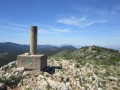
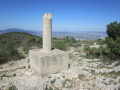
(7) You’ll reach the summit of the Serra del Flare, marked by a triangulation point (a cylinder on a cube) at an altitude of 1,043 metres. Continue along the path towards the large, clearly visible cairn. It’s a pleasant path that stays on the ridges, but is not difficult and doesn’t feel vertiginous. At the start, it’s almost flat.
(8) You’ll reach the start of the descent. You should take particular care as the paths are covered in small stones that tend to roll away underfoot.
(9) You’ll reach a spot called Remolcador at an altitude of 925 metres, a sort of pass where a superb tarmac road—reserved for emergency and fire-fighting services—joins the route. Continue straight ahead, then turn right to reach the summit of Peñarrubia at an altitude of 955 metres, marked by a small cairn.
(10) Head back the way you came and then begin the ascent of the Solana de Marrassà, an easy path along the ridges, followed by the descent. The path is easy to follow and there are numerous cairns.
(11) You’ll come out onto another path at a cairn; take this path by turning left. A short while later, you’ll come out onto a wide track; follow this to the right.
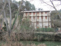
(12) Take a short round trip to see a very pretty restored well, then on your return, turn left and leave the track to take the path that climbs up to the left. You’ll reach a Fork in the road with a signpost.
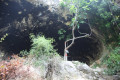
(13) Take a one-minute detour to the left to visit the huge Coveta Roja cave.
(13) On the way back, rejoin the path by heading left for a long climb towards the superb Peñas del Contador.
(14) You’ll reach a place called El Contador, which is effectively a pass at an altitude of 986 metres.
(15) Take a short round trip through the low vegetation to the exact spot of the Alt Redo summit at an altitude of 1,018 metres, marked by a fairly large circle of stones. Then return to the path and turn right.
(16) You’ll arrive at a place called Alt de Les Voltes, at an altitude of 942 metres. Then head left, following the sign for “Foietes”. At the end of the descent, you’ll reach a wide track; follow it to the left, and after a short while, you’ll rejoin part of the path you took earlier.
(1) Keep to the right to reach the car park (S/E).
 Visorando Member
 Moderate
 Easy
Easy