The Cabezo de la Sal in Pinoso

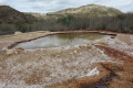
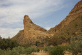
The Cabezo de la Sal is a rather special peak, dome-shaped and approximately 4 kilometres in diameter, containing a vast salt deposit which is still being mined. The route suggested here takes you to the summit, but also past various salt works and pipelines that carry the salt away for processing. You’ll also come across a gigantic cave.

Details

n°99421355
Creation:
Last update:
Last review:
–
  • Walking
    Activity: Walking
  • ↔
    Distance: 3.61 mi
  • ◔
    Average duration: 2h 30 
  • ▲
    Difficulty: Easy

  • ⚐
    Back to start: Yes
  • ↗
    Ascent: + 935 ft
  • ↘
    Descent: - 919 ft

  • ▲
    Highest point: 2,900 ft
  • ▼
    Lowest point: 2,008 ft

Description of the walk

The starting point for this walk is on Camino de Fatima in the town of Pinoso, also known as Els Pinos.
To reach this starting point by car, please refer to the ‘Practical Information’ section below.

For your information, the rating established by the French Hiking Federation (FFR) is as follows: IBP = 41, length = 5.7 kilometres and elevation gain = 340 metres. (These figures may sometimes differ from those given by Visorando; in this case, always use the higher figures to get an idea of the hike’s difficulty).

(S/E) From the car park, head towards the concrete track with a small kerb, but leave it almost immediately to take the dirt track on the left that leads uphill. Continue along this path. You will come to a junction.

(1) Turn left to see a cave.

(2) Explore the Grotte du Géant, a place steeped in legend. Retrace your steps back to the junction.

(1) Then turn left.

(3) You’ll reach a hilltop with six antennae. Head towards the last one and then take the dirt track that runs past it.

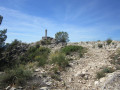
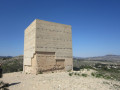
(4) Climb up to the summit of Cabezo de la Sal at an altitude of 892 metres, clearly visible with its geodetic benchmark (a cylinder on a cube). Continue a short way along the narrow path to the left, then head down towards a wooden post at the edge of a path, which you should take to the left.

(5) At the junction, take the path on the right.

(6) At the next fork, take the path on the left.

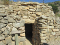
(7) Visit the ruins on the right, making a round trip, then return to the crossroads.

(7) Turn right.

(8) You’ll come to a tarmac road; follow it.

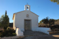
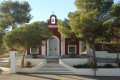
(9) At a bend, turn left. Visit the Ermita de Nuestra Señora de Fatima and its Stations of the Cross and enjoy the superb view, then retrace your steps.

(9) Finish the walk by turning left to return to the car park (S/E).

Waypoints

  1. S/E : mi 0 - alt. 2,011 ft - Camino de Fatima
  2. 1 : mi 0.53 - alt. 2,513 ft - Junction
  3. 2 : mi 0.61 - alt. 2,608 ft - Grotto of the Giant
  4. 3 : mi 0.96 - alt. 2,848 ft - Antennas
  5. 4 : mi 1.14 - alt. 2,894 ft - Summit
  6. 5 : mi 1.59 - alt. 2,753 ft - Junction
  7. 6 : mi 1.84 - alt. 2,782 ft - Junction
  8. 7 : mi 2.05 - alt. 2,746 ft - Ruins
  9. 8 : mi 2.11 - alt. 2,703 ft - Tarmac road
  10. 9 : mi 3.3 - alt. 2,057 ft - Return trip to the Ermita
  11. S/E : mi 3.61 - alt. 2,011 ft - Camino de Fatima

Notes

Driving directions to the start of the walk:
Head towards Pinoso on the CV-83. Drive past Pinoso and continue eastwards. After the 22-kilometre mark, turn right towards Enzebres and cross the road you have just left. At the stop sign, turn right: you are now on the CV-338 (or Carrer Pico). Continue straight on along Calle Baden de Rico Lucas. At the stop sign, carry on straight ahead, then at the roundabout turn left (you are now on the CV-836). Continue. Looking to the left of the road, look out for the restaurant La Torre, a chemist’s (farmacia) and finally an ice-cream parlour: then turn immediately into the street on the left (i.e. before a pedestrian crossing). This is a narrow street called Jacinto Benaverita. Carry on straight ahead along Calle Tejera de Roque and then straight on along Camino de Fatima (lined with trees). After a short while, you’ll see a 20 speed limit sign; the road curves to the right. There are some bins, a white stone bench and, most importantly, a Yellow Cross on the left. Park here without obstructing access to the various houses.

Worth a visit

The Giant’s Cave.

Legend has it that this cave was inhabited by a giant who terrorised the people of El Pinos. One day, whilst the giant was searching for food, he came across a small wooden mill. Upon opening it, he freed a fairy who had been trapped there for a long time; she told him that the mill was magical and could grant his wishes. First, he asked for water and drank his fill. As his second wish, he asked for oil so that he could cook. For his third wish, he asked for salt. But the mill slipped from his hands and fell into a hole in his cave, thus becoming inaccessible; yet it continued to function, producing salt. This is why the Cabezo del Sal is a mountain of salt.

In fact, two hundred million years ago there was a salt lake which, over time, became buried under sediment.

As for the cave, it was dug out by livestock farmers to extract the salt and feed it to their animals to make up for nutritional deficiencies.

Other walks in the area

For more walks, use our search engine .

The GPS track and description are the property of this route's author. Please do not copy them without permission.