


Bisserain73

 Visorando Member
 Premium user
- Location: Chambéry (73000)
- Gender: man
Sign up:
Published route(s)
 Mont des Acrays from Lac de Saint-Guérin
 7.30 mi
 +2,461 ft
 -2,497 ft
 5h 30
 Moderate
 Departure from Beaufort (Savoie) (Savoie)
A beautiful circular route for a long ridge walk with unobstructed views on both sides. Highlights include the majestic Mont Blanc, two large dam lakes, and the charming Beaufortain mountain pastures.
Lac de Brassa via Les Combettes
5.20 mi
+2,759 ft
-2,730 ft
4h 50
Moderate
Departure from Beaufort (Savoie) (Savoie)
Once you leave the forest, Mont Blanc is omnipresent. Then there is a lovely circular walk through the Combettes mountain pasture to discover Lac de Brassa at the foot of the Grand Mont. This is a circular walk with no technical difficulty.
Lac du Borgne via the Petit Borgne ridge
9.48 mi
+3,123 ft
-3,110 ft
7h 05
Moderate
Departure from Les Allues (Savoie)
Although situated in the heart of the Trois Vallées ski area, this walk retains a wild character. The marmots know this well, and it is not uncommon to spot them as you round a bend in the path.
Lac des Bataillères via Le Prec and the Bissorte Dam
9.83 mi
+3,048 ft
-3,035 ft
7h 10
 Difficult
Departure from Orelle (Savoie)
Two lakes in a single walk. Lake Bissorte is a key example of Savoie’s hydroelectric development. Lake des Bataillères, smaller and less well-known, has a wild, unspoilt character.
The Col de la Masse as seen from Plan d’Amont
5.51 mi
+2,864 ft
-2,861 ft
5h 00
Moderate
Departure from Aussois (Savoie)
A day’s hike in the Vanoise to reach the very rocky Col de la Masse at 2,922 m. The route offers stunning views of the region’s mountain ranges and far beyond.
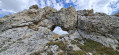
Plan Séry Pass and Lake
 7.73 mi
+3,488 ft
-3,478 ft
6h 35
Difficult
Departure from Champagny-en-Vanoise (Savoie)
This walk showcases some of the Vanoise’s highlights: glaciers, geology, wildlife, etc.
 Circular winter loop via the Crête d’Aillon
6.21 mi
+2,119 ft
-2,106 ft
6 hrs
Moderate
Departure from Aillon-le-Jeune (Savoie)
A pleasant route for exploring the Aillon ridge from south to north and enjoying a wide-open panorama.
You will find various types of signposting at intervals:GRP®, snowshoe markings and standard directional signs.
From Mouxy to the Saint-Maurice Chapel
4.83 mi
+673 ft
-679 ft
2h 50
 Easy
Departure from Mouxy (Savoie)
A country walk between Lac du Bourget and the foothills of Le Revard. Along the way, you will discover wash houses, a bread oven, a number of metal crosses perched on stone blocks, the slightly secluded Saint-Maurice Chapel, the old village of Clarafond, etc. And, weather permitting, more distant panoramic views.
There are no specific markings, but there are a few mountain bike markers here and there.
Crête du Paradis, La Buffaz, Sainte-Marguerite Chapel loop
5.27 mi
+1,831 ft
-1,831 ft
4 hrs
Moderate
Departure from Montaimont (Savoie)
A beautiful walk in the Montaimont cirque. The walk is described in a clockwise direction, but can also be done in the opposite direction.The markings, when visible, are those for the summer period. The route sometimes deviates from the official trail.The entire loop is well cleared, offering a vast panorama. Due to its orientation and modest altitude at the start, this hike is best enjoyed at the beginning of the season.There is no risk of snow slides on this route.
Chignin - Torméry themed walk
4.36 mi
+518 ft
-515 ft
2h 25
Easy
Departure from Chignin (Savoie)
A short walk for an afternoon in the sunshine in the vineyard. The route described is largely based on a local circular loop called: The winegrower's year.
In addition to the directional signs, there are yellow markings and pictograms (a winegrower working in the vineyard).
The route is marked at intervals by seven information panels.
Corsuet Forest and Cross
5.71 mi
+968 ft
-968 ft
3h 30
Easy
Departure from Aix-les-Bains (Savoie)
The Corsuet Forest is criss-crossed, indeed criss-crossed by numerous paths and trails. It is an open space that allows you to escape the urban environment whilst remaining close to the town.
The numerous signposts will provide useful guidance for walkers.
The route described here is just a modest example of the possibilities offered by the Corsuet Forest.
Here, the paths have taken their names from the animal kingdom.
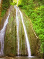
The Bridal Veil circular loop
 2.53 mi
+453 ft
-427 ft
1h 35
Easy
Departure from Chapeiry (Haute-Savoie)
A peaceful circular route for a short half-day hike, culminating in the discovery of the Cascade du Voile de la Mariée, whose drapery can vary depending on the flow of the Nant de l’Eau Salée stream.
Montgelas Circular – Croix de Chignin
7.41 mi
+2,060 ft
-2,067 ft
5h 10
Moderate
Departure from Savoie
This is a hike which, in its first section, follows little-used paths where the signposting is sparse.
The Montgelas ridge is marked by two crosses.
From (7), the signposting becomes more conventional.
The southern slope of Mont Jovet with a small circular path.
6.22 mi
+3,212 ft
-3,212 ft
5h 40
Difficult
Departure from Bozel (Savoie)
This hike on the southern slope of Mont Jovet offers beautiful views of the Vanoise and beyond.
The route is well cleared and best done early in the morning or in spring after the snow has melted, or on a beautiful autumn day.
La Petite Autane
6.96 mi
+3,094 ft
-3,091 ft
5h 55
Difficult
Departure from Ancelle (Hautes-Alpes)
This hike to La Petite Autane leads to a popular viewpoint. The suggested route includes a section off the marked trail and therefore unmarked, apart from the occasional cairn. A keen eye for observation and a good sense of direction are required; however, the destination is very often in sight and the landscape is wide open. The return journey follows a marked route.
The Col Rouge as seen from Pralognan-La-Vanoise
8.23 mi
+3,222 ft
-3,219 ft
6h 35
Difficult
Departure from Pralognan-la-Vanoise (Savoie)
This walk begins like a leisurely stroll. You’ll need to cover 4 km along theGR®55to climb 300 m, which gives you time to admire the scenery and imagine all there is to do in this beautiful Chavière valley. Then comes the ascent: nothing insurmountable, but you’ll need to keep at it, with a few sections where caution is advised. The landscape becomes increasingly rocky, rugged and jagged.
Fort de la Turra and Pas de la Beccia circular route
6.92 mi
+2,398 ft
-2,411 ft
5h 15
Moderate
Departure from Lanslebourg-Mont-Cenis (Savoie)
This circular route, which is mostly above 2,000 m, takes you to both French and Italian military heritage sites. It also offers beautiful views, particularly of the Vanoise and Lac du Mont Cenis. Marked by directional signs but also by numerous paint marks of all shapes and colours. However, look out for the blue stars on a white background.
From (3) to (6), the route is not very busy.
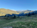
Loop to Le Grand Mont
 8.90 mi
+3,980 ft
-3,990 ft
7h 35
Difficult
Departure from Beaufort (Savoie) (Savoie)
In the heart of the Beaufortain massif, a beautiful summit offering a wide and distant panorama.Although not difficult, the final climb to reach the Grand Mont requires a minimum of attention to find your way. (!) 4 August 2025: user report: > However, I would like to point out that the western shore of Lac de St Guerin is closed to hikers by municipal decree due to the risk of rockfalls. The hike must therefore start and end on the eastern shore of the lake.
Le Grand Replomb
7.74 mi
+4,229 ft
-4,226 ft
7h 15
Difficult
Departure from Sainte-Agnès (Isère) (Isère)
This is a rather wild hike in Belledonne that requires a good sense of direction.
With the exception of the lower part, the markings, when they exist, are quite varied, with a few yellow marks, orange lines, blue dots and, above all, numerous cairns of all sizes.
There aretwo cable passages at (10).
Mont Charvin
5.10 mi
+2,526 ft
-2,500 ft
4h 35
Moderate
Departure from Saint-Jean-d'Arves (Savoie)
The unmissable hike in Saint-Jean-d'Arves.
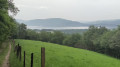
Les Granges and Le Villard from Barbizet
 3.45 mi
+620 ft
-604 ft
2h 10
Easy
Departure from La Motte-Servolex (Savoie)
A short walk above La Motte Servolex, offering rural scenery and panoramic views of the surrounding area.
The Roc de Torméry via the ladders, the Tapin, the Grotte de l’Ermite
6.88 mi
+3,166 ft
-3,169 ft
5h 55
Difficult
Departure from Chignin (Savoie)
From the Chignin vineyard, it takes a good two hours to reach the foot of the ladders that allow you to overcome the final obstacle. This structure was built in response to the threat posed by the Roc de Tormery to the village below. The view, already visible during the ascent, opens up as soon as you set foot on the ridge.
Mont Charvais, Croix de la Coche and Bec du Corbeau
5.41 mi
+1,890 ft
-1,883 ft
4h 10
Moderate
Departure from Saint-Baldoph (Savoie)
This circular route on the outskirts of Chambéry takes you to three vantage points offering panoramic views of the Belledonne mountain range, Les Bauges and La Chartreuse. On the outskirts of Mont Charvais, surrounded by pine trees, you can almost feel the Mediterranean atmosphere – all that's missing are the cicadas.
Towards Les Hauts de Chanaz
 4.23 mi
+942 ft
-935 ft
2h 45
Easy
Departure from Barberaz (Savoie)
This is a simple circular walk for a half-day excursion. It takes place in the foothills of the Chartreuse Mountains. Beautiful views of Les Bauges, Chartreuse, L'Épine and Lac du Bourget.
Around Mont Ronjou
 3.30 mi
+620 ft
-620 ft
2h 05
Easy
Departure from Saint-Jeoire-Prieuré (Savoie)
This is an easy hike to a small grassy peak overlooking the vineyards of Saint-Jeoire-Prieuré. Enjoy beautiful views of the Belledonne mountain range, the Chartreuse mountains and the Chambéry cluse. There are markings and even directional signs, but not along the entire route described.
From the Bassin du Flumet to Montouvrard
4.42 mi
+1,270 ft
-1,296 ft
3h 10
Moderate
Departure from Saint-Pierre-d'Allevard (Isère)
This is a half-day hike. A steady climb takes you to the village of Montouvrard, where you can enjoy beautiful views of Belledonne.
The yellow markings are a little faded.
 Crête de Montraillant from the Chapelle Blanche
 6.13 mi
+1,017 ft
-997 ft
3 hrs
Easy
Departure from La Chapelle-Blanche (Savoie) (Savoie)
A good half-day walk to enjoy panoramic views of the Chartreuse, the Vercors in the distance, Lauzière and the nearby Belledonnes.
Please note: there is an error. This hike is on foot and not by mountain bike as indicated.
Montmélian to Cruet circular loop
 4.54 mi
+1,214 ft
-1,184 ft
3h 10
Moderate
Departure from Montmélian (Savoie)
This circular route through the vineyards guarantees a sunny route. It also offers a panoramic view of the Belledonne Massif.
Depending on the time of year, you may see work being done in the vineyards.
The route is signposted.
Through the vineyards and the Marches plain
6.15 mi
+476 ft
-492 ft
3h 15
Moderate
Departure from Les Marches (Savoie)
An easy walk through the vineyards in search of sunshine, ending on the plain. Beautiful views of the region’s mountain ranges.
Montagne de Tigneux
4.18 mi
+2,910 ft
-2,910 ft
4h 25
Moderate
Departure from La Ferrière (Isère) (Isère)
A good hike that can be done from spring to autumn when snow conditions prevent you from going higher. However, you will be close to 2000 m.
Route around Combe Grenand
2.93 mi
+951 ft
-928 ft
2h 10
Easy
Departure from La Bridoire (Savoie)
An easy route, starting from the village of La Bridoire, offering an insight into contemporary history, whilst also providing the chance to marvel at the work of water which, over millennia, has shaped the geological features of what is now the Combe Grenand.There are various information boards along the route, including a series designed as a game for children.
The Glières Plateau
 7.93 mi
+1,696 ft
-1,696 ft
5h 10
Moderate
Departure from Thorens-Glières (Haute-Savoie)
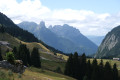
A peaceful hike through the plateau's mountain pastures, a place steeped in the history of the Glières maquis. The route also offers panoramic views of the region's mountain ranges.
Col du Loup and Pointe de la Sitre
6.17 mi
+3,081 ft
-3,071 ft
5h 30
Moderate
Departure from Saint-Mury-Monteymond (Isère)
A lovely day’s hike in Belledonne at the foot of some of its legendary peaks: Grand Pic de Belledonne, Petite and Grande Lance de Domène ...
Towards the Grand Arc from the Refuge de la Thuile
4.73 mi
+2,201 ft
-2,201 ft
4h 05
Difficult
Departure from Sainte-Hélène-sur-Isère (Savoie)
A beautiful hike in an area that is very open right from the start, with panoramic views of the Chartreuse, the Bauges, the Aravis and the Beaufortain. On the ridge, the views extend to include Mont Blanc, the Vanoise and the Écrins...
Circular Grands Moulins route via the Col and the Refuge de la Perrière
 5.54 mi
+2,831 ft
-2,815 ft
5h 00
Difficult
Departure from Arvillard (Savoie)
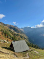
A beautiful hike in Belledonne towards a clearly visible summit. Between the Col de la Perrière and the summit, the ascent via the north-west ridge deviates from the classic route and is intended for experienced hikers.
Les Pas de la Coche and Les Pas du Pin and beyond from Prabert
8.43 mi
+2,710 ft
-2,713 ft
6h 15
Difficult
Departure from Laval (Isère)
This is a classic hike which, after the Pas de la Coche, enters the Belledonne Massif.
Hannibal is said to have taken this route.
There was even a road project between Grésivaudan and Le Rivier d'Allemont; the beautiful track between (6) and (7) is a remnant of this.
Today, the pass is used by shepherds, hikers, ski tourers, snowshoers and even tourist planes at an altitude higher than ours.
From La Plagne to the Chalet de l'Alpe or Habert Saint-Vincent
6.65 mi
+2,073 ft
-2,041 ft
7 hrs
Moderate
Departure from Entremont-le-Vieux (Savoie)
This is a snowshoe hike with no specific markings for this activity; however, theGR® 9 markings do exist, though they are less visible in winter conditions
The appeal of this hike lies not in the markings but rather in the atmosphere you experience along the route across the plateau.
Alpage de la Molière-Crête de Charande circular
7.01 mi
+1,650 ft
-1,654 ft
6 hrs
Moderate
Departure from Engins (Isère)
A lovely snowshoe outing in the Molière mountain pasture, offering a long view of the Charteuse, the Belledonnes and some peaks near the Vercors, such as Moucherotte and Pic Saint-Michel.
At the start, the wide path is obvious, higher up there are directional signs and green-yellow markings, sometimes yellow-red on the ridge.
Col d’Arclusaz from the Arolles car park
8.91 mi
+2,546 ft
-2,546 ft
6 hrs
Moderate
Departure from École (Savoie)
This description has been written for a snowshoe hike; the route differs significantly from the summer route. It crosses alpine pastures which should be bypassed in summer by staying on the track.
From Montmélian to La Roche du Guet, returning via the Col du Mont
5.92 mi
+3,084 ft
-3,091 ft
5h 25
Moderate
Departure from Montmélian (Savoie)
A good, challenging hike to reach La Roche du Guet and its two information boards.
La Croix du Léat
 4.42 mi
+2,438 ft
-2,418 ft
4 hrs
Moderate
Departure from Pinsot (Isère)
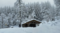
This hike was done on snowshoes, but it can of course be done on foot when there is no snow. Most of the route is marked, with no specific markings for snowshoeing.
The Bois de Chavot loop
4.98 mi
+2,887 ft
-2,877 ft
4h 50
Moderate
Departure from La Ferrière (Isère) (Isère)
The Bois de Chavot route is merely a pretext for a lovely route in the Belledonne massif. In this part of Belledonne, the chalets are numbered: the first chalet of this, the second chalet of that...This route is accessible for quite a long time during the season due to its moderate altitude of 1,860 m.The route is signposted, with a large section following theGRP®® “Tour du Pays d’Allevard”.
Landscapes of Lake Salagou
 7.43 mi
+738 ft
-728 ft
4h 05
Moderate
Departure from Clermont-l'Hérault (Hérault)
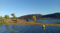
The artificial lake of Lac de Salagou has created an attraction that goes far beyond water sports and bathing. Geology, pastoralism, old villages, drystone shelters and vineyards complete the appeal of this region, which returns to peace and quiet at the end of summer.
Towards Lac du Mont Coua
 12.19 mi
+3,031 ft
-3,031 ft
8h 15
Difficult
Departure from Les Allues (Savoie)
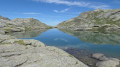
A hike in the Vanoise in search of the Lacs du Mont Coua. Mountain pastures, pastoral life, geology, torrents and glaciers add to the appeal of this outing.
Grande Sure from Col de la Charmette
 5.99 mi
+2,349 ft
-2,323 ft
4h 50
Moderate
Departure from Saint-Pierre-de-Chartreuse (Isère)
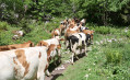
A fairly easy route to reach this summit in the Chartreuse mountains. However, the final ascent requires a bit of energy.
At Col de la Sure, you can enjoy a peaceful stroll through the mountain pastures.
Colle del Carro
10.06 mi
+3,652 ft
-3,665 ft
7h 50
Difficult
Departure from Bonneval-sur-Arc (Savoie)
The Refuge du Carro is already a lovely destination, but when you reach this first goal at the end of the morning and after seeing the panorama, there are various possibilities for a little extra treat. Why not the Col du Carro or Colle del Carro, as you can read on site?
The hundreds of cairns that dot the terrain are sure to catch your eye, as will the view of the Italian side.
Viewpoints and ridges of Le Revard
5.47 mi
+1,325 ft
-1,329 ft
3h 40
Moderate
Departure from Les Déserts (Savoie)
A pleasant route on the heights of Le Revard, combining a variety of points of interest.
Panoramic view of Aix-les-Bains and the lake, reminiscent of the old cable car and rack railway connections.
Poets' trail in summer. Panoramic views, mountain pastures and cheese...
Laisonnay Circular – Col du Palet – Col Grassaz
 14.15 mi
+4,170 ft
-4,154 ft
10h 10
Difficult
Departure from Champagny-en-Vanoise (Savoie)
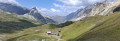
A beautiful hike in the Vanoise offering guaranteed spectacular views of the glacial landscape as well as the vibrant mountain pastures with on-site cheese production. Old chalets, mountain huts and a chapel, not to mention the ever-present marmots.
Discreet signposting.
Col and Tête Nord des Fours
7.77 mi
+3,166 ft
-3,960 ft
6h 20
Difficult
Departure from Bourg-Saint-Maurice (Savoie)
Using the shuttle bus in summer allows you to enjoy a lovely hike whilst shortening the route between Les Chapieux and La Ville des Glaciers.
The walk follows the Tour du Mont Blanc and one of its variants.
Lacs Robert from Le Recoin
 4.95 mi
+1,867 ft
-1,850 ft
3h 55
Difficult
Departure from Chamrousse (Isère)
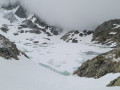
From Le Recoin, there are easy routes to visit the Robert Lakes. This description deviates slightly from the most commonly used trails, particularly from the Brèche Sud to reach Lac des Pourettes.