Circular winter loop via the Crête d’Aillon

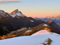
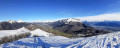
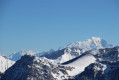
A pleasant route for exploring the Aillon ridge from south to north and enjoying a wide-open panorama.
You will find various types of signposting at intervals:GRP®, snowshoe markings and standard directional signs.

Details

n°18927891
Creation:
Last update:
Last review:
  • Snowshoeing
    Activity: Snowshoeing
  • ↔
    Distance: 6.21 mi
  • ◔
    Duration according to the author: 6 hrs 
  • ▲
    Difficulty: Moderate

  • ⚐
    Back to start: Yes
  • ↗
    Ascent: + 2,119 ft
  • ↘
    Descent: - 2,106 ft

  • ▲
    Highest point: 5,052 ft
  • ▼
    Lowest point: 3,074 ft

Description of the walk

Park near the start of the Rochettes chairlift in Aillon-le-Jeune.

(S/E) Follow the road south to the Saint-Blaise sign, then start climbing up the sunken path to the left of the small road, before crossing through the hamlet. Head south along the path once you’ve passed the last houses.

(1) Leave the path to head left up the rise and follow a wide curve back towards the Rochettes chairlift. After passing through a small copse, go under the chairlift and climb the steep slope to reach theGRP® Tour des Bauges trail.

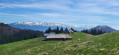
(2) Turn right onto it, following the yellow and red markings towards Morbié; it’s a good, slightly uphill, shaded path. This will take you to the Morbié farm.

(3) Pass above the farm and turn almost 180° to climb up to the Col de la Sciaz, which you’ll reach just after joining the track that descends from Mont Pela.

(4) Walk back up alongside the track and, via a steady climb, reach Mont Pelat.

(5) Descend for a long way northwards, following the ridge, with a few sections through woodland and a few short climbs, until you reach the Pré Condut signpost.

(6) Head down to the left towards Les Ginets along a steep slope through the woods before reaching the Chalets du Mont de la Vierge. Turn left and head towards the hamlet of Les Ginets, which is visible ahead; a few signposts will help you find your way.

(7) Make your way to the resort by crossing the meadows, then follow the ski lift runs to return to the car park at the Aillon-le-Jeune resort (S/E).


Waypoints

  1. S/E : mi 0 - alt. 3,074 ft - Aillon-le-Jeune car park
  2. 1 : mi 0.46 - alt. 3,186 ft - Path
  3. 2 : mi 0.86 - alt. 3,629 ft - GRP Massif des Bauges
  4. 3 : mi 2.3 - alt. 4,124 ft - Morbié Farm
  5. 4 : mi 2.62 - alt. 4,409 ft - Col de la Sciaz
  6. 5 : mi 3.44 - alt. 5,052 ft - Mont Pelat (massif des Bauges)
  7. 6 : mi 4.75 - alt. 4,518 ft - Pré Condut
  8. 7 : mi 5.47 - alt. 3,494 ft - Les Ginets
  9. S/E : mi 6.21 - alt. 3,077 ft - Aillon-le-Jeune car park

Notes

This description is for a snowshoe walk and crosses meadows which should be bypassed during the summer months.
Between (S/E) and (2), the route described is designed to avoid crossing the ski runs.
Note: in the hamlet of Saint-Blaise, it is possible to head directly to (2) without going via (1).

This route passes through multiple protected areas, which may be subject to special regulations:

Worth a visit

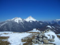
5:: At the summit: sweeping views, picnic table.

Reviews and comments

4 / 5
Based on 2 reviews

Reliability of the description
4 / 5
Ease of following the route
4 / 5
Route interest
4 / 5
Ismaël 74
Ismaël 74

Overall rating : 3.7 / 5

Date of your route : Mar 03, 2025
Reliability of the description : ★★★★☆ Good
Ease of following the route : ★★★★☆ Good
Route interest : ★★★☆☆ Average
Very busy route : No

The climb is in the shade… The final stretch up Mont Morbiè, with its views, makes up for the lack of interest in this hike. But that’s just my opinion.

Machine-translated

Deuxpattes
Deuxpattes

Overall rating : 4.3 / 5

Date of your route : Apr 05, 2022
Reliability of the description : ★★★★☆ Good
Ease of following the route : ★★★★☆ Good
Route interest : ★★★★★ Very good
Very busy route : No

A really, really lovely walk that’s well worth the detour for the 360° view from the summit.
There wasn’t enough snow that day to use snowshoes. However, there was enough snow to obscure the path at point 6, and the descent – steep and uncertain (with only a few wooden signs on trees…) – was perilous.

We didn’t come across a single hiker!

Thanks for this post!

Machine-translated

Other walks in the area

For more walks, use our search engine .

The GPS track and description are the property of this route's author. Please do not copy them without permission.