Lac des Bataillères via Le Prec and the Bissorte Dam

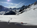
Two lakes in a single walk. Lake Bissorte is a key example of Savoie’s hydroelectric development. Lake des Bataillères, smaller and less well-known, has a wild, unspoilt character.

Details

25892499
Creation:
Last update:
Last review:
  • Walking
    Activity: Walking
  • ↔
    Distance: 9.83 mi
  • ◔
    Average duration: 7h 10 
  • ▲
    Difficulty: Difficult

  • ⚐
    Back to start: Yes
  • ↗
    Ascent: + 3,048 ft
  • ↘
    Descent: - 3,035 ft

  • ▲
    Highest point: 7,953 ft
  • ▼
    Lowest point: 5,531 ft

Description of the walk

Access: from the D1006 at Orelle La Praz, first head for the lower station of the EDF Bissorte cable car, then follow a long track in good condition. Just before you arrive, head towards Valmeinier to park directly opposite the cable car.

(S/E) From the car park, continue along the track for a good fifty metres until you reach the start of a path.

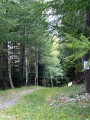
(1) Turn left and start climbing; you’ll soon reach a large clearing. Cross it, keeping more or less directly opposite the cable car, and continue the climb through the woodland until you reach a junction.

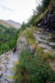
(2) Ignore the path branching off to the left – this is the route you’ll take on the way back. The climb continues more or less directly below the cable car along a good path, with some straight sections and others winding in hairpin bends. Some sections are fitted with guardrails to protect against the drop. You’ll eventually emerge at the far end of the dam.

(3) Follow the lakeshore for a long stretch along an almost level path. Towards the southern end of the lake, the path begins to climb; do not head down towards the lake.

(4) With the Refuge des Marches clearly in view, head right, following the signposts on the ground. Join theGRP® Tour du Mont Thabor trail and follow it, keeping in the same direction.

(5) Walk past the refuge to quickly reach a junction.

(6) Continue south. The path, part of theGRP® Tour du Mont Thabor, climbs up to Lac des Bataillères.

(7) Turn back to the fork in the path before the refuge.

(6) Take the path that climbs to the right. After a few tight bends, you’ll reach a junction.

(8) Let the path to the Col des Sarrasins branch off to the right, and continue to the left. This is a balcony path, sometimes narrow, with sections where you need to be careful. The route overlooks Lac de Bissorte and eventually descends to the dam.

(9) Cross over to the other side of the arch and descend along the sheltered path. You’ll reach the next junction.

(10) Ignore the path on the right leading to the Prec d’en bas and take the path on the left which continues down to the Ruisseau de Bissorte. Cross the stream via the metal footbridge, then begin the ascent and rejoin the route you took on the way up.

(2) Carry on to the right and follow the path back the way you came to reach the car park (S/E).

Waypoints

  1. S/E : mi 0 - alt. 5,531 ft - Car park
  2. 1 : mi 0.04 - alt. 5,545 ft - Start of the trail
  3. 2 : mi 0.26 - alt. 5,755 ft - Junction of the circular loop
  4. 3 : mi 1.2 - alt. 6,847 ft - Dam
  5. 4 : mi 2.41 - alt. 6,913 ft - Southern end of Lake Bissorte
  6. 5 : mi 3.13 - alt. 7,251 ft - Refuge des Marches
  7. 6 : mi 3.27 - alt. 7,283 ft - Junction: A/ straight on - R/ to the right
  8. 7 : mi 4.63 - alt. 7,946 ft - Lac des Bataillères
  9. 8 : mi 6.25 - alt. 7,487 ft - Junction, turn left
  10. 9 : mi 8.33 - alt. 6,857 ft - Dam
  11. 10 : mi 8.88 - alt. 6,083 ft - Junction, turn left
  12. S/E : mi 9.83 - alt. 5,531 ft - Car park

Notes

(9) You can cross the dam and rejoin (3) to head back down via the reverse route of the outward journey.

Reviews and comments

4.1 / 5
Based on 3 reviews

Reliability of the description
4 / 5
Ease of following the route
4 / 5
Route interest
4.3 / 5
nxt6980
nxt6980
• Edited:

Overall rating : 5 / 5

Date of your route : Jun 12, 2025
Reliability of the description : ★★★★★ Very good
Ease of following the route : ★★★★★ Very good
Route interest : ★★★★★ Very good
Very busy route : No

The only difficulty is getting to the car park without scraping the bottom of your car. The road is passable all the way to the Prek car park, but take care with your vehicle.
As for the hike, it's nothing complicated: a loop around the lake, climbing up to Lac des Bataillères while cooling off at the refuge below. Everything is very well marked, with no particular difficulties. The view from the top is simply magnificent; it's a real haven of peace. I highly recommend it

Machine-translated

brunocatania13
brunocatania13

Overall rating : 2.7 / 5

Date of your route : Aug 06, 2024
Reliability of the description : ★★★☆☆ Average
Ease of following the route : ★★☆☆☆ Disappointing
Route interest : ★★★☆☆ Average
Very busy route : No

From Valmenier, the track is closed to traffic (starting point indicated by Waze via the Visorando app). Even if it were open, the gradient and the condition of the road make it extremely difficult.
Consequently, if you want to reach the starting point, this adds 16 km there and back along an extremely monotonous forest track.
On the other hand, the arrival at Lac lives up to all expectations.

Machine-translated

Dan73
Dan73

Overall rating : 4.7 / 5

Date of your route : Jul 18, 2023
Reliability of the description : ★★★★☆ Good
Ease of following the route : ★★★★★ Very good
Route interest : ★★★★★ Very good
Very busy route : No

The access track leading to the start of the hike is not very passable in a light vehicle from La Praz power station.

Machine-translated

Other walks in the area

For more walks, use our search engine .

The GPS track and description are the property of this route's author. Please do not copy them without permission.