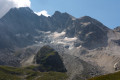
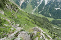
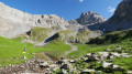
The Col Rouge as seen from Pralognan-La-Vanoise

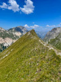
This walk begins like a leisurely stroll. You’ll need to cover 4 km along theGR®55to climb 300 m, which gives you time to admire the scenery and imagine all there is to do in this beautiful Chavière valley. Then comes the ascent: nothing insurmountable, but you’ll need to keep at it, with a few sections where caution is advised. The landscape becomes increasingly rocky, rugged and jagged.

Details

n°15308950
Creation:
Last update:
Last review:
  • Walking
    Activity: Walking
  • ↔
    Distance: 8.23 mi
  • ◔
    Average duration: 6h 35 
  • ▲
    Difficulty: Difficult

  • ⚐
    Back to start: Yes
  • ↗
    Ascent: + 3,222 ft
  • ↘
    Descent: - 3,219 ft

  • ▲
    Highest point: 8,957 ft
  • ▼
    Lowest point: 5,735 ft

Description of the walk

Park at the Pont de la Pêche car park.

(S/E) Set off southwards towards the Col de Chavière. Take the lovely track that forms part of theGR®55. About 100 m after setting off, you’ll reach the first junction.

(1) Stay on theGR®55, taking the track that begins to climb to the right. After two hairpin bends, the track heads south again; keep going in this direction to reach the Refuge du Roc de la Pêche.

(2) Walk past the refuge, staying on theGR®55; the path is now almost flat. Continue along this track for some time – this is a chance to take in the scenery at your leisure. Walk past the Ritort mountain pasture and, shortly afterwards, you’ll reach a junction.

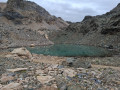
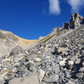
(3) Leave the track and turn right towards: Col du Soufre – Col Rouge, 2 hrs. The walk is now over. The ascent begins; there is about 700 m of elevation gain and just under 3 km to reach the Col Rouge, where the next signpost is located. In the meantime, stay on the well-marked, winding path, which is sometimes narrow and sloping. Cross three scree slopes, keeping a close eye out for the cairns amongst the enormous piles of stones. Shortly before the pass, cross a ravine that has been eroded by rockfalls; the path is very narrow for a few metres here. Reach the Col Rouge (2,731 m).

(4) Follow the route in the opposite direction to return to the car park (S/E).

Waypoints

  1. S/E : mi 0 - alt. 5,735 ft - Pont de la Pêche car park, along the - Doron de Bozel (rivère)
  2. 1 : mi 0.08 - alt. 5,755 ft - Y-junction
  3. 2 : mi 1.01 - alt. 6,296 ft - Refuge du Roc de la Pêche
  4. 3 : mi 2.47 - alt. 6,696 ft - Leaving the track
  5. 4 : mi 4.1 - alt. 8,957 ft - Col Rouge (2730m)
  6. S/E : mi 8.23 - alt. 5,738 ft - Pont de la Pêche car park

Worth a visit

Ritort mountain pasture: cheese production and sales.

Always be cautious and plan ahead when you're outdoors. Visorando and the author of this route cannot be held responsible for any accidents occurring on this route.

The GR® and PR® markings are the intellectual property of the Fédération Française de Randonnée Pédestre.

Reviews and comments

4.7 / 5
Based on 1 review

Reliability of the description
5 / 5
Ease of following the route
5 / 5
Route interest
4 / 5
danielfr40
danielfr40

Overall rating : 4.7 / 5

Date of your route : Sep 06, 2022
Reliability of the description : ★★★★★ Very good
Ease of following the route : ★★★★★ Very good
Route interest : ★★★★☆ Good
Very busy route : No

Not too difficult a walk. A few steep or narrow sections where you need to take care on the way down. But otherwise the path is always clearly visible, the scree sections are well-maintained, and there’s never any overhang
Thanks for this guide

Machine-translated

Other walks in the area

For more walks, use our search engine .

The GPS track and description are the property of this route's author. Please do not copy them without permission.