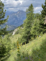
La Petite Autane

This hike to La Petite Autane leads to a popular viewpoint. The suggested route includes a section off the marked trail and therefore unmarked, apart from the occasional cairn. A keen eye for observation and a good sense of direction are required; however, the destination is very often in sight and the landscape is wide open. The return journey follows a marked route.

Details

15655216
Creation:
Last update:
Last review:
  • Walking
    Activity: Walking
  • ↔
    Distance: 6.96 mi
  • ◔
    Average duration: 5h 55 
  • ▲
    Difficulty: Difficult

  • ⚐
    Back to start: Yes
  • ↗
    Ascent: + 3,094 ft
  • ↘
    Descent: - 3,091 ft

  • ▲
    Highest point: 8,245 ft
  • ▼
    Lowest point: 5,315 ft

Description of the walk

Park at the Rouanne Haute car park.

(S/E) From the car park, head towards Petite Autane following the signposts, cross a stream and shortly afterwards reach a junction.

(1) Take the wide track that climbs to the right, pass a chalet, and cross another stream. Pass a sheepfold and arrive near a cross, then shortly afterwards at a junction.

(2) Here, ignore the path that branches off to the right. Continue left along the path, which winds in wide switchbacks up the hillside to reach another junction.

(3) Leave the signposted route for Petite and Grande Autane and head left, slightly downhill, towards Le Cuchon. Pass through a first valley, then a second, more pronounced one, and continue for a few dozen metres.

(4) Turn right. You are now on the off-trail, unmarked section of the hike. As you climb up the slope, the route heads westwards at first, roughly parallel to a blue trail shown on the IGN map (ski touring).

(5) Around the 2361 mark, the route turns sharply north to reach the summit of the Petite Autane. The climb is at times very steep and requires a good sense of direction.

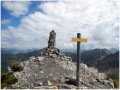
(6) From the summit, follow the path down the ridge to the right. This steep, well-marked path is also dotted with yellow markings and cairns. It levels out at the Col du Seigneur and a final climb takes you to the Tête du Seigneur (cairn).

(7) Continue down the route along the ridge, which includes a few very steep sections. This will take you to the Col de Combeau.

(8) Cross over to the right-hand (eastern) slope, where the path once again winds in wide switchbacks up the hillside to reach the Pra Mau junction.

(9) Take the most direct route down via the path you came up to return to the car park (S/E).

Waypoints

  1. S/E : mi 0 - alt. 5,325 ft - Rouanne Haute car park
  2. 1 : mi 0.08 - alt. 5,318 ft - Rouanne Haute
  3. 2 : mi 0.74 - alt. 6,024 ft - Croix de Lombard
  4. 3 : mi 1.62 - alt. 6,631 ft - Serre du Milieu
  5. 4 : mi 1.94 - alt. 6,578 ft - Start of the off-trail section
  6. 5 : mi 2.66 - alt. 7,694 ft - Elevation 2631, change of direction
  7. 6 : mi 2.91 - alt. 8,245 ft - Petite Autane
  8. 7 : mi 3.73 - alt. 7,694 ft - Tête du Seigneur
  9. 8 : mi 3.94 - alt. 7,543 ft - Col de Combeau
  10. 9 : mi 4.57 - alt. 7,113 ft - Pra Mau
  11. S/E : mi 6.96 - alt. 5,322 ft - Rouanne Haute car park

Reviews and comments

5 / 5
Based on 2 reviews

Reliability of the description
5 / 5
Ease of following the route
5 / 5
Route interest
5 / 5
nicoslv
nicoslv

Hello, and thank you for this lovely walk, but in my opinion it’s still best to do it the other way round. The fairly steep climb off the beaten track, with no clear destination in sight (you can’t see the summit), might put some people off. I’m planning to do it again very soon and am thinking of doing a round trip via the Col de Combeau – it’s certainly longer, but it’s lovely and offers a different view from the other direction.
Stunning views of the Écrins!

Yes, the summit is visible but obscured towards the end… and the route seems long… according to the group, the climb is gentler and more pleasant on the other side. It’s just a point of view; it’s obviously doable. My opinion is purely my own and isn’t meant to put off future hikers.
The book you mention is one of my greatest sources of inspiration over the last few years, along with the one on the Ubaye.

Machine-translated

Britanicus100
Britanicus100

The summit is clearly visible from below. See my video in my previous review, where I show the route. Bernard Ranc, a mountain guide, has also completed the route in the same direction. The route is featured in his book
"The Most Beautiful Hikes in the Southern Alps".

Machine-translated

nicoslv
nicoslv

Overall rating : 5 / 5

Date of your route : May 21, 2022
Reliability of the description : ★★★★★ Very good
Ease of following the route : ★★★★★ Very good
Route interest : ★★★★★ Very good
Very busy route : No

Hello, and thank you for this lovely walk, but in my opinion it’s still best to do it the other way round. The fairly steep climb off the beaten track, with no clear destination in sight (you can’t see the summit), might put some people off. I’m planning to do it again very soon and am thinking of doing a round trip via the Col de Combeau – it’s longer, of course, but lovely, with a different view from the other direction.
Stunning views of the Écrins!

Machine-translated

Britanicus100
Britanicus100

Overall rating : 5 / 5

Date of your route : Apr 25, 2014
Reliability of the description : Not used / Not applicable
Ease of following the route : Not used / Not applicable
Route interest : ★★★★★ Very good
Very busy route : No

I completed this route, which is considered one of the most beautiful in the Southern Alps, in 2014.
At the time, I wrote the route guide on the Altitude Rando website – where I’m also a contributor – but forgot to publish it on Visorando.

It’s great that one of my colleagues thought of it, as the route really deserves it.

At the time, I made a video on Dailymotion featuring a panorama and the names of the peaks, showing the route and some key points along the way. Here’s the link to that video, which is now on YouTube – I hope it inspires you to give this hike a go.

Machine-translated

Other walks in the area

For more walks, use our search engine .

The GPS track and description are the property of this route's author. Please do not copy them without permission.