Country:

 City:


From Aussois, take the road to the car park at the foot of the Plan d’Amont dam. You’ll need to drive past the large quarry car park to reach the foot of the dam.
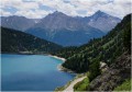
(S/E) Facing the monumental dam wall, head left along a good track which runs alongside – and above – the right bank of Lake Plan d’Amont. This will take you to the Pont de la Sétéria, at 2,215 m.
(1) Ignore the paths leading off to the right towards the Col d’Aussois and take the path starting on the left towards the Col de la Masse. A signpost indicates the Col de la Masse is 2h30 away. Climb gradually along this path until you reach a junction on a level stretch of ground.
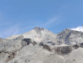
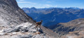
(2) First, ignore an inconspicuous, unmarked track leading off to the right towards the Refuge d’Aussois, then a second one to the left, signposted for the Col du Barbier. In fact, you must continue westwards to begin an ascent that will become increasingly steep through a very rocky landscape. You may sometimes need to choose your own route and not hesitate to use your hands; markings consisting of a red line on a white square background can help with navigation. This will take you to the 2,903-metre point, which is not the actual Col de la Masse.
(3) Take the path on the right, which quickly leads to the Col de la Masse, at the sign for Col de la Masse 2,922 m.
(4) Descend back to the car park, initially following the red markings, which are easier to spot on the way down, as the path is slightly easier to walk on at this stage. You will soon rejoin the route you took on the ascent and follow it in the opposite direction back to the car park (S/E).

 Visorando Member
 Difficult

 Very difficult

 Tourism professional