Plan Séry Pass and Lake

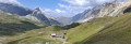
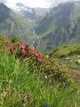
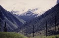
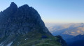
This walk showcases some of the Vanoise’s highlights: glaciers, geology, wildlife, etc.

Details

n°23862684
Creation:
Last update:
–
Last review:
  • Walking
    Activity: Walking
  • ↔
    Distance: 7.73 mi
  • ◔
    Average duration: 6h 35 
  • ▲
    Difficulty: Difficult

  • ⚐
    Back to start: Yes
  • ↗
    Ascent: + 3,488 ft
  • ↘
    Descent: - 3,478 ft

  • ▲
    Highest point: 8,573 ft
  • ▼
    Lowest point: 5,108 ft

Photos

Description of the walk

From Champagny-en-Vanoise, first head to Champagny le Haut via a narrow road and continue to the large car park at Laisonnay d’en bas.

(S/E) From the car park, head towards the hamlet and cross the footbridge over the Py torrent.

(1) After the footbridge, turn left to follow the winding path that climbs up the left bank of the torrent. After a steep climb, you’ll reach a small building at Les Caves on the opposite bank.
Normally, you would cross the torrent here via a wooden footbridge, but this was out of service in July 2022.

(2) Continue climbing, following the left bank of the torrent as closely as possible. You will then reach the Refuge de Plaisance on your left, on the opposite bank.

(3) Carry on through a wetland area towards the bottom of the valley until you reach another footbridge.

(4) Turn right to climb the path which ascends in successive stages, notably the Plan Séry section; it is easy to follow all the way to the Col du Plan Séry.

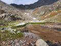
(5) From the pass, take a short detour down to Lac du Plan de Séry.

(6) Then head back up to the path leading to the pass and turn left, following the route in the opposite direction to your outward journey, until you reach the footbridge you did not cross on the way there.

(4) This time, cross the footbridge to follow the path along the right bank and reach the Refuge de Plaisance.
Cross the stream to rejoin the route you took on the way up.

(3) Follow it to the right, downhill, in the opposite direction to your outward journey, to return to the car park (S/E).
Waypoints

  1. S/E : mi 0 - alt. 5,112 ft - Lower Laisonnay car park
  2. 1 : mi 0.22 - alt. 5,157 ft - Footbridge
  3. 2 : mi 1.38 - alt. 6,798 ft - Les Caves
  4. 3 : mi 1.71 - alt. 7,119 ft - Refuge de Plaisance
  5. 4 : mi 1.87 - alt. 7,192 ft - Footbridge
  6. 5 : mi 3.83 - alt. 8,560 ft - Col du Plan Séry (2609m)
  7. 6 : mi 3.95 - alt. 8,494 ft - Lac du Plan de Séry
  8. S/E : mi 7.73 - alt. 5,108 ft - Lower Laisonnay car park

Notes

The Refuge de Plaisance is undergoing renovation during the summer of 2022.
Toilets at the car park.

Reviews and comments

5 / 5
Based on 1 review

Reliability of the description
5 / 5
Ease of following the route
5 / 5
Route interest
5 / 5
quito84
quito84

Overall rating : 5 / 5

Date of your route : Sep 08, 2026
Reliability of the description : ★★★★★ Very good
Ease of following the route : ★★★★★ Very good
Route interest : ★★★★★ Very good
Very busy route : No

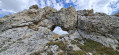
A really lovely walk! A steady climb up to the ‘Des Caves’ hut. The two plateaus (Essérieux and Plan Séry) are stunning! Stunning views throughout the hike. The lake was a bit dreary at this time of year… Don’t miss the beautiful natural arch just before the pass on the left (altitude approx. 2,550 m) Didn’t spot any ibex that day… Return from the refuge along the right bank of the Py, then across the footbridge and back down via the waterfall, just as on the way up. Thanks for suggesting this route.

Machine-translated

Other walks in the area

For more walks, use our search engine .

The GPS track and description are the property of this route's author. Please do not copy them without permission.