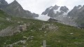
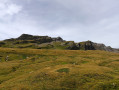
Col and Tête Nord des Fours

Using the shuttle bus in summer allows you to enjoy a lovely hike whilst shortening the route between Les Chapieux and La Ville des Glaciers.
The walk follows the Tour du Mont Blanc and one of its variants.

Details

n°2299424
Creation:
Last update:
Last review:
  • Walking
    Activity: Walking
  • ↔
    Distance: 7.77 mi
  • ◔
    Average duration: 6h 20 
  • ▲
    Difficulty: Difficult

  • ⚐
    Back to start: No
  • ↗
    Ascent: + 3,166 ft
  • ↘
    Descent: - 3,960 ft

  • ▲
    Highest point: 9,035 ft
  • ▼
    Lowest point: 5,075 ft

Description of the walk

(S/E) From the La Ville des Glaciers shuttle bus stop, take the track that climbs alongside the buildings. After passing the sixth 150-metre hairpin bend, leave the track.

(1) Take the path branching off to the left, which turns into a trail through the mountain pasture, and rejoin the track 30 metres before the Chalets des Tufs.

(2) Leave the track again and turn left onto the path at the hairpin bend. Follow this path uphill for a long stretch, keeping the Tufs stream on your left. Then, after crossing a few tributaries of the torrent, you’ll reach a junction.

(3) Continue climbing, turning left. At a slight plateau, you’ll reach a junction. Let the path to Lac de Mya branch off to the left.

(4) Continue the ascent until you reach the Col des Fours.

(5) Turn right, cross a scree slope to rejoin a good path leading to the Tête Nord des Fours.

(6) Return via the same route to the previous junction.

(5) Descend south-west at first, then south to reach the memorial stone at the Col du Bonhomme.
Continue down to reach the Col de la Croix du Bonhomme refuge and its orientation board.

(7) Look out for theGR® Tour du Mont Blanc path, which sets off to the east of the building. After a long descent, you’ll reach a bridge over the Raja torrent.

(8) After the bridge, turn left onto the track; 350 metres further on, you’ll reach a junction.

(9) Leave the track. Head down the path to reach Les Chapieux (S/E).

Waypoints

  1. S : mi 0 - alt. 5,869 ft - ‘Ville des Glaciers’ shuttle bus stop. Near the - Torrent des Glaciers (torrent)
  2. 1 : mi 0.71 - alt. 6,243 ft - Path to the left
  3. 2 : mi 1.12 - alt. 6,545 ft - Les Tufs
  4. 3 : mi 1.92 - alt. 7,208 ft - Turn left at the fork
  5. 4 : mi 2.52 - alt. 7,867 ft - Junction
  6. 5 : mi 3.09 - alt. 8,763 ft - Col des Fours
  7. 6 : mi 3.45 - alt. 9,035 ft - Tête Nord des Fours 2756m
  8. 7 : mi 4.79 - alt. 8,009 ft - Refuge du Col de la Croix du Bonhomme
  9. 8 : mi 6.76 - alt. 5,886 ft - Bridge over the Raja
  10. 9 : mi 6.99 - alt. 5,751 ft - Towards Les Chapieux
  11. E : mi 7.77 - alt. 5,075 ft - Les Chapieux car park

Notes

To reach the start of the Ville des Glaciers:
Park at Les Chapieux; the shuttle bus takes 20 minutes to reach La Ville des Glaciers.
In summer, the shuttle runs between 8.30 am and 5.30 pm; during these hours, traffic is restricted.
Note: (From 1 to 2) it is possible to stay on the track; it’s just a little longer.
From (1 to 5), this is a variant of the TMBGR® route
(6) Tête Nord des Fours: Orientation board – Panorama.

Snowfields may be present above 2,500 m in July and August.

On IGN maps, the Col de la Croix du Bonhomme is not located at the WPT

Always be cautious and plan ahead when you're outdoors. Visorando and the author of this route cannot be held responsible for any accidents occurring on this route.

The GR® and PR® markings are the intellectual property of the Fédération Française de Randonnée Pédestre.

Reviews and comments

5 / 5
Based on 1 review

Reliability of the description
5 / 5
Ease of following the route
5 / 5
Route interest
5 / 5
domi73
domi73

Overall rating : 5 / 5

Date of your route : Aug 07, 2023
Reliability of the description : ★★★★★ Very good
Ease of following the route : ★★★★★ Very good
Route interest : ★★★★★ Very good
Very busy route : No

A lovely day’s hike. The day after a snowfall – even in August. There are always groups passing by, which means that, if you’re on your own, you don’t feel in danger when conditions get a bit trickier.
The climb from the ‘Ville des Glaciers’ is quite steep and marshy, despite the ongoing works. A lovely, long descent towards Les Chapieux from the Refuge de la Croix du Bonhomme. The landscape, the light and the flora are magnificent!

Machine-translated

Other walks in the area

For more walks, use our search engine .

The GPS track and description are the property of this route's author. Please do not copy them without permission.