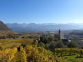
Through the vineyards and the Marches plain

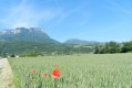
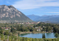
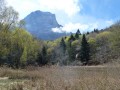
An easy walk through the vineyards in search of sunshine, ending on the plain. Beautiful views of the region’s mountain ranges.

Details

4819420
Creation:
Last update:
Last review:
  • Walking
    Activity: Walking
  • ↔
    Distance: 6.15 mi
  • ◔
    Average duration: 3h 15 
  • ▲
    Difficulty: Moderate

  • ⚐
    Back to start: Yes
  • ↗
    Ascent: + 476 ft
  • ↘
    Descent: - 492 ft

  • ▲
    Highest point: 1,283 ft
  • ▼
    Lowest point: 853 ft

Description of the walk

Parking in the centre of the village of Les Marches (town hall, post office, shops, etc.).

(S/E) Head towards the roundabout on the D1090, then turn right down Chemin de Crincaille, which is already lined with vineyards. At the junction with Route du Lac Saint-André, turn right and then right again immediately afterwards onto Chemin de Poisy. Continue to the junction with Chemin de Cresmont.

(1) Turn left and, shortly afterwards, turn right onto Chemin des Lauriers and follow it until you reach a junction with a road on the left.

(2) Follow the road to the left, pass through a first junction, then a second, and reach a crossroads.

(3) Turn left onto Route des Fontanettes, pass through the Col de Dijoud, then head down the road, ignoring all left-hand turnings. Pass the first junction on the right and continue to a further Y-junction.

(4) Head up the small road on the right (Chemin des Combes de Truchon), which will soon turn into a good track. Follow the yellow signposts to join the Chemin des Gandy. Turn right onto this road, which will soon start to descend, ignoring various junctions. Reach the Chemin de la Redoute and follow it to the left until you reach a junction.

(5) Head downhill to the right along the Chemin des Fromagets, coming out onto the Route du Lac Saint-André: __take care of the traffic.
__
(6) Cross the road, head downhill for 50 m and turn right onto the track which rejoins the road a little further down. Continue right along the road and, 100 m further on at the crossroads, turn right (south) towards Chapareillan for about 500 m until you reach a junction.

(7) Turn left (no signpost) onto the track, and walk for a long stretch on level ground through the vineyard. Cross the D1090 and first turn left then right to continue along the Chemin de la Corne. At the junction, follow the road to the right leading to the hamlet of Murs. In the hamlet, you’ll reach a junction with a signpost.

(8) Head down to the left towards the plain until you reach a crossroads.

(9) Take the path on the left (unmarked), following a stream, and when you reach the area below the village of Les Marches, join a track.

(10) Head up to the left along the stony track, pass the cemetery, then turn left onto the Chemin de la Placette. Return to the roundabout where you started and go round it on the right to reach the village centre and the car park (S/E).

.

Waypoints

  1. S/E : mi 0 - alt. 1,063 ft - Car park at Les Marches Town Hall
  2. 1 : mi 0.85 - alt. 1,020 ft - Chemin de Cresmont
  3. 2 : mi 1.39 - alt. 1,073 ft - Pierre Hachée
  4. 3 : mi 1.55 - alt. 1,073 ft - Route des Fontanettes
  5. 4 : mi 2.17 - alt. 1,198 ft - Chemin des Combes de Truchon
  6. 5 : mi 3.06 - alt. 1,237 ft - Chemin des Fromagets
  7. 6 : mi 3.33 - alt. 1,089 ft - Route du Lac Saint-André
  8. 7 : mi 3.7 - alt. 948 ft - Junction with Route de Chapareillan
  9. 8 : mi 4.9 - alt. 928 ft - Walls – Signpost
  10. 9 : mi 5.08 - alt. 856 ft - Crossroads
  11. 10 : mi 5.62 - alt. 873 ft - Stony track
  12. S/E : mi 6.15 - alt. 1,063 ft - Car park at Les Marches Town Hall

Reviews and comments

4.1 / 5
Based on 4 reviews

Reliability of the description
4.3 / 5
Ease of following the route
4 / 5
Route interest
4 / 5
gg0673
gg0673
• Edited:

Overall rating : 5 / 5

Date of your route : Nov 17, 2024
Reliability of the description : ★★★★★ Very good
Ease of following the route : ★★★★★ Very good
Route interest : ★★★★★ Very good
Very busy route : No

A lovely walk through the vineyards, with beautiful autumn colours and a lovely view of the surrounding countryside. Suitable for everyone.

Machine-translated

francois 38
francois 38

Overall rating : 4 / 5

Date of your route : Mar 06, 2023
Reliability of the description : ★★★★☆ Good
Ease of following the route : ★★★★☆ Good
Route interest : ★★★★☆ Good
Very busy route : No

It’s quite a pleasant route, but it can be shortened if you don’t have enough time

Machine-translated

Clavelinette
Clavelinette

Overall rating : 3.7 / 5

Date of your route : Feb 03, 2022
Reliability of the description : ★★★★☆ Good
Ease of following the route : ★★★☆☆ Average
Route interest : ★★★★☆ Good
Very busy route : No

A pleasant route, very accessible in winter as it features many small roads and paths that aren’t muddy

Machine-translated

lalou 73
lalou 73

Overall rating : 3.7 / 5

Date of your route : Nov 17, 2021
Reliability of the description : ★★★★☆ Good
Ease of following the route : ★★★★☆ Good
Route interest : ★★★☆☆ Average
Very busy route : No

Do not turn off at point 9, as this path leads nowhere.
You need to go a little further to another junction with signposts that take you back onto the stony track

Machine-translated

Other walks in the area

For more walks, use our search engine .

The GPS track and description are the property of this route's author. Please do not copy them without permission.