Country:

 City:


Park in the car park situated to the south of Méribel-Mottaret.
Signposted with directional signs and, in particular, coloured markings on the ground.
(S/E) From the car park, take the correct path leading to Lac de Tuéda, then walk alongside the lake until you reach the wooden bridge over the Doron.
(1) Cross the bridge, pass above the buildings and take the track that climbs up to Les Mûres Rouges.
(2) At the junction, carry on straight ahead uphill.
(3) Turn left to pass the Mûres Rouges chairlift station, leaving it below on your left.
(4) Continue uphill along the track, keeping the stream on your left, and follow the signs for Mont du Vallon. You’ll reach a clear, open area.
(5) Take the path on the right at the signpost for “Ruisseau du Vallon”. Staying on the path, which is sometimes steep, follow the stream upstream to reach Plan des Mains. Go round the Mont Vallon cable car station and reach a large junction of trails (signpost).
(6) Take the track which climbs gently towards Mont Vallon and the Glacier du Borgne, amongst other destinations.
(7) Further up, turn left, cross the Ruisseau de Côte Brûlée and then wade across the Ruisseau du Borgne. Note the path on the left that leads downhill; you will take this on the way back.
(8) Continue straight on until you reach the start of a clearly visible path on the left, signposted “Petit Borgne 20 mins, Lac du Borgne 45 mins”.
(9) Take this path to climb up to the ridge.
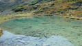
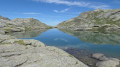
(10) Pass Petit Borgne (2,466 m), then descend along the path to the 2,403 m point and begin a climb, which is steep in places, to reach Lac du Borgne. Red markings on the ground are regularly spaced along the route.
(11) At the lake, turn left towards Lac du Vallon and La Plagne. The path climbs gently to reach the highest point of the walk at 2,605 m.
(12) Ignore the path leading up to the right towards Mont Vallon; reach a track and follow it downwards. After a few hairpin bends, you’ll come to a junction.
(13) Ignore the path branching off to the right towards the Col du Vallon and continue down the track.
(8) Head down to the right along the route you took on the way up to Plan des Mains.
(6) From here, you can either rejoin the path that runs alongside the Ruisseau du Vallon or take the track opposite that leads down to Le Mottaret (the route chosen). 150 metres further on, take the track that descends to the right to rejoin the route taken on the ascent further down.
(4) Continue to the left and follow the route back down the way you came until you reach the car park (S/E).

 Visorando Member
 Difficult

 Very difficult
 Easy