Country:

 City:
City:





Park near the church or the cemetery, which are situated side by side.
(S/E) From the car park, head towards Curienne, passing the first junction. At the second junction, turn left and then immediately right towards Les Viviers.
In the hamlet, take the street on the right, then shortly afterwards, turn left up the street which turns into a concrete path. Pass a yellow marker and head down the path opposite.
(1) Once at the bottom of the descent, head back up the path opposite, pass below a house and reach the signpost for “Les hauts de Chignin”. Turn left towards the Roc de Torméry. The path, which isn’t always clearly signposted, winds through the vineyards a few times before reaching the edge of a woodland. Take the narrow track for a long, steep climb and, after many hairpin bends, you’ll reach a crossroads.
(2) Head straight on along theGRP® for a long stretch that continues to climb but is less steep; there are some lovely viewpoints along the way. You’ll reach the signpost for “Trou de Chignin”.
(3) Leave theGRP® here as it heads off to the left and continue towards the ladder section. The path becomes a little more challenging. Pass the reinforcement structure supporting the Roc de Tormery. Reach the foot of the ladders.
(4) Climb the ladders (see photo). As you come off the ladders, turn immediately right along the edge of the cliff, climb up the slabs on the hillside, and pass the signpost for “Le Roc de Tormery”, which is slightly below the Tormery cross erected in 2013.
You’ll find yourself back on theGRP®. Walk past the cross, continue along the ridge, then begin the descent into the valley. Go through a fence and continue along theGRP®, which follows a gently undulating route. As you emerge from a small wood on the descent, look out for a path branching off to the left, which you’ll take on the return journey.
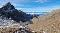
(5) Stay on theGRP® and you’ll soon begin the climb towards Le Tapin. When you reach a signpost for “Tapin Ouest”, go past it and take the path on the right uphill. To reach the summit, there are two sections with safety cables: the first on the hillside, the second along the edge of the cliff. Reach the summit (1,202 m): panoramic views of the Chartreuse, Belledonne and Mont Aiguille in the distance.
(6) Head back down to the junction.
(5) Turn right onto the unmarked path. After a gentle climb, the path descends gently. Head left towards a small copse. Reach a large meadow; follow the path to the left which runs alongside a fence. Reach the signpost for “Les Combes Sud”.
(7) Ignore the path leading back up to the Tormery cross and begin the descent along theGRP® to the next junction.
(8) Montfruitier: here, ignore the path branching off to the left, which offers a shorter route back to the Trou de Chignin.
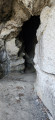
- For the longer route, leave theGRP® and continue to the right towards the Grotte de l’Ermite. Further on, ignore the path on the right leading to the Croix de Chignin and continue the descent along the narrow, little-used and not always easy path leading to the cave. Once you reach the cave, a brief look around is sufficient. Then continue the descent to rejoin theGRP® further down at the ‘Bois de la Mègne’ sign.
(9) Follow theGRP® down to the left, rejoining the route you took on the way up.
(1) At this point, you can either head back up towards Les Viviers, or, as suggested, turn left to descend into the village of Chignin as far as the Route du Chef-Lieu.
(10) Head back up to the right along the road, passing close to the Town Hall, which also has a car park, and return to the starting point (S/E).


 Visorando Member
 Easy
Easy 
 Moderate