


Refine your search for walks in Volvent
Volvent walks


 La Servelle via Volvent
 Visorando Member
 10.34 mi
 +2,582 ft
 -2,566 ft
 7h 00
7h 00
 Moderate
 Departure from Volvent (Drôme)
A summit in southern Diois (1613m), isolated between the Aucelon and Couspeau mountains, offers beautiful 360° views. The starting point is in Volvent, a small village of thirty inhabitants at the end of the Roanne Valley.
Praloubeau ridges
 8.11 mi
+2,293 ft
-2,293 ft
5h 45
Moderate
Departure from Chalancon (Drôme)
8.11 mi
+2,293 ft
-2,293 ft
5h 45
Moderate
Departure from Chalancon (Drôme)
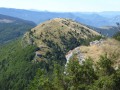
On the border between the Baronnies and the Diois, the ridges of the Montagne de Praloubeau overlook the village of Volvent and its valley with arid vegetation on the western side and, on the eastern side, Jonchères with a greener valley.Magnificent 360° panorama of the surrounding mountains, stretching as far as the Dévoluy massif to the north and Mont Ventoux to the south.
La Servelle from Brette
 10.98 mi
+3,009 ft
-2,979 ft
7h 40
10.98 mi
+3,009 ft
-2,979 ft
7h 40
 Difficult
Departure from Brette (Drôme)
Difficult
Departure from Brette (Drôme)
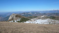
This is a long hike but without any technical difficulties apart from the relatively steep grassy slopes below the summit of La Servelle. Your efforts will be rewarded with a magnificent 360° view from Vercors to Ventoux and from Dévoluy to the Monts d'Ardèche! Return via a partial circular route passing through Champ Rabi.
Chalancon rock
 2.55 mi
+925 ft
-945 ft
2h 00
Moderate
Departure from Chalancon (Drôme)
2.55 mi
+925 ft
-945 ft
2h 00
Moderate
Departure from Chalancon (Drôme)
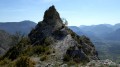
A short circular loop along a wild path, starting from the village of Chalancon, takes you to an old watchtower (or what remains of it) perched on a rock. A short round trip along the ridge to Pas de la Lune offers exceptional panoramic views. Then return via the old mule track of Pas de l'Échaillon to complete this hike.
La Bergerie des Pradaux
 6.95 mi
+1,995 ft
-1,978 ft
4h 55
Moderate
Departure from Saint-Nazaire-le-Désert (Drôme)
6.95 mi
+1,995 ft
-1,978 ft
4h 55
Moderate
Departure from Saint-Nazaire-le-Désert (Drôme)
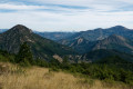
Beautiful hike on the slopes of Couspeau, above Saint-Nazaire-le-Désert. Unobstructed view of the Roanne basin, the Servelle, the Diois and Vercors mountains.
La Brette and La Roanne with your feet in the water
 8.53 mi
+1,339 ft
-1,375 ft
5h 05
Difficult
Departure from Pradelle (Drôme)
8.53 mi
+1,339 ft
-1,375 ft
5h 05
Difficult
Departure from Pradelle (Drôme)
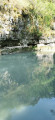
A demanding hike where you walk in water most of the time. The first 4 kilometres are on dry land and the rest in the beds of the Brette and Roanne rivers. A very beautiful route that allows you to discover the wild gorges of these two rivers.
Please note: the walking time is calculated for routes on dry land; walking in water is much more difficult, so you should allow around 1 to 1.5 km/h, or around 8 to 9 hours of walking for this route.
The Crêtes d'Aucelon
 10.34 mi
+2,808 ft
-2,792 ft
7h 10
Moderate
Departure from Aucelon (Drôme)
10.34 mi
+2,808 ft
-2,792 ft
7h 10
Moderate
Departure from Aucelon (Drôme)
After a long climb, a 360° view awaits you on the ridges.
Les Ruelles from La Motte-Chalancon
10.08 mi
+2,779 ft
-2,759 ft
7h 05
Difficult
Departure from La Motte-Chalancon (Drôme)
This long walk starting from La Motte-Chalancon offers a magnificent panoramic view of the village and the Oule valley. You’ll come across lavender fields, springs and streams, lambs, and more...
La Montagne d'Oule
 6.43 mi
+1,437 ft
-1,457 ft
4h 10
Moderate
Departure from La Motte-Chalancon (Drôme)
6.43 mi
+1,437 ft
-1,457 ft
4h 10
Moderate
Departure from La Motte-Chalancon (Drôme)
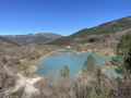
Hike starting from La Motte-Chalancon, a pretty hilltop village in Drôme Provençale nestled around its church. The Montagne d’Oule takes its name from the river that flows around its northern and eastern flanks. Or perhaps it is the river that takes its name from the mountain... This easy walk through the woodland, suitable for all, will take you to the lake at Cornillon-sur-Oule.
A short circular loop around the slopes of Longe Serre
1.77 mi
+453 ft
-433 ft
1h 15
 Easy
Departure from La Motte-Chalancon (Drôme)
Easy
Departure from La Motte-Chalancon (Drôme)
A walk offering views of the village of La Motte-Chalancon from Longe Serre. The route starts in the village. The first half of the walk is through woodland, whilst the second half leads down through fields.
Couspeau Mountain: Serre Delègue
 10.39 mi
+3,018 ft
-3,018 ft
7h 25
Difficult
Departure from Rochefourchat (Drôme)
10.39 mi
+3,018 ft
-3,018 ft
7h 25
Difficult
Departure from Rochefourchat (Drôme)
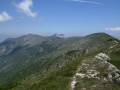
This route starts in Rochefourchat and allows you to explore the Montagne de Couspeau by following the ridge that rises from the south from Serre Délégué (1,482 m) to the north, at its northern end, at Grand Delmas (highest point at 1,544 m). This hike offers views of the surrounding mountains from Diois to Baronnies, including the Trois Becs.
Hiking is prohibited by the owner (private property) during the summer grazing period, from 20 May to 31 October.
The Crêtes du Col de Pennes
 4.18 mi
+1,273 ft
-1,273 ft
3h 00
Moderate
Departure from Barnave (Drôme)
4.18 mi
+1,273 ft
-1,273 ft
3h 00
Moderate
Departure from Barnave (Drôme)
This route presents certain difficulties: walking through thickets, crossing small rocks or holes dug by erosion, and passing along the edge of steep cliffs.
Absolutely not recommended in hot weather due to its south-west exposure, it remains very pleasant from autumn to spring on a beautiful sunny day. Avoid if the trail is covered with snow covering crevasses and due to the risk of slipping.
Clamontard Mountain from the Claps departure point
 7.27 mi
+2,221 ft
-2,241 ft
5h 15
Moderate
Departure from Luc-en-Diois (Drôme)
7.27 mi
+2,221 ft
-2,241 ft
5h 15
Moderate
Departure from Luc-en-Diois (Drôme)
Set off to conquer a 1,085-metre mountain on a steep path, under a peaceful forest of tall trees and interspersed with breathtaking views of the rocky chaos of the Claps.
At the summit, enjoy a breathtaking panorama of the Diois valley and the first peaks of the Vercors.
Walk along the ridge to feast your eyes once more, this time in the direction of the Hautes-Alpes.
Finally, descend gently through a landscape typical of the South of France.
Pas de la Pousterle and its panoramic views
6.18 mi
+2,467 ft
-2,461 ft
5h 00
Moderate
Departure from Recoubeau-Jansac (Drôme)
A superb circular walk starting from the charming hamlet of Jansac in the Diois region, leading to a pass (pousterle) between the Drôme and Roanne valleys.
The route is mostly shaded and presents no particular difficulties, apart from a 600-metre elevation gain. It is signposted with blue circles and yellow lines.