Country:

 City:
City:


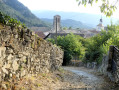
Coming from Châtillon-en-Diois via the Route de Die (D539), turn left at the junction fitted with traffic-calming measures. Take the narrow road leading down into the valley, pass under a small aqueduct bridge (suspended pipe) and park as soon as possible in a lay-by on the left, a few dozen metres further on. Regardless of exactly where you park, the walk begins by following this road downhill.
(S/E) Follow the road in the direction you’ve come from for about 1.2 km.
(1) At this point, a sign on the left indicates the entrance to the Marais des Nays Sensitive Natural Area, which has been developed to welcome visitors to this wetland at the confluence of the Drôme and the Bès rivers, a habitat favourable to beavers. Do not head towards this site, but continue along the narrow road, between the foot of the hillside and the valley floor farmland, which leads to the Ferme du Bès. On this alluvial plain, the single-track Valence–Briançon railway line runs about a hundred metres away.
(2) Cross the farm: the tarmac road becomes a track and runs very close to the railway line. To the right lies a lovely little valley of cereal crops.
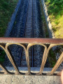
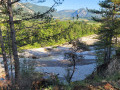
(3) Cross the railway line via the pretty 19th-century bridge and continue straight on. Note, along the route which remains overlooking the Drôme, the tangle of water crossings that make up the riverbed. On the other side, the Die mountain, nestled between woodland and eroded slopes, forms the backdrop to the landscape; however, this river occasionally becomes torrential and can cause scaly rockfalls, to the extent that it narrows the road here, allowing passage only to vehicles of a limited weight. The route descends into a refreshing little valley before reaching a refurbished level crossing.
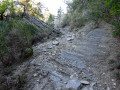
(4) Cross the railway line then head straight up through the woods, following the lovely path that veers slightly to the right, almost directly opposite. You’ll reach the top of the hill fairly quickly, where you’ll see beautiful cultivated fields to your right. Naturally follow the path running along the ridge of the slope facing the foothills of the Glandasse. It narrows to a track in a wooded section before descending towards a stony track.
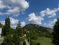
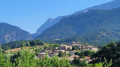
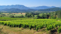
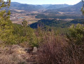
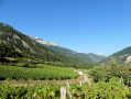
(5) Take this track as it continues. On one side, there are views of the vineyards and the upper Drôme valley; on the other, a panoramic view looking down on the village of Saint-Roman.
(6) Continue to the right. The path passes between a few beautiful houses before rejoining the small road you took at the start, at a hairpin bend. Take the road to the right, pass under the small aqueduct and head back to the car park (S/E).
 Visorando Member

 Moderate
 Difficult