Pas de la Pousterle and its panoramic views

A superb circular walk starting from the charming hamlet of Jansac in the Diois region, leading to a pass (pousterle) between the Drôme and Roanne valleys.
The route is mostly shaded and presents no particular difficulties, apart from a 600-metre elevation gain. It is signposted with blue circles and yellow lines.

Details

3447590
Creation:
Last update:
Last review:
  • Walking
    Activity: Walking
  • ↔
    Distance: 6.18 mi
  • ◔
    Average duration: 5h 00 
  • ▲
    Difficulty: Moderate

  • ⚐
    Back to start: Yes
  • ↗
    Ascent: + 2,467 ft
  • ↘
    Descent: - 2,461 ft

  • ▲
    Highest point: 4,163 ft
  • ▼
    Lowest point: 2,185 ft

Description of the walk

Start from the Jansac car park.

(S/E) Follow the road towards Recoubeau for 50 metres and turn right onto the Chemin des Oches.

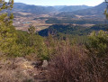
(1) Once you reach the junction of the circular path after a short 350-metre climb, continue along the path to the left and enjoy the view over the Drôme valley and the village of Jansac through the lavender fields. Walk for about 1 km.

(2) Leave the Chemin des Oches by taking the path uphill through the pine trees on the right.

(3) At the top of the climb, after 700 m, take the path to the left.

(4) The Serre viewpoint overlooking Luc-en-Diois. Continue along the pleasant path through a forest of oak and beech trees. Cross a dry stream, following the Blue Circles. You’ll reach a clearing with a view of Montlaur.

(5) Continue along the path, which descends slightly for 500 m, then take the path on the right.

(6) Take care not to miss the path leading uphill to the right (marked with Blue Circles and a small cairn). The path climbs steadily but steadily through a pine forest and then a hornbeam forest, covering an elevation gain of 350 m. You’ll reach a junction not far from the ridge.

(7) Turn left to reach the Pas de la Pousterle.

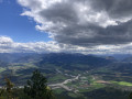
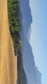
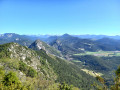
(8) Magnificent panoramic views over the Drôme valley, the Glandasse mountain opposite and, beyond that, the Jocou, the snow-capped Trièves mountains, and then the Dévoluy massif.

Follow the path for one kilometre along the ridge towards the south-east to see the hanging rock, or Piton de l’Ours, followed by picnic spots offering bird’s-eye views of Luc-en-Diois and its rockfall.

(9) Return to the Pas de la Pousterle.

(8) Reach the junction with the path you took on the way up and take the circular path to the left, which descends gently through a beautiful beech forest.

(10) At the western end of the path, continue downwards by turning right and join the Chemin des Oches.

(1) Carry on straight ahead and retrace your steps to return to the Jansac car park (S/E).

Waypoints

  1. S/E : mi 0 - alt. 2,208 ft - Jansac car park
  2. 1 : mi 0.22 - alt. 2,323 ft - Junction of the circular loop
  3. 2 : mi 0.62 - alt. 2,490 ft - Climb to the right
  4. 3 : mi 0.85 - alt. 2,720 ft - At the junction, turn left
  5. 4 : mi 0.95 - alt. 2,825 ft - Serre viewpoint
  6. 5 : mi 1.79 - alt. 2,782 ft - Clearing with a view of Montlaur
  7. 6 : mi 2.01 - alt. 2,700 ft - Eastern point of the route, cairn
  8. 7 : mi 3.07 - alt. 4,078 ft - Junction of the upper circular loop - Pas de la Pousterle (1293m)
  9. 8 : mi 3.14 - alt. 4,131 ft - Pas de la Pousterle – Viewpoint.
  10. 9 : mi 3.58 - alt. 4,062 ft - Ridge path, Barre de Josseaume
  11. 10 : mi 4.96 - alt. 3,294 ft - Western end of the route
  12. S/E : mi 6.18 - alt. 2,208 ft - Jansac car park

Notes

Most of the route is in the shade.
There are no difficult sections. Take care along the ridge at the summit as there are steep 300-metre cliffs.
Take water with you as there are no water sources along the route.
There is drinking water at the Jansac fountain and a shop selling local produce and fresh bread in Recoubeau.

Worth a visit

Visit the picturesque fortified village of Jansac, situated 3 km from Recoubeau-Jansac.
A small hilltop fortified village, of which the entrance arch, the bell tower, the fountain and the site of the fortress remain.

Magnificent views over the Drôme valley from Die to Luc-en-Diois, as well as the Glandasse mountains and, further afield, the Triève and Dévoluy ranges. On the other side, views over the Roanne valley and the Trois Becs.

On the way back, as you reach the village, there are vast fields of lavender offering unforgettable views.

Reviews and comments

4.3 / 5
Based on 3 reviews

Reliability of the description
4 / 5
Ease of following the route
4 / 5
Route interest
5 / 5
Gazelle77
Gazelle77

Overall rating : 3.7 / 5

Date of your route : Aug 15, 2024
Reliability of the description : ★★★☆☆ Average
Ease of following the route : ★★★☆☆ Average
Route interest : ★★★★★ Very good
Very busy route : No

A fairly challenging hike on the way up, but with a magnificent reward at the end! We were even up in the clouds – it was stunning. One thing to note, though: we took a wrong turn on the way down because the route description isn’t very clear: you do need to head back down the path you came up on for a few metres before turning left at a rock to start the descent. Make sure you follow the yellow markings closely. Much further down the descent, it’s difficult to find your way at a sort of Fork in the road, as a tree hides the yellow markings on the left. Thanks to the author – the scenery up there is magnificent. A word of warning to anyone with a fear of heights!

Machine-translated

dany2073
dany2073

I can confirm Barnavon’s comments of 27 May 2021. In my opinion, the climb of over 350 metres is gruelling and demanding. The reward of a magnificent view at the Pas de la Pousterle made up for it. We didn’t walk the one-kilometre stretch along the ridge. And we still clocked up 10 kilometres in 5 hours 30 minutes.

Machine-translated

atraver
atraver

Overall rating : 4.7 / 5

Date of your route : May 08, 2023
Reliability of the description : ★★★★☆ Good
Ease of following the route : ★★★★★ Very good
Route interest : ★★★★★ Very good
Very busy route : No

A lovely walk through the woods, with a beautiful view from the Pas de la Pousterle, where we were greeted by a roe deer.

Machine-translated

DIONISIUS BRUN Bernard

Thank you for your comments, which really highlight the little things to look out for along the route.
Have a great hike!

Machine-translated

BARNAVON
BARNAVON

Overall rating : 4.7 / 5

Date of your route : May 26, 2021
Reliability of the description : ★★★★★ Very good
Ease of following the route : ★★★★☆ Good
Route interest : ★★★★★ Very good
Very busy route : No

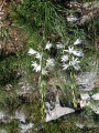
A route of great interest both visually and physically; marvellous, vast landscapes and a very long, challenging climb up the Pas de Pousterle (which took us 55 minutes). We also came across peonies in bloom, particularly on the descent – what a delight.

Comments regarding the route description:
1. Point 4: you need to walk slightly upstream along the stream for about ten metres before reaching the path opposite; it’s not enough just to cross over,
2. Point 6: it is indeed not easy to find the path leading up to the Pas de Pousterle. We took a small track (marked on the IGN map) running parallel to the recommended path and, after 50 metres, we came across the ascending path. Incidentally, the elevation gain is well over 350 metres up to point 8 (at least 450 metres according to two different barometric altimeters).
3. Point 10: there are several possible paths. Take the one that slopes down slightly (in the middle)

Thanks to the author.

Machine-translated

Other walks in the area

For more walks, use our search engine .

The GPS track and description are the property of this route's author. Please do not copy them without permission.