


Refine your search for walks in Velaine-en-Haye
Velaine-en-Haye walks


 Between Velaine-en-Haye and Sexey-les-Bois
 Visorando Member
 4.29 mi
 +105 ft
 -112 ft
 2h 05
2h 05
 Easy
Easy
 Departure from Velaine-en-Haye (Meurthe-et-Moselle)
Starting from Velaine-en-Haye, a short walk through the countryside, taking in fields and old villages.
Around Velaine-en-Haye via the Greenway
3.57 mi
+69 ft
-69 ft
1h 40
Easy
Departure from Velaine-en-Haye (Meurthe-et-Moselle)
A lovely walk through the countryside and forest, with a chance to discover the old village of Velaine-en-Haye.
Les Deux Malpierre
 6.83 mi
+358 ft
-351 ft
3h 25
6.83 mi
+358 ft
-351 ft
3h 25
 Moderate
Departure from Velaine-en-Haye (Meurthe-et-Moselle)
Moderate
Departure from Velaine-en-Haye (Meurthe-et-Moselle)
NEW ROUTE
Mostly in the Haye forest near Nancy, this route partly uses unmarked but perfectly passable trails. Follow the instructions as you go along.
After the Second World War, the site was home to an air base, used for 15 years by the US Army, as evidenced by the old concrete paths and buildings.
During the tour, you will also discover a memorial to the Resistance during World War II.
The Fort du Vieux Canton route
 6.24 mi
+171 ft
-174 ft
3h 00
Moderate
Departure from Villey-Saint-Étienne (Meurthe-et-Moselle)
6.24 mi
+171 ft
-174 ft
3h 00
Moderate
Departure from Villey-Saint-Étienne (Meurthe-et-Moselle)
A beautiful nature walk exploring the Sensitive Natural Areas (ENS) of the communal forest and the meadows of Villey-Saint-Étienne, with their local flora and fauna. This route offers an interesting insight into the Fort du Vieux Canton and the military fortifications of the Séré de Rivières defence system (1874–1914).
Gondreville and the Canalised Moselle
 6.08 mi
+62 ft
-62 ft
2h 50
Easy
Departure from Gondreville (Meurthe-et-Moselle) (Meurthe-et-Moselle)
6.08 mi
+62 ft
-62 ft
2h 50
Easy
Departure from Gondreville (Meurthe-et-Moselle) (Meurthe-et-Moselle)
Route starting from Gondreville, one of the oldest towns in Lorraine, with beautiful views of the canalised Moselle.
Between Gondreville and Villey-le-Sec
 3.74 mi
+112 ft
-115 ft
1h 50
Easy
Departure from Gondreville (Meurthe-et-Moselle) (Meurthe-et-Moselle)
3.74 mi
+112 ft
-115 ft
1h 50
Easy
Departure from Gondreville (Meurthe-et-Moselle) (Meurthe-et-Moselle)
For a day’s hike, you can combine this route with the one covering Gondreville and the canalised Moselle, which offers a fine view of Villey-le-Sec and the hills around Toul.
Terrouin Valley Discovery Trail
 5.12 mi
+243 ft
-230 ft
2h 35
Easy
Departure from Villey-Saint-Étienne (Meurthe-et-Moselle)
5.12 mi
+243 ft
-230 ft
2h 35
Easy
Departure from Villey-Saint-Étienne (Meurthe-et-Moselle)
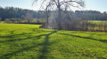
An easy, idyllic walk. The trail offers a lovely view over the heights of the Terrouin Valley and takes you to the former Villey-Saint-Étienne quarry, designated a Sensitive Natural Area, where nature has reclaimed its rightful place. You’ll wind your way through meadows and woods and cross the stream via a footbridge.
The Terrouin Valley in Villey-Saint-Étienne
 5.33 mi
+217 ft
-207 ft
2h 40
Easy
Departure from Villey-Saint-Étienne (Meurthe-et-Moselle)
5.33 mi
+217 ft
-207 ft
2h 40
Easy
Departure from Villey-Saint-Étienne (Meurthe-et-Moselle)
An easy walk from the banks of the majestic Moselle at this point, with views of the Toulois hills and, further away, the Meuse hills and finally the meadows and forests around the loops of the Terrouin.
A circular bend in the Moselle between Gondreville and Villey-Saint-Etienne
 11.93 mi
+148 ft
-148 ft
5h 35
11.93 mi
+148 ft
-148 ft
5h 35
 Difficult
Departure from Gondreville (Meurthe-et-Moselle) (Meurthe-et-Moselle)
Difficult
Departure from Gondreville (Meurthe-et-Moselle) (Meurthe-et-Moselle)
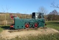
Explore the circular bends of the Moselle between Gondreville and Villey-Saint-Etienne, passing through:
- the old Marne–Rhine Canal,
- part of the fortifications at Villet-Saint-Etienne: Shelter No. 1, the Mordant Battery, the Bas du Chêne fortification and the East Vieux Canton fortification,
- a wayside shrine with an orientation board above Villey-Saint-Etienne,
- the bridges over the Terrouin,
Return along the Moselle, the wide-gauge canal and the Fontenoy lock.
From the Fort de Villey-le-Sec to the Caves on the banks of the Moselle
7.25 mi
+404 ft
-387 ft
3h 40
Moderate
Departure from Villey-le-Sec (Meurthe-et-Moselle)
A walk from the Fort de Villey-le-Sec to the Moselle / the canalised Moselle, exploring the numerous caves opposite Pierre la Treiche. The second part passes through the Bois de Chaudeney and the Bois Blanc and goes past the Redoute de Chaudeney.
Please note! Access to the caves is regulated by a right of way granted by the local council and the ONF!
Route de découverte de Liverdun
3.64 mi
+397 ft
-371 ft
2h 00
Easy
Departure from Liverdun (Meurthe-et-Moselle)
Liverdun is a small medieval village situated on the banks of the Moselle, 30 minutes from Nancy. It has a charming atmosphere with medieval houses, narrow, picturesque streets and views over the circular bends of the Moselle. It is therefore easy and pleasant to spend several hours strolling through this charming town. Highlights of the route include Château Corbin and its grounds, the Esplanade du Moulin, Saint-Pierre Church, and the short round trip to the Roche Barbotte cave. Of course, before you leave, don’t forget to buy the famous Liverdun madeleines.
The Fourasse Circular Loop
 Tourism professional
 6.82 mi
+722 ft
-712 ft
3h 45
Moderate
Departure from Liverdun (Meurthe-et-Moselle)
6.82 mi
+722 ft
-712 ft
3h 45
Moderate
Departure from Liverdun (Meurthe-et-Moselle)
This route forms part of a network of 12 ‘Au cœur des Boucles’ trails around Liverdun, offering 80 km of footpaths marked with the oak leaf, the town’s emblem. They allow you to choose a walk to suit you – short, medium or longer – or to create your own route combining any of the four circular loops. These circular loops will introduce you to the old village, whose history is linked to the Moselle, and allow you to enjoy a varied array of woodland settings and sensitive natural areas. As you wander, you’ll discover breathtaking views of the Moselle valley and the medieval village.The long Fourasse circular hike (marked with three green stripes) is a 4½-hour hike. This woodland trail takes you through a variety of forest habitats (coppice, high forest, wetland, deciduous and coniferous woodland). It is possible to complete the route by mountain bike; it’s very easy going apart from the lower section of the descent just before reaching the viewpoint (4).
Circular of the Moselle between Liverdun and Lock No. 5 at Aingeray.
 7.43 mi
+387 ft
-387 ft
3h 45
Moderate
Departure from Liverdun (Meurthe-et-Moselle)
7.43 mi
+387 ft
-387 ft
3h 45
Moderate
Departure from Liverdun (Meurthe-et-Moselle)
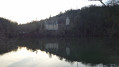
A circular route starting from Liverdun, passing through the communal woods of La Fourasse, then in front of Château de la Flie, continuing along the Moselle to Aingeray Lock No. 5. Crossing the Moselle and returning via a cycle path along the river.
Grande Boucle Villageoise in Liverdun
 5.62 mi
+371 ft
-344 ft
2h 55
Moderate
Departure from Liverdun (Meurthe-et-Moselle)
5.62 mi
+371 ft
-344 ft
2h 55
Moderate
Departure from Liverdun (Meurthe-et-Moselle)
This route forms part of a network of 12 ‘Au cœur des Boucles’ trails around Liverdun, offering 80 km of footpaths marked with the town’s emblem, the oak leaf. They allow you to choose a suitable walk – short, medium or long – or to create your own route combining any of the four circular loops. These circular loops will introduce you to the old village, whose history is linked to the Moselle, and allow you to enjoy a varied array of woodland settings and sensitive natural areas. As you wander, you’ll discover breathtaking views of the Moselle valley and the medieval village.
The Chênot Hazotte circular loop
 4.17 mi
+469 ft
-472 ft
2h 20
Easy
Departure from Liverdun (Meurthe-et-Moselle)
4.17 mi
+469 ft
-472 ft
2h 20
Easy
Departure from Liverdun (Meurthe-et-Moselle)
This route forms part of a network of 12 trails known as ‘Au cœur des Boucles’ around Liverdun, offering 80 km of footpaths marked with the oak leaf, the town’s emblem. This circular route runs mainly through woodland. It is suitable for mountain biking, but the section between (1) and (2) is difficult. This long circular route is signposted with an orange “oak leaf” symbol, the emblem of the town of Liverdun. The long circular route is marked with three horizontal lines, but it is possible to shorten the walk by taking the medium circular route (two horizontal lines) or even the short circular route (one horizontal line). All this is explained on this page of the Liverdun town website.
The Greater Nancy area from Liverdun to the Bois des Hospices de Pompey
 10.29 mi
+945 ft
-928 ft
5h 35
Moderate
Departure from Liverdun (Meurthe-et-Moselle)
10.29 mi
+945 ft
-928 ft
5h 35
Moderate
Departure from Liverdun (Meurthe-et-Moselle)
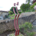
On the ‘Tour du Grand Nancy’ route, a circular stage between Liverdun and the Bois des Hospices de Pompey, passing through the village of Saizerais.
The walk is mainly through woodland, along wide paths.
Visit to the village of Saizerais.
A tour of part of the town of Liverdun, passing, at the entrance, by the old canal which flows beneath the town, then through a cave and back via the old town and its significant heritage.
Circular Moselle between Villey-le-Sec and Pierre-la-Treiche
 5.77 mi
+269 ft
-259 ft
2h 55
Easy
Departure from Villey-le-Sec (Meurthe-et-Moselle)
5.77 mi
+269 ft
-259 ft
2h 55
Easy
Departure from Villey-le-Sec (Meurthe-et-Moselle)
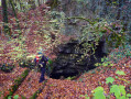
Walk along the circular loops of the Moselle between Villey-le-Sec and Pierre-la-Treiche or the 'cave route'.
Start at the Villey-le-Sec dam car park, hike through the woods of Villey-le-Sec and along the old railway line to see the caves.
Return on flat ground via the cycle path.
The circular Moselle between Villey-le-Sec and Pierre-le-Treiche.
 6.27 mi
+384 ft
-384 ft
3h 15
Moderate
Departure from Villey-le-Sec (Meurthe-et-Moselle)
6.27 mi
+384 ft
-384 ft
3h 15
Moderate
Departure from Villey-le-Sec (Meurthe-et-Moselle)
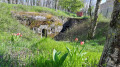
Explore the circular loops of the Moselle between Villey-le-Sec and Pierre-la-Treiche, passing by old military structures and caves.
From the car park at the Villey-le-Sec dam, hike through the woods of Villey-le-Sec and Pierre-la-Treiche to discover the military structures, then return along the old railway line and the Moselle to visit the caves.
Natrou Grand Circular Route
6.65 mi
+449 ft
-436 ft
3h 25
Moderate
Departure from Liverdun (Meurthe-et-Moselle)
This route forms part of a network of 12 ‘Au cœur des Boucles’ trails around Liverdun, offering 80 km of footpaths signposted with the oak leaf, the town’s emblem. They allow you to choose a suitable walk – short, medium or longer – or to create a route combining any of the four circular loops. These circular loops will introduce you to the old village, whose history is linked to the Moselle, and allow you to enjoy a varied array of woodland settings and sensitive natural areas. As you wander, you’ll discover breathtaking views of the Moselle valley and the medieval village.
Through forests and meadows via Chaligny
 4.85 mi
+404 ft
-420 ft
2h 35
Easy
Departure from Maron (Meurthe-et-Moselle) (Meurthe-et-Moselle)
4.85 mi
+404 ft
-420 ft
2h 35
Easy
Departure from Maron (Meurthe-et-Moselle) (Meurthe-et-Moselle)
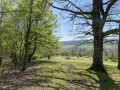
A hike on the outskirts of Nancy offering a variety of landscapes, with forest sections and open areas around Chaligny.
 Maron - Pierre-la-Treiche
 15.26 mi
+236 ft
-233 ft
3 hrs
Easy
Departure from Sexey-aux-Forges (Meurthe-et-Moselle)
15.26 mi
+236 ft
-233 ft
3 hrs
Easy
Departure from Sexey-aux-Forges (Meurthe-et-Moselle)
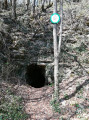
A leisurely bike ride along the Moselle with a few stops to visit the caves carved out by the Moselle in the karst rock when its level was much higher.
Maron/Sexey-aux-Forges
 4.58 mi
+364 ft
-364 ft
2h 25
Easy
Departure from Sexey-aux-Forges (Meurthe-et-Moselle)
4.58 mi
+364 ft
-364 ft
2h 25
Easy
Departure from Sexey-aux-Forges (Meurthe-et-Moselle)
A beautiful walk through the forest and along the Moselle with a lovely viewpoint halfway along the route, complete with a bench.
Circular Moselle route between Maron and Villey-le-Sec
 11.84 mi
+709 ft
-728 ft
6h 05
Difficult
Departure from Maron (Meurthe-et-Moselle) (Meurthe-et-Moselle)
11.84 mi
+709 ft
-728 ft
6h 05
Difficult
Departure from Maron (Meurthe-et-Moselle) (Meurthe-et-Moselle)
Follow the circular course of the Moselle between Maron and Villey-le-Sec.
Starting from Maron, at the car park by the old station, the route takes you through the Maron Forest and the Gondreville Forest, then down towards the Moselle via the Bois L’Évêque. The paths are in good condition and, at times, you might feel as though you’re in the Hautes Vosges.
Cross the Moselle via the dam and the large-capacity lock.
Return on flat ground via the cycle path along the Moselle.
Circular Moselle route between Dommartin-lès-Touls and Gondreville
 10.93 mi
+407 ft
-404 ft
5h 25
Moderate
Departure from Dommartin-lès-Toul (Meurthe-et-Moselle)
10.93 mi
+407 ft
-404 ft
5h 25
Moderate
Departure from Dommartin-lès-Toul (Meurthe-et-Moselle)
Follow the circular course of the Moselle between Dommartin-lès-Toul and Gondreville. Visit the Dommartin redoubt and the Chaudeney battery. Walk through the old village of Gondreville, passing the Maison des Dîmes and along a short stretch of a small road to reach the Marne–Rhine Canal. Return to the car park along the canal.
Greater Nancy – Haye State Forest
 9.56 mi
+535 ft
-538 ft
4h 50
Moderate
Departure from Villers-lès-Nancy (Meurthe-et-Moselle)
9.56 mi
+535 ft
-538 ft
4h 50
Moderate
Departure from Villers-lès-Nancy (Meurthe-et-Moselle)
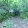
On the ‘Tour du Grand Nancy’ route, a circular stage through the Haye State Forest, starting from Clairlieu and heading towards Les Baraques.
The walk is mainly through woodland on wide tracks and narrow forest paths.
Visit to two blockhouses dating from the First World War and what remains of the Cistercian Abbey of Clairlieu.
On the IGN map, near the coordinates (6), there is a symbol for a cave; in fact, it is enclosed within a building and therefore of no interest.
Circular from Bois de Bicqueley to Pierre-la-Treiche
 7.62 mi
+738 ft
-738 ft
4h 10
Moderate
Departure from Pierre-la-Treiche (Meurthe-et-Moselle)
7.62 mi
+738 ft
-738 ft
4h 10
Moderate
Departure from Pierre-la-Treiche (Meurthe-et-Moselle)
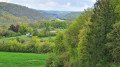
This walk in the Toulois region at Pierre-la-Treiche will take you to the Deuille, a small stream in the Bicqueley forest, with a return trip along the Moselle.
Circular route of the Moselle between Pierre-la-Treiche and Toul
 9.43 mi
+135 ft
-135 ft
4h 25
Moderate
Departure from Pierre-la-Treiche (Meurthe-et-Moselle)
9.43 mi
+135 ft
-135 ft
4h 25
Moderate
Departure from Pierre-la-Treiche (Meurthe-et-Moselle)
Explore the Moselle circular loops between Pierre-la-Treiche and Toul. Starting from the car park at Pierre-la-Treiche, head towards Chaudeney along a small path through the woods on the right bank of the Moselle. Visit the Chaudeney dam and the two locks at Toul. Return along the narrow-gauge canal, then via the hamlet of Gare-le-Cou and the Château de la Rochotte.
Avant-Garde Forest in Pompey – Green Triangle Circular Loop
 Association / Club / Walk leader
 4.26 mi
+246 ft
-249 ft
2h 10
Easy
Departure from Pompey (Meurthe-et-Moselle)
4.26 mi
+246 ft
-249 ft
2h 10
Easy
Departure from Pompey (Meurthe-et-Moselle)
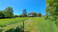
Walk organised by the FLI Association of Pompey. A fairly easy circular walk, suitable for families, starting from the Avant-Garde fitness trail. Four further circular walks are available as extensions to this one.
Pompey and the Avant-Garde Forest via the Green Triangle and White Cross
 5.63 mi
+384 ft
-387 ft
2h 55
Easy
Departure from Pompey (Meurthe-et-Moselle)
5.63 mi
+384 ft
-387 ft
2h 55
Easy
Departure from Pompey (Meurthe-et-Moselle)
Walk organised by the FLI Association of POMPEY. An easy circular walk (a short extension of the 7 km loop) suitable for families, starting from the Avant-Garde fitness trail, mostly in the shade.
Avant Garde Forest from Pompey
 7.14 mi
+371 ft
-371 ft
3h 35
Moderate
Departure from Pompey (Meurthe-et-Moselle)
7.14 mi
+371 ft
-371 ft
3h 35
Moderate
Departure from Pompey (Meurthe-et-Moselle)
Easy circular hike starting from the plateau of the avant-garde in Pompey
Start from the car park near the acrobatic course.
Follow the yellow triangle markings along the entire route.
La Cense Saint-Paul in Saizerais
 3.87 mi
+190 ft
-194 ft
1h 55
Easy
Departure from Saizerais (Meurthe-et-Moselle)
3.87 mi
+190 ft
-194 ft
1h 55
Easy
Departure from Saizerais (Meurthe-et-Moselle)
La Cense Saint-Paul was a very old farm. The word ‘Cense’ comes from the Latin ‘censa’, meaning ‘farm rent’. In Lucien Geindre’s history of Liverdun, we learn that this farm had a large dovecote containing 857 nests!La Cense Saint-Paul appears on the Cassini Map, but it seems to have disappeared after the Revolution. Until a few years ago, the remains of an old cellar were still visible.
The Grand Southern Loop of Saizerais
7.83 mi
+381 ft
-364 ft
3h 55
Moderate
Departure from Saizerais (Meurthe-et-Moselle)
This circular walk, starting from Saizerais Town Hall, has been signposted by the Oxygène association. It follows three signposted walks in succession: the Bois Saint-Ignon, the connecting path and then the Cense Saint-Paul.
The Bois Saint-Ignon
 4.34 mi
+213 ft
-207 ft
2h 10
Easy
Departure from Saizerais (Meurthe-et-Moselle)
4.34 mi
+213 ft
-207 ft
2h 10
Easy
Departure from Saizerais (Meurthe-et-Moselle)
Woods and open terrain make this circular route varied.
It is a easy, smooth route for mountain bikes.
On horseback, it is pleasant terrain but involves a dangerous crossing of the D907 road.
Single tracks towards Saizerais and Marbache
9.70 mi
+479 ft
-489 ft
1.5 hrs
Moderate
Departure from Saizerais (Meurthe-et-Moselle)
For mountain bike singletrack enthusiasts! A lovely, great-fun circular route with very little elevation gain. The route isn’t signposted in any way, so it’s important to download the GPX file onto your hiking app and follow the instructions in the route description.
This route can also be done as a trail run if you’re not looking for significant elevation gain.
Single tracks towards Saizerais and the Ferme du Haras
8.00 mi
+459 ft
-472 ft
1 hr
Easy
Departure from Saizerais (Meurthe-et-Moselle)
A short circular route featuring lovely single tracks for three-quarters of the route. An ideal route for learning to ride without getting too scared or getting your heart rate up too much. The return stretch, a gentle downhill towards Saizerais, is brilliant! It can also be tackled as a trail run for a relaxed little outing with hardly any elevation gain.
Chavigny Forest
 5.30 mi
+174 ft
-161 ft
2h 35
Easy
Departure from Chavigny (Meurthe-et-Moselle) (Meurthe-et-Moselle)
5.30 mi
+174 ft
-161 ft
2h 35
Easy
Departure from Chavigny (Meurthe-et-Moselle) (Meurthe-et-Moselle)
A short walk through the woods on the outskirts of Nancy. No roads to cross. Easy parking next to the forester’s lodge on Route Charlemagne. Take care when setting off again, as the road from the University Hospital towards Chavigny is very busy.
History of iron
 13.35 mi
+1,319 ft
-1,319 ft
7h 15
Moderate
Departure from Chavigny (Meurthe-et-Moselle) (Meurthe-et-Moselle)
13.35 mi
+1,319 ft
-1,319 ft
7h 15
Moderate
Departure from Chavigny (Meurthe-et-Moselle) (Meurthe-et-Moselle)
Discover the history of iron around Neuves-Maisons.
Greater Nancy between Chavigny and Clairlieu
 8.35 mi
+981 ft
-981 ft
4h 40
Moderate
Departure from Chavigny (Meurthe-et-Moselle) (Meurthe-et-Moselle)
8.35 mi
+981 ft
-981 ft
4h 40
Moderate
Departure from Chavigny (Meurthe-et-Moselle) (Meurthe-et-Moselle)
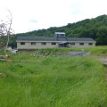
On the ‘Tour du Grand Nancy’ route, a circular stage between Chavigny and Clairlieu, returning via Chaligny and the Neuves Maisons iron mine
The walk is largely through woodland.
An urban section takes you through Chaligny and its historic gardens, and part of Neuves Maisons to reach the iron mine.
The cliffs of Bois des Roches from Chavigny
 3.93 mi
+728 ft
-745 ft
2h 25
Moderate
Departure from Chavigny (Meurthe-et-Moselle) (Meurthe-et-Moselle)
3.93 mi
+728 ft
-745 ft
2h 25
Moderate
Departure from Chavigny (Meurthe-et-Moselle) (Meurthe-et-Moselle)
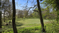
Complete tour of the cliffs overlooking the commune of Messein, following them along the top and at their foot. Beautiful views of the natural evolution of the sedimentary massifs. Caution is advised on the cliff edge.
Moselle circulars: between Neuves-Maisons and Maron
 10.25 mi
+26 ft
-23 ft
4h 45
Moderate
Departure from Neuves-Maisons (Meurthe-et-Moselle)
10.25 mi
+26 ft
-23 ft
4h 45
Moderate
Departure from Neuves-Maisons (Meurthe-et-Moselle)
Start between the canal and the Moselle, then follow the right bank to the Maron. Return along the left bank via Sexey-aux-Forges and Pont-Saint-Vincent. Discover how iron ore was transported from the old mines at Sexey-aux-Forges.
Deuille d'Ochey and Puits du Chahalot starting from Bicqueley
 9.93 mi
+650 ft
-650 ft
5h 10
Moderate
Departure from Bicqueley (Meurthe-et-Moselle)
9.93 mi
+650 ft
-650 ft
5h 10
Moderate
Departure from Bicqueley (Meurthe-et-Moselle)
This walk allows you to discover, particularly in mid-winter (mid-January), the phenomenon of water resurgences near the small village of Bicqueley, a stone’s throw from the town of Toul.
Blue, pure waters, springing up amidst beautiful forests.
Very little elevation gain.