Circular Moselle route between Maron and Villey-le-Sec

Follow the circular course of the Moselle between Maron and Villey-le-Sec.

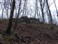
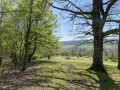
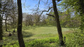
Starting from Maron, at the car park by the old station, the route takes you through the Maron Forest and the Gondreville Forest, then down towards the Moselle via the Bois L’Évêque. The paths are in good condition and, at times, you might feel as though you’re in the Hautes Vosges.
Cross the Moselle via the dam and the large-capacity lock.
Return on flat ground via the cycle path along the Moselle.

Details

962930
Creation:
Last update:
Last review:
  • Walking
    Activity: Walking
  • ↔
    Distance: 11.84 mi
  • ◔
    Average duration: 6h 05 
  • ▲
    Difficulty: Difficult

  • ⚐
    Back to start: Yes
  • ↗
    Ascent: + 709 ft
  • ↘
    Descent: - 728 ft

  • ▲
    Highest point: 1,158 ft
  • ▼
    Lowest point: 702 ft

Photos

Description of the walk

Park in the car park at the former Maron railway station, Rue de la Gare.

(S/E) Cross the disused railway line and take the path between the railway line and the Moselle. Follow the railway line, go through the tunnel on the right and join the D909.

(1) Turn left, follow the D909 for 500 metres until you reach the end of a metal parapet.

(2) Turn right onto the path leading up to the Grande Goutte, and carry on straight ahead until you reach the forest road, ignoring any other paths.

(3) At the Route Forestière Charlemagne, turn left and follow the road. Pass through a small clearing at the end of the road and continue straight ahead down the path.

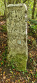
(4) At the end of the track, turn left and take the Chemin du Grand Valonnier, passing the metal posts, boundary stone 521 and another fallen boundary stone. At the end of the track, cross the stream.

(5) Turn right, walk past the spring, continue for a few metres along the Chemin de Monvaux and take the first path leading uphill to the left (not shown on the map).

(6) At the junction, turn right and carry on straight ahead, ignoring the other paths. At the end of the path, turn left; at the Y-junction that follows, keep to the right and, at the next junction, turn right to join a forest track.

(7) When you reach the forest road known as Route Neuve, turn left and carry on straight ahead, ignoring the other paths. Pass the three vehicle barriers and join the D909.

(8) On the D909, turn right and follow the road for 350 metres.

(9) Leave the road and turn left into the car park; in the middle, take the small path on the left which climbs up the embankment. Turn right onto the forest track running parallel to the road (not shown on the map), and carry on straight ahead.

(10) At the military base, turn left and head down towards the Moselle. At the end of the track, turn right, pass number 92, carry on, go under the EDF power line and continue along this track.

(11) At the T-junction, take the path leading down to the left, passing numbers 91 and 92. At the bottom of the path, cross the old railway line and you’ll come out onto a small road.

(12) At the small road, turn right and carry on straight ahead towards the dam.

(13) At the dam, turn left and cross the Moselle; turn right, then left to cross the lock.

(14) After the lock, turn left, follow the cycle path and ride alongside the Moselle on your left.

(15) Continue along the cycle path on a strip of land in the middle of the river.

(16) Return to the riverbank and continue as close to the river as possible until you reach the Pont de Maron.

(17) Climb the steps slightly to the right. At the top, turn left and cross the Moselle via the bridge. You’ll reach the car park straight away (S/E).

Waypoints

  1. S/E : mi 0 - alt. 735 ft - Car park at the former Maron railway station
  2. 1 : mi 0.6 - alt. 745 ft - Junction with the D909
  3. 2 : mi 0.93 - alt. 735 ft - Metal parapet
  4. 3 : mi 1.58 - alt. 1,122 ft - Route Charlemagne
  5. 4 : mi 2.38 - alt. 807 ft - Le Grand Valonnier
  6. 5 : mi 2.6 - alt. 768 ft - Stream
  7. 6 : mi 2.91 - alt. 997 ft - End of the climb
  8. 7 : mi 3.25 - alt. 1,083 ft - Route Neuve
  9. 8 : mi 4.14 - alt. 1,043 ft - D909 road
  10. 9 : mi 4.35 - alt. 1,043 ft - Car park
  11. 10 : mi 4.84 - alt. 1,020 ft - Military land
  12. 11 : mi 5.33 - alt. 932 ft - T-junction
  13. 12 : mi 5.82 - alt. 709 ft - Crossing the railway line
  14. 13 : mi 6.66 - alt. 709 ft - Crossing the Moselle
  15. 14 : mi 7.02 - alt. 705 ft - Cycle path
  16. 15 : mi 8.17 - alt. 705 ft - Cycle path along the river - Moselle (la)
  17. 16 : mi 9.74 - alt. 705 ft - Back on solid ground - Moselle (la)
  18. 17 : mi 11.77 - alt. 705 ft - Pont de Maron
  19. S/E : mi 11.84 - alt. 732 ft - Car park at the old Maron railway station

Worth a visit

A lovely walk through the forest, with plenty of ups and downs.

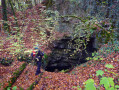
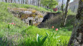
On the way back, from the cycle path, you can see the entrance to the Grotte du Géant above the highest retaining wall of the railway line.

Reviews and comments

4.1 / 5
Based on 3 reviews

Reliability of the description
4 / 5
Ease of following the route
4 / 5
Route interest
4.3 / 5
rosiecca
rosiecca

Overall rating : 4 / 5

Date of your route : Jun 03, 2018
Reliability of the description : ★★★★☆ Good
Ease of following the route : ★★★★☆ Good
Route interest : ★★★★☆ Good

There was no connection between (4 and 7) to follow the route on GPXViewer, which meant we had to take a detour.

The forest track (8 and 9) is bumpy and very muddy.

There were quite a few people on the cycle path on the way back.

Machine-translated

gamote
gamote

Overall rating : 4 / 5

Date of your route : May 06, 2018
Reliability of the description : ★★★★☆ Good
Ease of following the route : ★★★★☆ Good
Route interest : ★★★★☆ Good

It’s a bit tricky on the path to the Grand Valonnier (4 and 5)

The forest track (9) is difficult as it is very overgrown and full of brambles.

The return via the cycle path (14 to 16) is a bit monotonous and very busy

Otherwise, a lovely walk in glorious sunshine

Machine-translated

zeblechat
zeblechat
• Edited:

Overall rating : 4.3 / 5

Date of your route : Apr 18, 2018
Reliability of the description : ★★★★☆ Good
Ease of following the route : ★★★★☆ Good
Route interest : ★★★★★ Very good

It’s described as difficult, though actually it’s more of a medium difficulty – but that’s subjective, of course
I did it in fine weather; I imagine the paths must be very muddy and slippery when it rains
Several sections of the path have been damaged by timber-hauling work, so there are some tricky sections
A lovely walk for regular walkers
Thanks for this lovely route... JP

Machine-translated

Other walks in the area

For more walks, use our search engine .

The GPS track and description are the property of this route's author. Please do not copy them without permission.