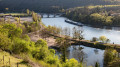
The ‘Forêt entre Deux Chemins’ circular walk starting from Saizerais

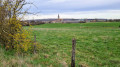
The idea was to organise a 10 km walk for the Pink October event in Saizerais on 18 October 2026. The result is a beautiful, varied route: two-thirds of it through woodland, mostly along narrow paths. Exactly halfway along the route is a magnificent viewpoint over the village of Marbache. This walk can be done by mountain bike, but take care on the descent towards Marbache, which is technical; a fall could have serious consequences (walking down may be the safest option).

Details

n°110055218
Creation:
Last update:
Last review:
–
  • Walking
    Activity: Walking
  • ↔
    Distance: 6.56 mi
  • ◔
    Average duration: 3h 25 
  • ▲
    Difficulty: Moderate

  • ⚐
    Back to start: Yes
  • ↗
    Ascent: + 413 ft
  • ↘
    Descent: - 404 ft

  • ▲
    Highest point: 1,037 ft
  • ▼
    Lowest point: 686 ft
  • ⚐ Country: France
  • ⚐ City: Saizerais (54380)
  • ⚑
    Start/End: N 48.79425° / E 6.04965°
  • ❏
    IGN map(s): Ref. 3315ET
  • Hour-by-hour weather

Description of the walk

The route starts at the multi-activity hall in Saizerais.

(S/E) Set off along the Chemin des Vignes to reach Rue St-Georges.

(1) Turn right. Then turn right onto Rue des Chardonnerets.

(2) At the junction, continue right onto Chemin des Jardins, which you should follow until it turns left (signposted).

(3) Follow this path. After the climb, the path descends to the edge of the forest.

(4) Keep a close watch so as not to miss the narrow path that heads off to the right into the forest. Follow this path for about 350 metres.

(5) Take a lovely path that climbs to the left.

(6) At the junction at the top of the hill, continue to the right. Carry on climbing.

(7) Cross the high-voltage power line, then head back down.

(8) You’ll cross a track leading towards Belleville, which you must cross. Be careful not to miss a small, barely visible path leading uphill, which is located directly opposite.

(9) You’ll then reach another track, which you should follow for about a hundred metres to the right before taking a small, barely visible path on the left. Follow the best-marked path, turning right, then left and then right again to reach the hillside overlooking the Marbache valley (a lovely view of the village).

(10) For cyclists, this section along the hillside is quite technical (with rocks on the path). Follow the hillside for a good kilometre.

(11) You’ll then notice a signposted path on the right leading down towards the village. Take this path. For mountain bikers, this descent is technical and exposed in places.

(12) At the bottom of the descent, take the road on the right towards Faubourg St-Nicolas. Then carry on straight ahead for over 2 km to reach the composting centre.

(13) Take the path signposted “Saizerais” which runs alongside the road below. When the path crosses another track, continue across the grass between the field and the hedge bordering the road, and you will then arrive in Saizerais.

(14) Follow the pavement, which leads easily to the multi-purpose hall (S/E).

Waypoints

  1. S/E : mi 0 - alt. 787 ft - Starting point: multi-activity hall car park
  2. 1 : mi 0.22 - alt. 804 ft - Rue Saint-Georges
  3. 2 : mi 0.33 - alt. 794 ft - Crossroads
  4. 3 : mi 0.86 - alt. 794 ft - Crossroads with signposting
  5. 4 : mi 1.24 - alt. 738 ft - The start of the path is not very visible
  6. 5 : mi 1.46 - alt. 738 ft - Junction
  7. 6 : mi 1.52 - alt. 781 ft - Top of the hill
  8. 7 : mi 2.03 - alt. 846 ft - Pass under a power line
  9. 8 : mi 2.21 - alt. 817 ft - Crossing a track suitable for vehicles
  10. 9 : mi 2.55 - alt. 906 ft - Vehicle track
  11. 10 : mi 3.31 - alt. 1,004 ft - Viewpoint over Marbache
  12. 11 : mi 4.03 - alt. 955 ft - Junction with a signposted path
  13. 12 : mi 4.35 - alt. 689 ft - T-junction – Tarmac road
  14. 13 : mi 5.78 - alt. 820 ft - Composting centre
  15. 14 : mi 6.32 - alt. 827 ft - Entrance to the village
  16. S/E : mi 6.56 - alt. 791 ft - Arrival at the multi-activity hall

Worth a visit

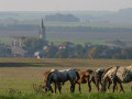
View of Marbache.

Other walks in the area

For more walks, use our search engine .

The GPS track and description are the property of this route's author. Please do not copy them without permission.