Country:
 City:
City:


The walk starts in front of the town hall (small car park, bus stop near Rue Saint-Amand).
(S/E) Cross the D907 carefully and set off opposite the town hall along Rue Saint-Georges, which leads uphill towards the church.
(1) Continue straight on along Rue Saint-Georges until you reach the crossroads.
(2) Leave Rue Saint-Georges via Chemin de Fourchevoie, on the left.
(3) Cross Route de Villers.
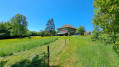
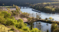
(4) Then cross the D907 carefully, as it is dangerous. Next, head uphill and, looking back, the landscape offers beautiful views all the way to the other side of the Moselle. You can make out the villages of Bezaumont and Sainte-Geneviève, even though they are more than 10 km away. Follow the path until you reach the edge of the forest.
(5) Here, the air begins to feel cooler, and from this point, follow a very pleasant, gently sloping path through the forest.
(6) You’ll then reach the edge of the vast Natrou State Forest and turn left at the junction. Even in the height of summer, this section of the walk is wonderfully cool. In this little valley, in early spring, wild garlic abounds and gives off its characteristic scent. You’ll come to a junction.
(7) Cross the track that runs straight through the Natrou Forest.
From here, you can:
- significantly shorten the walk by taking the signposted route (yellow circle) through the Bois Saint-Ignon (please note, it is described in the opposite direction), which leads back to Saizerais.
- to continue along the path at the bottom of the valley (suggested route). This section of the route can be very muddy or even impassable after heavy rain or in winter. If this is the case, take the small sections of path that have formed off to the side of the main track. This section is shared with the GR®5 and also with other local paths.
(8) At the fork, leave the valley floor and turn left to head back up onto the plateau.
(9) At the next Fork in the road, take care not to miss the path on the right which leads to the edge of the D90b.
(10) At the end of the valley, be careful not to miss the path on the left! This path is very steep but short.
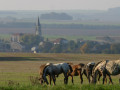
(11) Turn right onto a small track leading to the D90b road. Cross it with care! Danger! Then take the track opposite, which involves a descent followed by a fairly steep climb. As you approach the Neyette riding centre, it’s common to come across horses in this area. Be careful not to startle or frighten them, especially if you’re on a bike. Stopping and letting them pass is the best option.
(12) Take the wide, straight path on the left at a 90° angle, which leads to the Neyette equestrian centre.
(13) Turn right onto a straight track.
(14) Enter the woods and then, very soon after, turn left onto a track frequently used by horses.
(15) At the fork in the road, take the path on the left which climbs slightly.
(16) Join the Avant Garde track on the left, then turn left straight away onto a small, gently sloping path. Here too, after heavy rain, the path can be very muddy. In this case, take the small tracks running alongside the path.
(17) Leave the woods to join the Grande Tranchée path (the Nancy–Metz route), where you’ll be treated to a lovely view of Saizerais.
(18) Take care not to miss the signposting and follow it, turning left to cross the Haute Épine housing estate. At the junction, head straight ahead, then keep to the right and immediately turn left. Continue left again to go round the Stade Deleys. Stay on the road to the left.
(19) Walk past the GAEC Saint-Amand (selling homemade bread every Friday, horse boarding). At the junction, keep to the right to return to the starting point (S/E).
 Tourism professional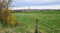
 Easy
Easy 
 Visorando Member

 Association / Club / Walk leader