Between Velaine-en-Haye and Sexey-les-Bois

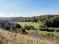
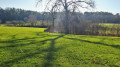
Starting from Velaine-en-Haye, a short walk through the countryside, taking in fields and old villages.

Details

572811
Creation:
Last update:
Last review:
  • Walking
    Activity: Walking
  • ↔
    Distance: 4.29 mi
  • ◔
    Average duration: 2h 05 
  • ▲
    Difficulty: Easy

  • ⚐
    Back to start: Yes
  • ↗
    Ascent: + 105 ft
  • ↘
    Descent: - 112 ft

  • ▲
    Highest point: 919 ft
  • ▼
    Lowest point: 830 ft

Description of the walk

Car park on Rue de la Taille Michaud, next to the stadium and the Socio-Cultural and Sports Centre.

(S/E) Head towards the car park exit, turn left, then take the first street on the left, Rue des 7 Lieues.

(1) At the end of the street, go straight on along a dirt track. Admire the fields on your right. You’ll see a row of new buildings on your left.
At the end of this track, turn left and then immediately right onto a farm track.

(2) At the junction, take the path on the right; take a moment to admire the view of the church at Velaine-en-Haye and the village of Sexey-les-Bois. Carry on straight ahead.

(3) Turn right at the water points and head up the path that enters the village, turning left as you go.

(4) Walk through the village, passing between the church and the school, and join the Grande Rue. Head left until you reach the cemetery.

(5) Then take the D90a (very little traffic) towards Velaine-en-Haye. Pass in front of the ranch.

(6) Shortly afterwards, take the dirt track on the left towards the two water retention basins.

(3) Retrace your steps back to Rue des 7 Lieues.

(1) Turn right onto Chemin de l’École, then left to reach the car park (S/E).

Waypoints

  1. S/E : mi 0 - alt. 915 ft - Car park at the Maison des Associations
  2. 1 : mi 0.23 - alt. 909 ft - Dirt track
  3. 2 : mi 0.86 - alt. 863 ft - Junction
  4. 3 : mi 1.24 - alt. 830 ft - Water point
  5. 4 : mi 1.58 - alt. 846 ft - Entrance to Sexey-les-Bois
  6. 5 : mi 2.08 - alt. 883 ft - Cemetery
  7. 6 : mi 2.59 - alt. 886 ft - Ranch
  8. S/E : mi 4.29 - alt. 915 ft - Car park at the community centre

Worth a visit

You can round off this walk with a visit to the centre of the village of Velaine-en-Haye.

Reviews and comments

3.9 / 5
Based on 3 reviews

Reliability of the description
4.3 / 5
Ease of following the route
5 / 5
Route interest
2.3 / 5
Christecol
Christecol

Overall rating : 4.3 / 5

Date of your route : Jan 20, 2021
Reliability of the description : ★★★★★ Very good
Ease of following the route : ★★★★★ Very good
Route interest : ★★★☆☆ Average
Very busy route : No

During these times of lockdown, this short walk will give you a chance to get some fresh air. Obviously, there’s a bit of tarmac involved, but never mind!...

Machine-translated

henri57
henri57 ★

Hello,

@euzen and @franchie

it’s actually the Socio-Cultural and Sports Centre,
preferably on Rue de la Taille Michaud, next to the stadium

It’s been corrected – thank you very much

See you soon

Machine-translated

euzen
euzen

Overall rating : 3.3 / 5

Date of your route : Jan 04, 2019
Reliability of the description : ★★★★☆ Good
Ease of following the route : ★★★★★ Very good
Route interest : ★☆☆☆☆ Very disappointing

Friday 4 January 2018

Incorrect description of the starting point; opt for Rue de la Taille Michaud, next to the stadium

No tourist attractions:
The outward route runs between fields and the back of housing estates.
From the village of Sexey-les-Bois, the section along the D90 (a fairly busy road) is dangerous, monotonous and completely uninteresting.
The return leg, which follows the outbound route in reverse, only serves to confirm its lack of interest. Passing through the village is slightly less disappointing.

Why even mention such a route? As it stands, it’s not even suitable for walking your dog.

Fortunately, there are plenty of other, far more interesting routes in the area.

Machine-translated

franchie
franchie

Overall rating : 4 / 5

Date of your route : Feb 28, 2018
Reliability of the description : ★★★★☆ Good
Ease of following the route : ★★★★★ Very good
Route interest : ★★★☆☆ Average

We went round in circles for a while trying to find the ‘Maison des Associations’, but it’s actually the Socio-Cultural and Sports Centre; the landmark is the stadium, which can be seen on the map. A very short walk, with – as the description puts it so well – fields on the right, concrete blocks on the left, and a stretch of country road of little interest. But hey, it’s a nice bit of fresh air!

Machine-translated

Other walks in the area

For more walks, use our search engine .

The GPS track and description are the property of this route's author. Please do not copy them without permission.