Country:
 City:
City:


Park behind the cemetery, accessed via the church square.
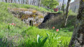
(S/E) Leave the car park on the north-eastern side of the cemetery, taking the path heading south-east. On your left is a wooded area. Walk past the water tower on your right before reaching the Route de Maron (D909). Cross the road carefully and continue straight ahead for about a hundred metres before turning right onto a cul-de-sac with parking spaces, leading to Rue de la Géologie. Turn left and follow this street. Before the last building on the right, turn right onto the tarmac road, which turns into a path just past the last houses. The path climbs gently and steadily towards the Fort de Villey-le-Sec. It reaches the fort at its south-eastern corner.
(1) Turn left onto the path that runs alongside the fort as far as the south-west corner.
(2) At a junction of dirt tracks, take the small path on the right which leads towards a copse of trees and up to a turret.
(3) Return to the crossroads at this point.
(2) Take the path on the right (as you come down from the turret) and turn onto the second path on the left, known as ‘Les Sept Noyers’. This is theGR®5F, which heads south-west on a gentle slope. Shortly afterwards, it reaches a clearing and runs alongside the woods on the left-hand side. It then turns left to enter the Villey-le-Sec Communal Forest and begins a steep descent towards the Moselle. Continue straight on until you reach a T-junction. Turn left to complete the descent about a hundred metres further on, above the hamlet known as Ras de l’Eau.
(4): At the bottom of the descent, turn right and follow theGR®5F, which passes close to various caves at the foot of the hillside, including the Grotte des Sept Salles, the Grotte des Puits and the Grottes Sainte-Reine. Please note: Access to the caves is regulated by a right of way granted by the local council and the ONF!
(5) Upon emerging onto a sort of forest track, turn right onto the path which climbs straight ahead towards the north into a sort of small valley. At a junction with a path on the right, continue straight ahead to cross the bottom of the valley and carry on along its western flank before walking along an almost level slope. The path then moves away from the Moselle river and, just as it bends to the right, take the path on the left, staying on theGR®5F.
(6) The path climbs diagonally towards the edge of the woods at a place called La Rouge Pierre. There, the path joins a white track at the edge of the woods. Follow it straight on to the right to reach a T-junction after about one hundred and fifty metres.
(7) Head right along the white track, which crosses a small strip of woodland and, a little further on, joins the road to Villey-le-Sec. Turn left and follow the road to Villey-le-Sec with care until you reach a junction with two tracks on the right at the edge of the woodland at a place called Fond du Rupt.
(8) Turn right and immediately leave theGR®5F, which heads north-west along Rue de Lattre de Tassigny, and turn right again onto a white track (PR®) that climbs gently. About six hundred metres further on, the track enters the Dommartin-lès-Toul Communal Forest.
Carry on straight ahead until you reach a junction with a small road/track.
(9) Turn right onto the track heading south-east, which slopes gently downwards. Follow it straight on until you reach the junction with the road to Villey-le-Sec, next to the Chaudeney Battery.
(10) Turn left onto the level road which skirts the Chaudeney Redoubt on its western and northern sides.
Just as the road begins to descend, turn right onto the path which continues to skirt the Redoute de Chaudeney on its north-eastern side. Shortly afterwards, the path veers away from the Redoute de Chaudeney, heading eastwards and climbing gently towards the Fort de Villey-le-Sec. The path is then lined with a hedge of trees on the left-hand side. Follow the path until you reach the south-western corner of the fort.
(2) Take the tarmac lane branching off to the left to go round the Fort de Villey-le-Sec. Continue along this lane, skirting the fort, until you reach the middle of the fort’s eastern side. There, turn right onto the gently sloping Rue du Fort. At the junction with the D909, cross it carefully on the right-hand side (at the pedestrian crossing) to continue straight ahead into Place de l’Église. Walk past the Church of the Nativity of the Virgin, then past the cemetery to return to the car park on the right behind the cemetery (S/E).

 Visorando Member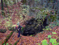
 Easy
Easy 
 Difficult