Between the Sainte-Barbe plateau and the forest at Pont-Saint-Vincent

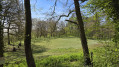
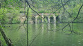
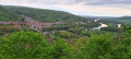
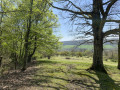
A very easy walk with little elevation gain and two distinct landscapes: a very open woodland and the Sainte-Barbe plateau, which allows you to finish an autumn walk a little later in the day whilst still enjoying good visibility.

Details

n°28386387
Creation:
Last update:
Last review:
  • Walking
    Activity: Walking
  • ↔
    Distance: 6.98 mi
  • ◔
    Average duration: 3h 35 
  • ▲
    Difficulty: Moderate

  • ⚐
    Back to start: Yes
  • ↗
    Ascent: + 410 ft
  • ↘
    Descent: - 387 ft

  • ▲
    Highest point: 1,286 ft
  • ▼
    Lowest point: 958 ft

Photos

Description of the walk

At Pont Saint-Vincent, take Rue Carnot then Rue Albert Martin, follow it to the Saint-Barbe plateau and park at the three-way junction by the information board.

(S/E) Walk across the meadow towards the forest and follow the edge of the woodland.

(1) Turn right onto theGR®5F(red and white markings) and follow it to a large crossroads.

(2) Make sure you turn left and do not carry on straight ahead.

(3) Leave theGR®5Fand take a small path on the left. Keep heading in the same direction until you reach a large, fairly open crossroads where some cars may even be parked.

(4) Take the only path on the left that isn’t aGR®. Cross the Bois du Chanot.

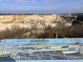
(5) As you emerge from the woods, carry on straight ahead and follow a motocross route on your left. Ignore the path on the right leading to Viterne and the Notre-Dame de la Paix Chapel, and continue straight on until you reach the orientation table.

(6) Turn left and carry on until you reach a road leading to the Vicat quarry.

(7) Carry straight on across it.

(8) Pass the access to the aerodrome on your left and carry on straight ahead to the car park (S/E).

Waypoints

  1. S/E : mi 0 - alt. 1,250 ft - Sainte Barbe Plateau
  2. 1 : mi 0.79 - alt. 1,194 ft - GR°°®°° junction
  3. 2 : mi 1.03 - alt. 1,102 ft - Three-way junction
  4. 3 : mi 2.87 - alt. 961 ft - Exit GR°°®°°, on the left
  5. 4 : mi 3.54 - alt. 1,040 ft - At the crossroads, turn left
  6. 5 : mi 4.6 - alt. 1,283 ft - Exit the forest, go straight on
  7. 6 : mi 5.22 - alt. 1,211 ft - On the left - Table d'orientation de la Friche Midy
  8. 7 : mi 5.8 - alt. 1,188 ft - Crossing the road
  9. 8 : mi 6.7 - alt. 1,270 ft - Airfield junction, straight ahead
  10. S/E : mi 6.98 - alt. 1,250 ft - Sainte-Barbe Plateau

Always be cautious and plan ahead when you're outdoors. Visorando and the author of this route cannot be held responsible for any accidents occurring on this route.

The GR® and PR® markings are the intellectual property of the Fédération Française de Randonnée Pédestre.

Reviews and comments

4.7 / 5
Based on 1 review

Reliability of the description
5 / 5
Ease of following the route
5 / 5
Route interest
4 / 5
François VERNIER
François VERNIER

Overall rating : 4.7 / 5

Date of your route : Oct 16, 2023
Reliability of the description : ★★★★★ Very good
Ease of following the route : ★★★★★ Very good
Route interest : ★★★★☆ Good
Very busy route : No

This route is fairly easy, with wide, well-signposted paths for most of the way. The mix of open countryside and woodland is what makes it interesting. The section running alongside the motocross track can be a bit of a nuisance, but it’s better to see these vehicles on a dedicated track than raring through the woods....

Machine-translated

Other walks in the area

For more walks, use our search engine .

The GPS track and description are the property of this route's author. Please do not copy them without permission.