Circular Moselle route between Dommartin-lès-Touls and Gondreville

Follow the circular course of the Moselle between Dommartin-lès-Toul and Gondreville. Visit the Dommartin redoubt and the Chaudeney battery. Walk through the old village of Gondreville, passing the Maison des Dîmes and along a short stretch of a small road to reach the Marne–Rhine Canal. Return to the car park along the canal.

Details

988190
Creation:
Last update:
Last review:
  • Walking
    Activity: Walking
  • ↔
    Distance: 10.93 mi
  • ◔
    Average duration: 5h 25 
  • ▲
    Difficulty: Moderate

  • ⚐
    Back to start: Yes
  • ↗
    Ascent: + 407 ft
  • ↘
    Descent: - 404 ft

  • ▲
    Highest point: 1,020 ft
  • ▼
    Lowest point: 653 ft

Photos

Description of the walk

Park in a small car park on Rue de la Prairie (on the right at the traffic lights when coming from Nancy) in Dommartin-lès-Toul.

(S/E) Walk up Rue de la Prairie. At the traffic lights, cross Avenue Foch and go straight on to join Rue Georges Clemenceau.

(1) At the end of the street, turn right onto Rue Thiers, walk past the church, take the left-hand bend and continue straight up Rue Gambetta.

(2) At the water tower, carry on straight ahead along Rue du 8ème Bataillon, go over the motorway and continue straight on towards Villey-le-Sec.

(3) At the entrance to the woods, at the Y-junction, turn left towards the water tower. When you reach the entrance to the old Dommartin redoubt, you can easily walk around it via the ditch.

(4) Return to the Y-junction.

(3) Continue left along the small road and enter the woods. Carry on straight ahead along this forest track, passing a stone marker, crossing a small clearing and then passing the stone marker marked ‘Dommartin 3km’.

(5) At the junction of two tracks, carry straight on.

(6) At the T-junction, take the track on the left. After about fifty metres, follow a small path to the right to visit the buildings of the Chaudeney battery, then return to the track.

(7) At the bend just after this, take a small path leading down to the right to see the remains of the battery, then return to the track. Pass a large electricity pylon; opposite, in the woods, is the Chaudeney redoubt, which is inaccessible; continue straight on.

(8) At the junction with the D909, cross the road carefully and carry on straight ahead along the track. Pass a mast and carry on straight ahead. Before the motorway, turn right to follow it alongside.

(9) At the junction with the road, turn left, go over the motorway and carry on straight ahead along Route de Villey-le-Sec until you reach the junction with Avenue de la Libération.

(10) Carry on straight ahead along Rue du Château des Princes, go under the archway and continue along this street, passing the town hall and the church.

(11) After the church, take the first street on the left, Rue du Moulin.

(12) At the junction with Rue des Bergeries, turn left and cross over the canal. Take Rue de la Gréve to cross the Moselle; continue straight on towards Toul along the small road which curves sharply to the left and then runs alongside the canal before reaching a junction just before the bridge.

(13) Turn right to rejoin the path along the Marne–Rhine Canal, then turn left to go under the bridge. Continue along the canal, passing under the conveyor belt, then under the road bridge.

(14) Note the lock on the right, which connects to the small Marne–Rhine Canal. At the bridge, carry on straight ahead along the canal, pass under an old railway line and join Avenue Foch.

(15) Turn left, cross the Moselle, then go over the old railway line.

(16) Before the third bridge, turn left, then immediately right. About fifty metres further on, turn left onto Rue des Marronniers to reach the car park (S/E).


Waypoints

  1. S/E : mi 0 - alt. 673 ft - Car park on Rue de la Prairie
  2. 1 : mi 0.15 - alt. 699 ft - Rue Thiers
  3. 2 : mi 0.52 - alt. 810 ft - Water tower, straight ahead
  4. 3 : mi 1.33 - alt. 925 ft - Y-junction; turn left
  5. 4 : mi 1.41 - alt. 948 ft - Dommartin Redoubt
  6. 5 : mi 2.51 - alt. 945 ft - Two cycle paths cross; go straight on
  7. 6 : mi 3.05 - alt. 1,017 ft - X-shaped junction; turn left
  8. 7 : mi 3.19 - alt. 1,017 ft - Take the Chemin de la Batterie on the right
  9. 8 : mi 3.74 - alt. 899 ft - Cross the D909
  10. 9 : mi 5.9 - alt. 738 ft - Route de Villey-le-Sec, on the left
  11. 10 : mi 6.2 - alt. 732 ft - Avenue de la Libération
  12. 11 : mi 6.41 - alt. 689 ft - The Maison des Dîmes
  13. 12 : mi 6.53 - alt. 669 ft - Rue des Bergeries, on the left - Moselle (la)
  14. 13 : mi 7.54 - alt. 666 ft - Canal de la Marne au Rhin
  15. 14 : mi 9.47 - alt. 679 ft - View of the lock leading to the small canal
  16. 15 : mi 10.34 - alt. 686 ft - Avenue Foch, turn left
  17. 16 : mi 10.79 - alt. 686 ft - Before the third bridge, turn left
  18. S/E : mi 10.93 - alt. 673 ft - Car park on Rue de la Prairie

Worth a visit

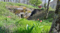
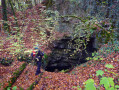
(4) Visit the Dommartin redoubt: you can walk all the way round it; the moat is fairly clear and the masonry is in good condition.

Back at (3), admire the view over Toul.

(6) Walkers can head into the woods to explore the ruined buildings of the Chaudeney battery.

(7) Walkers can take the small path leading down to the site of a former battery and catch a glimpse of the outline of the Chaudeney redoubt.

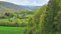
After the (7), before heading down towards the D909, there is a lovely view of the Croix de Metz and Gondreville.

In Gondreville, at the junction with Avenue de la Libération: a very beautiful fountain, then Rue du Château des Princes, passing under an old gateway.

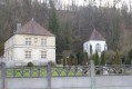
(11) On the corner of the streets are the remains of the former Ducal Palace and the Maison des Dîmes, a listed building.

On leaving the town, you cross the unchannelled Moselle.

Return along the wide-gauge Marne–Rhine Canal.

Reviews and comments

4.8 / 5
Based on 2 reviews

Reliability of the description
5 / 5
Ease of following the route
5 / 5
Route interest
4.5 / 5
Christecol
Christecol

Overall rating : 4.5 / 5

Date of your route : May 30, 2023
Reliability of the description : Not used / Not applicable
Ease of following the route : ★★★★★ Very good
Route interest : ★★★★☆ Good
Very busy route : No

A lovely route through the villages of Lorraine, but one that’s almost better suited to mountain bikes.

Machine-translated

Michwin
Michwin

Overall rating : 5 / 5

Date of your route : Jun 29, 2020
Reliability of the description : ★★★★★ Very good
Ease of following the route : ★★★★★ Very good
Route interest : ★★★★★ Very good
Very busy route : No

A brilliant walk – 18 km but not at all difficult. Some interesting sights: the remains of a redoubt (fortifications) dating from 1875...
Please note that most of the route is not shaded!

Machine-translated

Other walks in the area

For more walks, use our search engine .

The GPS track and description are the property of this route's author. Please do not copy them without permission.