Refine your search for walks in Marcieux
Marcieux walks
Verthemex - Le Sentier de la Vierge.
A short hike in the Savoyard hinterland on ancient paths, once essential to economic life, now developed for the enjoyment of hikers.
Croix du Signal
The Croix du Signal is a point on the Mont du Chat ridge that is easily accessible in all seasons and offers, in fine weather, a sweeping view. In winter, the easiest ascent is on the western slope, from the former Verthemex snow stadium.
Château Richard and Croix du Signal on the Verthemex side
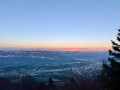
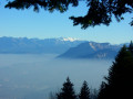
A hike for everyone, entirely through woodland, with two superb viewpoints to discover the Chambéry basin, the foothills of the Bauges massif, the northern Chartreuse (Mont Granier) and, the icing on the cake, His Majesty Mont Blanc.
There is a slight difficulty in the form of three steel ladders, which can be bypassed via another path so you don’t miss a thing.
La Croix du Signal and the Échelles de Château Richard on the Verthemex side
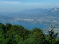
A circular forest loop, which can be completed in half a day and is accessible for most of the year, passing by the Croix du Signal viewpoint overlooking the Cluse de Chambéry and the Échelles de Chateau-Richard with its views of Lake Aiguebelette.
Circular walk from Nances
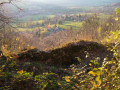
This circular walk can be enjoyed in any season, taking you up above Novalaise to the Sainte-Rose Chapel, then up to the former Villas Doria before crossing over to the site of the old Épine fortified castle and descending back into the valley.
The Balcons du Lac d'Aiguebelette from Nances
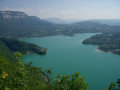
This long circular loop takes you across the slopes of L'Épine overlooking Lake Aiguebelette, between a rather tough and steep climb and a return to lake level. It can get hot here on summer afternoons, but it remains passable until late in the season, as long as the snow does not fall below 800m.
Circular walk of Chenevières, via the Roche des Millières
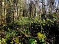
Les Chenevières is a wooded rocky ridge connecting Banchet to Mont Tournier, between the Cols de la Crusille and Cols de la Lattaz. This short circular route, which can be completed in half a day with the family, passes by the Pierre des Millières viewpoint and numerous daffodil sites in spring.
Mont Tournier
The Mont Tournier hike is described several times on the site, and this circular route differs from previous descriptions in a few ways. Part of this route is on tarmac roads, but there is very little traffic.
Bois de Glaize: Saint-Martin Chapel, Recorba and Mont Tournier
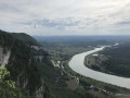
This circular route takes place mainly in the forest and can be completed in any season in half a day, allowing you to visit the characteristic sites and viewpoints of this area crossed by pilgrims on the Way of St James.
Circular route from La Lattaz to Mont Tournier from Saint-Maurice-de-Rotherens
This circular route, suitable for all seasons, takes you along the ridge of the Montagne du Tournier, which runs from the Col de la Lattaz to Mont Tournier (877m), passing through various characteristic spots in the area, with unobstructed views of the surrounding mountain ranges.
Mont Tournier from Saint-Maurice
A modest peak in the Savoyard foothills, Mont Tournier offers the opportunity for a pleasant hike to discover the vestiges of the past and the history of the Italian engineer Galetti.
Château Richard Croix du Signal circuit.
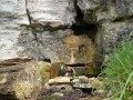
The Épine massif near Chambéry is criss-crossed by numerous marked and unmarked trails; it is a mountain that has always been traversed by people. It is a vibrant area with economic and tourist appeal.Here is a short route that allows you to discover some of its attractions.
Circular Mont Tournier hike via the Chemin de la Boissière
The Mont Tournier area offers numerous combinations of forest trails, which are often signposted and relatively well-used. This circular path deviates from these paths in part to reveal an ancient passage between two levels of the cliff overlooking the Rhône, leading to the Trou de la Mule and the Grotte de Jean Gonet, known only to a select few and a handful of hunters.
Please note: the route is in poor condition and difficult to follow in places: see Practical Information
From the Col de l'Épine
A beautiful hike, not too difficult despite a few climbs! But no problem for experienced hikers. The route is partly shaded.
The circular Banchet: daffodils and Château de Montbel
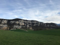
Montagne du Banchet is very popular when the daffodils are in bloom: the proposed route runs along the flower-covered ridge and stretches to the ruins of the proud Château de Montbel.
From Col du Banchet to Château de Montbel
A pleasant, sunny half-day walk, very popular in spring when the daffodils are in bloom.
Les Granges and Le Villard from Barbizet
A short walk above La Motte Servolex, offering rural scenery and panoramic views of the surrounding area.
Route above La Motte-Servolex
A circular route mainly through woodland in the Montagne de l’Épine above La Motte-Servolex. The path, which is quite steep for the first few kilometres, joins a forest track that descends towards the hamlet of Les Cattis, where there are views towards Lac du Bourget (to the north-east), the Massif des Bauges (to the east) and the Cluse de Chambéry. On the return journey, after a few sections along roads, you pass through the hamlets of Les Granges, Le Villard and Montaugier.
The Saint-Alban tour
An easy walk at the foot of the Montagne de l'Epine, enhanced by a waterfall and panoramic views of Lac du Bourget and Les Bauges. Markings are inconsistent.
Loop starting from Grésin
This loop starting from the village of Grésin allows you to discover the site where the Italian engineer Galetti installed his harp antenna.
Today, the site on the edge of a cliff offers a beautiful view of the Rhône canalised between the departments of Savoie and Ain.
It then follows a section of the Way of St James.
The route is dotted with shells, of course, but also with stone and metal crosses.
Route through the hamlets of La Motte Servolex
This walk passes through some of the many hamlets of La Motte Sevolex. Although they are gradually being swallowed up by urbanisation, they nevertheless retain their rural character.
Along the way, there are beautiful views of Les Bauge and Lac du Bourget.
Chemin du Follaton, Chemin des Bidons
This is an 8-shaped hike; you can do the southern circular loop or the northern circular loop. You can also do both, starting from the centre of the village of Dullin.
On the heights of Bourget-du-Lac
Enjoy the undergrowth and streams as you walk along the stony paths and through the forest. Pass through the hamlets of Grimaillon and Les Cachouds to La Roche Saint-Alban. Return via Château de la Serraz, Les Grangeons and La Matassine.
The Dent du Chat from the Relais des Aigles
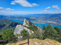
Ascent to the Dent du Chat from the Relais des Aigles. Splendid views, with 90 per cent of the walk taking place in the shade amongst the trees. Along the way, you’ll come across giant anthills shaped like large piles of fir needles, magnificent vegetation and plenty of butterflies and bumblebees. On arrival, there’s a superb view of Lake Bourget, with – in season – numerous paragliders flying overhead.
Avressieux Marshes Route
The Avressieux Marshes: an easy route to discover peace and nature along the water’s edge.
Saint-Sulpice - The three passes
An easy hike on the eastern slope of the Épine mountain, taking the Roman road and the Sardinian road.
Mont Grelle from Saint Sulpice
This hike takes place on the eastern flank of the Montagne de l'Épine towards a destination that is clearly visible from the entire Chambéry basin.
At the summit, there is a beautiful view of the Savoyard foothills and Lake Aiguebelette, and Lake Bourget is also visible.
The route does not present any orientation difficulties.
The Rocher du Corbeau, starting from Saint-Sulpice
The Rocher du Corbeau is easily accessible from Aiguebelette-le-Lac. I suggest you get there without taking the car to cross the massif. I have deliberately extended the hike slightly by adding a bit of elevation gain and giving us the chance to walk through this massif and discover two passes and the François I Cave.
It’s a hike I particularly enjoy in winter (when it’s warm, I prefer to head for the higher peaks), but above all, as it’s mainly through woodland, the lack of vegetation means you can enjoy more views.
The Dent du Chat and the Molard Noir
Variation of the "Dent du Chat" with a route that passes through Molard Noir and starts above Caton, instead of the traditional "Col du Chat".
Mont Gela and Château de Tavollet circular
Mont Gela is a micro-range at the southern end of the Bugey, which offers a variety of routes despite its low altitude and limited size. The proposed circular visits its main sites and endeavours to pass by the viewpoints of its limestone ridge. Feasible in all seasons, it requires a good sense of direction, as some forgotten passages are poorly marked on the ground and vegetation sometimes obstructs the path.
The Dent du Chat circular route from the Hôtel de la Source
A fairly challenging walk on the first section with an average gradient of around 20%. Some quite vertiginous sections, but well secured with cables and ladders.On the descent, part of the path is poorly marked or unmarked; it is best to have some basic orienteering skills. At the top, superb views of Mont Blanc, Belledone, the Chartreuse, the Bauges, etc.
Mont Grelle
This hike takes you to the summit of Mont Grelle and runs along part of Lake Aiguebelette, which can be admired from a viewpoint.
Montagne d’Izieu and Grand Thur from Murs
The Montagne d’Izieu and the Grand Thur are accessible all year round via numerous paths criss-crossing the area. The circular route described here takes you along these paths from the Route de Fay via pleasant wooded trails.
Aiguebelette, Rocher du Corbeau, Col du Crucifix and Col Saint-Michel
Starting from Aiguebelette, this is an easy hike on the western slope of the Épine mountain, taking the Voie Romaine and the Voie Sarde. This route offers numerous views of Lake Aiguebelette.
See the safety recommendations at (9).
On the heights of Lake Aiguebelette
A moderately challenging hike overlooking the beautiful Lac d'Aiguebelette. You’ll follow part of the old trade routes between France and Italy and discover the François I Cave.
Maisons Fortes viewpoint: a circular walk from Le Chevelu
From Saint-Jean-de-Chevelu, a circular route to the Maison Forte viewpoint above Vernatel offers a superb view towards the Chevelu Lakes. It is possible to climb to the Dent du Chat via the Col de la Vacherie.
Le Chemin de Coirat
Peri-urban circuit to quickly escape the city. Views of Chartreuse and Bauges.
The Chemin du Bon Pas
A short walk to escape the city. Some clear views as soon as you climb.
Route around Combe Grenand
An easy route starting from the village of La Bridoire, offering an opportunity to explore contemporary history whilst also marvelling at the work of water, which over millennia has shaped the geological features of what is now the Combe Grenand.There are various information panels along the route, including a series designed as a game for children.
Loop around La Bridoire and Saint-Béron
A very pleasant walk, often in the shade. Ideal for very hot days. Very little tarmac and, as a bonus, waterfalls. Points of interest: the Robin Stele (a tragic episode in the Resistance), the gorges visible from the footbridge, the waterfall, etc.
On the heights of La Bridoire
A pleasant walk in good weather. Some sections are quite steep.
Please note that for much of the route, signposting is virtually non-existent. Take care, and use the map or GPS track.
Discovery trail around the Chevelu Lakes
This walk in the Savoyard foothills runs alongside the vineyards of this region.
Vineyards are synonymous with well-exposed plots.
The Chevelu Lakes
In the Savoyard foothills, in the Chambéry Pre-Alps, a walk of less than two hours around the magnificent Chevelu Lakes.
Notre-Dame de la Montagne and the Chevru Cross on the heights of Yenne.
A hike in partial shade and partial sun on the heights of Yenne, offering beautiful panoramic views of Mont du Chat and the Rhône plain. Beautiful views of the Gorges de la Balme, the Château de Pierre Châtel and Fort les Bancs.
Circuit of viewpoints and balconies in Yenne
This is a half-day outing and the route is dotted with points of interest with information panels.
Until the Pré Cevin intersection, shortly after the Croix de Chevru, the route follows theGR® trail, which is part of the Way of St. James. Then follow the yellow markings until you reach your destination.
Circular route in the Montagne de Parves from the Pont de Nattages
The Montagne de Parves is a promontory of the Bugey region, wedged between the Rhône diversion feeding the Belley waterfall and the route of the bypassed section of the Rhône passing through the Pierre-Châtel gorge. Its modest altitude makes it accessible all year round; the suggested route starting from Yenne offers a wide variety of landscapes and views, ranging from the banks of the Rhône, the site of Fort les Bans, the limestone plateau of Mont Chevreaux and the rural landscape of the commune of Parves-et-Nattages.
Grand loop of the lakes of Saint-Jean-de-Chevelu
A pleasant hike in the Savoyard foothills. Vineyards are still very much present. Yellow markings and a few directional signs help you follow the description.
Cat Tunnel Circular Loop
Exploring the Cat Tunnel via the safety gallery. This gallery, running parallel to the road tunnel, serves as an emergency exit in the event of an incident. Normally, this passage is used by many cyclists as well as pedestrians to get from the Lac du Bourget side to the Yenne Valley and the Chevelu Lakes. The tunnel has been converted into the “Musée du Chat” and features an impressive collection of murals created by contemporary artists, inspired by Savoyard tradition. In my opinion, it is unique in France. A note on the route: you will see an elevation gain of 732 m, which is incorrect, as the software includes the mountain height above the tunnel; you must therefore subtract 321 m, bringing the route’s total elevation gain down to 455 m.
From Bourdeau to Hautecombe overlooking Lake Bourget
Here is a good route connecting Bourdeau to Hautecombe Abbey.
The outward journey takes you above the wild shores of Lake Bourget with numerous viewpoints, all on a somewhat rugged route.
After climbing a little higher, the return route takes you in the shadow of Mont de la Charvaz before coming back via the Col du Chat.
Circuit de la Chapelle du Mont-du-Chat
This hike takes place in a setting dear to Lamartine. The first part, which runs alongside Lac du Bourget, offers beautiful views, and a good climb leads to the Chapelle Notre-Dame de l'Étoile. Be sure to linger around the building and take advantage of the facilities to admire the panorama.
On the way back through the forest, there are other viewpoints over the Savoyard countryside. Finally, the descent to Bourdeau also offers some sought-after views.
19/09/2023 Message from the moderator: the section between (2) and (3) is very steep and slippery on the way up and requires a good level of fitness for around 500 m. Some sections between (8) and (9) are also slippery on the way down. This route should be attempted in dry weather. Not recommended for young children.
From Col du Chat to Petit Villard
A lovely little walk with lots of views of the lake. Much of the route is in the forest, making this hike ideal on a hot day.
The Dent du Chat and the Roc de Cornillon
This is a lovely half-day hike with beautiful views of Lac Du Bourget, Aix-Les-Bains and the Chambérien basin, the Belledonne massif and Mont Blanc on one side, and the Savoyard foothills (Yenne, Belley, Grand Colombier) on the other.
Please note: Those who are afraid of heights may be affected by some technical sections equipped with cables or ladders.
Circular Mont de la Charvaz route via the southern ridge
A circular route allowing you to walk along the wild ridge that runs from the Col du Chat to the summit of Mont de la Charvaz, returning to the foot of the mountain. Much of the ridge route is off-trail but presents no real difficulty other than orientation.
Corsuet Forest and Cross
The Corsuet Forest is criss-crossed, indeed criss-crossed by numerous paths and trails. It is an open space that allows you to escape the urban environment whilst remaining close to the town.
The numerous signposts will provide useful guidance for walkers.
The route described here is just a modest example of the possibilities offered by the Corsuet Forest.
Here, the paths have taken their names from the animal kingdom.