Route above La Motte-Servolex

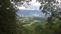
A circular route mainly through woodland in the Montagne de l’Épine above La Motte-Servolex. The path, which is quite steep for the first few kilometres, joins a forest track that descends towards the hamlet of Les Cattis, where there are views towards Lac du Bourget (to the north-east), the Massif des Bauges (to the east) and the Cluse de Chambéry. On the return journey, after a few sections along roads, you pass through the hamlets of Les Granges, Le Villard and Montaugier.

Details

101215250
Creation:
Last update:
Last review:
  • Walking
    Activity: Walking
  • ↔
    Distance: 6.19 mi
  • ◔
    Average duration: 4h 15 
  • ▲
    Difficulty: Moderate

  • ⚐
    Back to start: Yes
  • ↗
    Ascent: + 1,578 ft
  • ↘
    Descent: - 1,555 ft

  • ▲
    Highest point: 2,661 ft
  • ▼
    Lowest point: 1,319 ft

Description of the walk

Park at the Sources des Fées car park, Route de Villard Péron.

(S/E) With your back to the car park, cross the Nant de Gariod and join a side path.

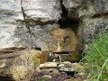
(1) Take the path on the right, then at the junction continue straight on to the Sources des Fées.

(2) Cross the stream again and head up to the right, ignoring all the paths running at right angles. Pass under a power line, then turn left to reach the junction with the Chemin du Garde.

(3) Turn right onto this path until you reach a junction.

(4) Ignore the track going uphill opposite, take the hairpin bend to the right and continue along the Chemin du Garde until you reach the Chemin des 3 Murgers.

(5) Leave Chemin du Garde and head down to the right along this track until you reach Chemin des Cattis.

(6) Follow it to the right and continue towards the Route de Barbizet.

(7) Carry on straight ahead along this road until you reach a path starting on the right.

(8) Leave the road and take this path. At the bend, head straight on until you reach the hamlet of Chatet.

(9) Join a road, follow it for 50 metres, then cross it and take the path opposite.

(10) Turn right onto the path leading into the forest and continue straight on to Les Granges du Villard.

(11) Join the Route de Montaugier and follow it straight ahead, cutting across some of the hairpin bends. You’ll come out onto the Route de Villard Péron.

(12) Follow it to the right until you reach the Sources au Fées car park (S/E).

Waypoints

  1. S/E : mi 0 - alt. 1,555 ft - La Source des Fées car park
  2. 1 : mi 0.08 - alt. 1,617 ft - Junction
  3. 2 : mi 0.24 - alt. 1,690 ft - Source des Fées junction. - Nant Bruyant (cours d'eau) - Affluent du Doron de la Leysse
  4. 3 : mi 1.33 - alt. 2,651 ft - Junction with the Garde track
  5. 4 : mi 1.98 - alt. 2,539 ft - Junction of paths
  6. 5 : mi 3.06 - alt. 1,949 ft - Junction with the Chemin des 3 Murgers
  7. 6 : mi 3.54 - alt. 1,532 ft - Chemin des Cattis junction
  8. 7 : mi 3.65 - alt. 1,493 ft - Junction with the Route de Barbizet
  9. 8 : mi 3.96 - alt. 1,345 ft - Junction onto a footpath
  10. 9 : mi 4.45 - alt. 1,335 ft - Chatet hamlet
  11. 10 : mi 4.52 - alt. 1,332 ft - Junction
  12. 11 : mi 5.43 - alt. 1,742 ft - Les Granges du Villard
  13. 12 : mi 6.04 - alt. 1,568 ft - Junction with the Route de Villard Péron
  14. S/E : mi 6.19 - alt. 1,555 ft - La Source des Fées car park

Notes

There are no drinking water points along the walk.

Worth a visit

Various panoramic views at Les Cattis and along the Route de Montaugier.

Other walks in the area

For more walks, use our search engine .

The GPS track and description are the property of this route's author. Please do not copy them without permission.