Refine your search for walks in Malbo
Malbo walks


 Route des Volcans de Malbo
 Association / Club / Walk leader
 5.44 mi
 +735 ft
 -715 ft
 3h 10
3h 10
 Moderate
 Departure from Malbo (Cantal)
A path offering the chance to discover distinctive geological formations (tuff).
The Malbonnet circuit
 6.97 mi
+1,010 ft
-1,007 ft
4h 05
Moderate
Departure from Malbo (Cantal)
6.97 mi
+1,010 ft
-1,007 ft
4h 05
Moderate
Departure from Malbo (Cantal)
A walk through the hills above Malbo, amongst woods and pastures.
The Rocaillade Trail starting from Malbo
 2.86 mi
+463 ft
-423 ft
1h 45
2.86 mi
+463 ft
-423 ft
1h 45
 Easy
Departure from Malbo (Cantal)
Easy
Departure from Malbo (Cantal)
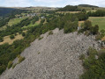
A geological account of the formation of this periglacial scree.
Montréal Waterfall and Montréal Cross in Brezons
 Visorando Member3.09 mi
+1,135 ft
-1,135 ft
2h 25
Moderate
Departure from Brezons (Cantal)
Visorando Member3.09 mi
+1,135 ft
-1,135 ft
2h 25
Moderate
Departure from Brezons (Cantal)
A gentle warm-up walk in the superb Brezons valley. The walk starts in this pretty village, typical of the Cantal region. The Croix de Montréal, our destination, is clearly visible against the backdrop of the forest. There’s a viewpoint overlooking the lovely Montréal waterfall, followed by the climb up to the cross, offering panoramic views across the whole valley. For almost the entire walk, apart from a few short sections, you’ll be in the shade of a beautiful beech forest.
La Borie Waterfalls (Brezons Valley)
 0.91 mi
+338 ft
-338 ft
0h 45
Moderate
Departure from Brezons (Cantal)
0.91 mi
+338 ft
-338 ft
0h 45
Moderate
Departure from Brezons (Cantal)
Truly spectacular waterfalls. Well-designed facilities (without which a visit would be impossible), including a vertiginous 30-metre staircase and viewing platforms. A short but steep walk. The hamlet of Laborie is also very charming.
From Lacapelle-Barrès to Malbo and back, around the Siniq valley
 9.18 mi
+1,283 ft
-1,293 ft
5h 20
Moderate
Departure from Lacapelle-Barrès (Cantal)
9.18 mi
+1,283 ft
-1,293 ft
5h 20
Moderate
Departure from Lacapelle-Barrès (Cantal)
A beautiful walk along a ridge above a lush green valley. Superb views over the Cantal plateau. The route generally follows the contour lines, though there are still a few steep ascents and descents.
Le Puy Gros and the Sources du Goul
 7.29 mi
+968 ft
-968 ft
4h 10
Moderate
Departure from Saint-Clément (Cantal) (Cantal)
7.29 mi
+968 ft
-968 ft
4h 10
Moderate
Departure from Saint-Clément (Cantal) (Cantal)
A beautiful walk along the Cantalian ridges. Open landscapes and magnificent views. To be done in good weather.
Le Puy Gros via the burons
 11.90 mi
+1,896 ft
-1,916 ft
7h 05
11.90 mi
+1,896 ft
-1,916 ft
7h 05
 Difficult
Departure from Saint-Clément (Cantal) (Cantal)
Difficult
Departure from Saint-Clément (Cantal) (Cantal)
A circular route starting from the Buron de la Tuillière, passing through Puy Gros, whilst avoiding theGR® trails as much as possible, as they are very busy in summer.
The numerous burons encountered along the route offer some lovely moments.
This hike is for experienced walkers only (navigation, livestock, barbed wire).
Please note: you will be crossing pastures with cows and bulls. So please take care (dogs, children, etc.). And don’t forget to close the gates behind you.
Saut de la Truite and the waterfalls of the Livernade stream
 3.61 mi
+1,211 ft
-1,220 ft
2h 45
Moderate
Departure from Brezons (Cantal)
3.61 mi
+1,211 ft
-1,220 ft
2h 45
Moderate
Departure from Brezons (Cantal)
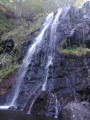
Waterfalls, woodland, stream, at the bottom of the magnificent Brezons Valley.Forests and pastures, magnificent Cantalian landscapes; old stone burons, summer pastures, views of the Plomb du Cantal peaks.Three routes: easy (40 mins), moderate (1 hr 30 mins), full (3 hr 30 mins).Well-designed facilities to make the most of the site’s beauty without spoiling it.
"Mountains" route in Pailherols
 6.26 mi
+846 ft
-863 ft
3h 35
Moderate
Departure from Pailherols (Cantal)
6.26 mi
+846 ft
-863 ft
3h 35
Moderate
Departure from Pailherols (Cantal)
The Montagnes are isolated burons (shepherd's huts) on the Carladès summer pastures. This easy walk offers views of the typical landscapes of this Auvergne high plateau.
Puy Gros from Niervèze
 5.51 mi
+1,890 ft
-1,903 ft
4h 10
Moderate
Departure from Thiézac (Cantal)
5.51 mi
+1,890 ft
-1,903 ft
4h 10
Moderate
Departure from Thiézac (Cantal)
From the village of Niervèze, this route, mainly along summer pasture paths, takes you to the summit of Puy Gros and its plateau, passing close to magnificent restored burons (private) and the old Chapelle du Cantal, of which only a few ruins and a basalt cross remain.There is a magnificent view over the Cère valley and the main peaks: Puy Chavaroche, Puy Mary, Puy Griou, Peyre Arse, Téton de Vénus and Rocher du Bec de l’Aigle.
Puy Gros, Cirque d'Encloux and Grandval and return via Niercombe
 10.33 mi
+3,369 ft
-3,320 ft
7h 40
Difficult
Departure from Thiézac (Cantal)
10.33 mi
+3,369 ft
-3,320 ft
7h 40
Difficult
Departure from Thiézac (Cantal)
This hike allows you to discover "forgotten" places, away from the GR®400, on the section between Puy Gros and Plomb du Cantal. You will discover many restored burons (stone huts), amazing sites and, especially in spring, a rich variety of wild flora and animals with their young. However, this circuit is often off the beaten track, taking you closer to the wildest areas where you are most likely to encounter animals or see rare plants.
Niervèze and Chaos de Casteltinet
 4.20 mi
+974 ft
-945 ft
2h 45
Moderate
Departure from Thiézac (Cantal)
4.20 mi
+974 ft
-945 ft
2h 45
Moderate
Departure from Thiézac (Cantal)
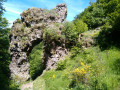
A walk in the mountains among cows and typical Cantal landscapes. Niervèze, a lively mountain village, and the geological curiosity of Chaos de Casteltinet and its impressive Lion's Gate are on the programme. Yellow markings.
Chaos de Casteltinet
 1.95 mi
+633 ft
-607 ft
1h 25
Easy
Departure from Thiézac (Cantal)
1.95 mi
+633 ft
-607 ft
1h 25
Easy
Departure from Thiézac (Cantal)
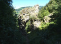
This route takes you on a stroll through the woodland at the Chaos de Casteltinet site, formed by a rockslide characterised by piles of boulders. Walking along these paths allows you to explore this magnificent spot, not forgetting the passage through the ‘portal’ of the Porte du Lion.
A quote from L. Delhostal that sums up the place perfectly:
The ancient giants rooted in the earth
Seem like strange warriors,
The last vestiges of a war
Terrifying war of the Titans.
Thiézac – Mandailles
 8.43 mi
+2,802 ft
-2,379 ft
6h 20
Moderate
Departure from Thiézac (Cantal)
8.43 mi
+2,802 ft
-2,379 ft
6h 20
Moderate
Departure from Thiézac (Cantal)
Stage3 of theGR®400, clockwise.
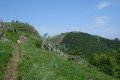
A fairly peaceful stage with a short climb up the Elancèze, offering a stunning view of the peaks and the previous day’s route.
Carladez - The Laussac Peninsula.
 9.42 mi
+1,358 ft
-1,368 ft
5h 30
Moderate
Departure from Thérondels (Aveyron)
9.42 mi
+1,358 ft
-1,368 ft
5h 30
Moderate
Departure from Thérondels (Aveyron)
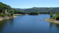
This hike, leading from the Thérondels plateau to the wooded slopes of the Truyère, offers a bird's eye view of the narrow "fjord" formed by the Sarrans Lake reservoir. The Laussac peninsula and its splendid chapel are one of the most iconic sites in Carladez, north of Aveyron.
Rocher des Pendus
 0.74 mi
+197 ft
-197 ft
0h 30
Easy
Departure from Saint-Clément (Cantal) (Cantal)
0.74 mi
+197 ft
-197 ft
0h 30
Easy
Departure from Saint-Clément (Cantal) (Cantal)
Quick access to an orientation board offering a view of the town of Vic-sur-Cère and its valley.
Prat de Bouc – Thiézac
 11.90 mi
+1,969 ft
-3,927 ft
7h 10
Moderate
Departure from Albepierre-Bredons (Cantal)
11.90 mi
+1,969 ft
-3,927 ft
7h 10
Moderate
Departure from Albepierre-Bredons (Cantal)
Stage2 of theGR®400, travelling clockwise.
Plomb du Cantal and a long panoramic ridge before descending to Thiézac.
The Pas de Cère Gorges
 1.52 mi
+676 ft
-682 ft
1h 15
Easy
Departure from Thiézac (Cantal)
1.52 mi
+676 ft
-682 ft
1h 15
Easy
Departure from Thiézac (Cantal)
A lovely, short round-trip walk through the Gorges de la Cère with no major difficulties. The path is a bit steep on the way down into the gorges (and back up again), so make sure you wear suitable footwear as the ground can be slippery after rain and there are plenty of roots and rocks. The walk is shaded and takes you through some very pretty gorges, which are less developed but just as beautiful as the better-known Jordanne Gorges in the neighbouring valley.
Plateau de la Planèze from Col de Prat de Bouc
 7.80 mi
+853 ft
-863 ft
4h 20
Moderate
Departure from Albepierre-Bredons (Cantal)
7.80 mi
+853 ft
-863 ft
4h 20
Moderate
Departure from Albepierre-Bredons (Cantal)
The Plateau de la Planèze starting from Prat de Bouc.
N.B. Following the route with the Visorando app can be very useful in the forest due to the numerous trail intersections encountered.
Prat de Bouc–Lavessière
 9.12 mi
+814 ft
-2,316 ft
4h 55
Moderate
Departure from Albepierre-Bredons (Cantal)
9.12 mi
+814 ft
-2,316 ft
4h 55
Moderate
Departure from Albepierre-Bredons (Cantal)
Stage 7 of our Tour du Cantal. This is the final stage of the Tour du Cantal, with another change to the GR®400 route: instead of returning to Murat, we head back to Laveissière (where we left our vehicle, see episode 1). Most of this stage is in the shade, but the descent brings the heat..
Plomb du Cantal from the Col de Prat-de-Bouc
 4.88 mi
+1,535 ft
-1,535 ft
3h 35
Moderate
Departure from Albepierre-Bredons (Cantal)
4.88 mi
+1,535 ft
-1,535 ft
3h 35
Moderate
Departure from Albepierre-Bredons (Cantal)
The highest peak in Europe's largest volcanic complex, the Plomb du Cantal (1,855 m) offers unobstructed views of the Monts-Dore (Puy-de-Sancy) to the north and the Cézallier and Aubrac plateaus to the south.
Loop around Plomb du Cantal
 8.85 mi
+3,061 ft
-3,061 ft
6h 45
Difficult
Departure from Albepierre-Bredons (Cantal)
8.85 mi
+3,061 ft
-3,061 ft
6h 45
Difficult
Departure from Albepierre-Bredons (Cantal)
Its height of 1855 metres make Plomb du Cantal the second highest peak in the Massif Central after the Puy de Sancy.
Starting from the Col de Prat de Bouc, this hike initially leads to the summit ascent and descent on the northern slope, followed by a climb up the slopes of the Puy du Rocher before returning to Prat de Bouc.
Plomb du Cantal and its ridge via the Prés Marty
12.14 mi
+2,549 ft
-2,543 ft
7h 50
Moderate
Departure from Albepierre-Bredons (Cantal)
Hike on one of the must-see sites in Cantal, preferably outside the tourist season, when the Lioran chairlifts are not in operation. After the tranquillity of the summer pastures on the Prés Marty, the Plomb du Cantal reveals superb landscapes. A return trip along the ridge to the Chapelle du Cantal allows you to make the most of these heights.
The Vergnes Waterfall
4.50 mi
+951 ft
-935 ft
2h 55
Easy
Departure from Albepierre-Bredons (Cantal)
A partially shaded hike in the Lagnon valley offering views of two waterfalls.
From Plomb du Cantal to Lioran via Puy du Rocher
 4.08 mi
+404 ft
-2,205 ft
2h 15
Moderate
Departure from Saint-Jacques-des-Blats (Cantal)
4.08 mi
+404 ft
-2,205 ft
2h 15
Moderate
Departure from Saint-Jacques-des-Blats (Cantal)
Short hike along the ridges with breathtaking views of the Cantal mountains. You can reach the starting point by taking the cable car from Le Lioran or by following the same route in the opposite direction. After enjoying the view from the highest point in this beautiful department, you will reach the Pas des Alpins by following the GR®4/GR®400 marked trail. You will then climb up to the Puy du Rocher to enjoy another breathtaking view of the Plomb du Cantal and its surroundings. Then you will descend towards the Lioran resort on the ridges. The walk ends in the Lioran forest.Please note: after passing Puy du Rocher, two areas may seem a little difficult for some as they require descending the rock, but aids have been put in place.
Around the hamlet of Les Gardes
4.38 mi
+1,339 ft
-1,332 ft
3h 10
Moderate
Departure from Saint-Jacques-des-Blats (Cantal)
A lovely route starting from the hamlet of Les Gardes with beautiful views of the Arpon du Diable, the cable car arrival point and the Plomb du Cantal. The route passes through the summer pastures and above the Lioran resort. Watch out for cows in summer and autumn.
Le Plomb du Cantal starting from Les Gardes. Return via Ferval
8.96 mi
+2,884 ft
-2,877 ft
6h 40
Difficult
Departure from Saint-Jacques-des-Blats (Cantal)
A lovely walk starting from the hamlet of Les Gardes with beautiful views of the Cantal massif. A gentle, steady climb up to the Plomb du Cantal. A route along the ridges followed by a descent into the Ferval valley. The walk passes through mountain pastures; watch out for cows present from May through to autumn.
Faillitoux Waterfall
 2.68 mi
+597 ft
-574 ft
1h 45
Easy
Departure from Thiézac (Cantal)
2.68 mi
+597 ft
-574 ft
1h 45
Easy
Departure from Thiézac (Cantal)
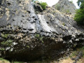
This route takes you to one of the prettiest waterfalls in the Cantal. The Faillitoux waterfall, with a drop of around 40 metres, flows over a lava flow with basalt columns at the foot of the waterfall. The pretty hamlet of Lasmolineries, with its renovated bread oven, is also worth a visit.
Puy Griou and Puy de l'Usclade circular loop
 8.31 mi
+2,457 ft
-2,434 ft
6h 00
Difficult
Departure from Saint-Jacques-des-Blats (Cantal)
8.31 mi
+2,457 ft
-2,434 ft
6h 00
Difficult
Departure from Saint-Jacques-des-Blats (Cantal)
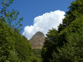
After a steep climb at the start, the Puy Griou, the central cone of the Cantal mountains, offers a magnificent panoramic view. The route then becomes easier and, alternating between slight ascents and descents, offers different views of this distinctive dome.
The Puy de l'Usclade is a must-see due to its strategic position. It offers a view to the north of the various puys and also of the Jordanne valley.
Circular walk around Puy Griou starting from the hamlet of Les Chazes
 4.47 mi
+1,545 ft
-1,539 ft
3h 25
Moderate
Departure from Saint-Jacques-des-Blats (Cantal)
4.47 mi
+1,545 ft
-1,539 ft
3h 25
Moderate
Departure from Saint-Jacques-des-Blats (Cantal)
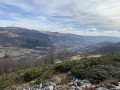
A circular walk around Puy Griou, taking in rural heritage, beech forests, mountain pastures, a buron (traditional dairy hut), scree slopes, peaks and views over the surrounding valleys. A very beautiful walk on one of the area’s most famous puys.
Puy Griou from Les Chazes
9.55 mi
+2,385 ft
-2,392 ft
6h 30
Moderate
Departure from Saint-Jacques-des-Blats (Cantal)
Starting from the chapel dedicated to Puy Griou, a circular route allows you to discover this unmissable summit of the Cantal volcano, crossing forests, summer pastures and hamlets on the slopes of the Cère valley.
Jordanne Valley via Élancèze and Courpou Sauvage
8.02 mi
+2,785 ft
-2,795 ft
6h 05
Moderate
Departure from Mandailles-Saint-Julien (Cantal)
Starting from the Col du Pertus, climb quickly to the heights for a long walk along the ridge, which offers beautiful views. Then discover a few villages in the Jordanne valley before climbing back up to the pass through the pastures.The Visorando app is useful for following this route at the end of the walk.
Élancèze from the Col du Pertus
 2.09 mi
+860 ft
-860 ft
1h 45
Easy
Departure from Mandailles-Saint-Julien (Cantal)
2.09 mi
+860 ft
-860 ft
1h 45
Easy
Departure from Mandailles-Saint-Julien (Cantal)
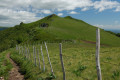
This is a fairly easy short hike to a beautiful promontory offering a panoramic view of the main Monts du Cantal and the Jordanne and Cère valleys.
Puy de l'Usclade from Col du Pertus
 4.23 mi
+886 ft
-886 ft
2h 45
Moderate
Departure from Mandailles-Saint-Julien (Cantal)
4.23 mi
+886 ft
-886 ft
2h 45
Moderate
Departure from Mandailles-Saint-Julien (Cantal)
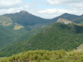
Puy de l'Usclade is little known, but offers a beautiful view of Puy Griou and the other surrounding peaks. The first part of the walk, up to Col de Gliziou, is easy and shaded, and fairly busy, while the second part is less frequented and ends with a steeper section.
Puy Griou from Les Chazes
4.31 mi
+1,818 ft
-1,818 ft
3h 35
Moderate
Departure from Saint-Jacques-des-Blats (Cantal)
The summit of Puy Griou has a characteristic cone shape and can be seen from afar. Located in the heart of the Cantalian volcano, it offers a superb panorama. The proposed route, which is fairly short, has the advantage of avoiding the Super Lioran ski resort facilities.
Jordanne Valley from the Col du Pertus
8.29 mi
+1,594 ft
-1,594 ft
5h 10
Moderate
Departure from Mandailles-Saint-Julien (Cantal)
From the Col du Pertus, discover the village of Mandailles and the hamlets of Larmandie and Liadouze on the banks of the Jordanne. On both the outward and return journeys, gaps in the forest offer beautiful views of the valley, the Chavaroche and Puy Mary massifs, as well as the Gliziou and Puy Griou.
Update 2025: see practical information
Puy Griou from Col du Pertus
 6.56 mi
+1,686 ft
-1,686 ft
4h 30
Moderate
Departure from Mandailles-Saint-Julien (Cantal)
6.56 mi
+1,686 ft
-1,686 ft
4h 30
Moderate
Departure from Mandailles-Saint-Julien (Cantal)
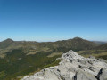
An easy, shaded approach to this iconic peak in the Monts du Cantal, with its perfect cone shape and superb views. However, the final climb is quite technical and challenging.
The Cirque de Chamalière via the waterfalls and the forest
 8.05 mi
+1,227 ft
-1,227 ft
4h 45
Moderate
Departure from Albepierre-Bredons (Cantal)
8.05 mi
+1,227 ft
-1,227 ft
4h 45
Moderate
Departure from Albepierre-Bredons (Cantal)
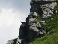
This route is ideal in hot weather. You will enjoy the coolness near the waterfalls and especially in the forest. In spring and autumn, this route will undoubtedly allow you to discover the wild flora and fauna in the Cirque. You will leave the coolness behind at the Col de la Molède, just long enough to descend towards Albepierre.
⚠️ At the point (3) , the hamlet of Raveyrol is replaced by Buron de Joaniol haut. This is a naming error on the IGN map.
Mandailles - Le Lioran
 7.79 mi
+2,274 ft
-1,273 ft
5h 35
Moderate
Departure from Mandailles-Saint-Julien (Cantal)
7.79 mi
+2,274 ft
-1,273 ft
5h 35
Moderate
Departure from Mandailles-Saint-Julien (Cantal)
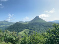
Stage 5 of our Tour du Cantal / GR®400A forest stage (therefore shaded) with two potential climbs: the Puy de l'Usclade and the Puy Griou.
* Editor's note: we have also decided not to follow the original GR®400 route, which makes a long detour to the Col de Pertus, which we don't think is worth the effort. We will reach the Col de Gliziou via the PR® (orange and green markings) which climb up the Ruisseau du Luc valley.