Country:

 City:
City:


Park in the car park 500 m before the Buron de la Tuillière (follow the signs).
GR®400
(S/E) Follow the road towards the Buron de la Tuillière.
(1) Walk past the buron, follow theGR® and continue straight on until you reach a fork in the path at a small pass at an elevation of 1327. The return route is to the right.
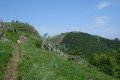
(2) Carry on straight ahead on theGR®, which begins the ascent along the plateau and passes a small peak at an elevation of 1,530. Carry on straight ahead again, descend slightly then climb, and you’ll see a valley on the left and a path leading down into it. Go slightly past this path to find a grassy path on the left that leads back a little way.
Unmarked
(3) Leave theGR® and take this path, which leads to the edge of the valley, where there is an entrance gate. Open and then close the gate to take the path that descends along the valley. After skirting the valley, the path descends quite steeply through the meadows and passes the three Burons de la Chambe; the lowest of the three appears to be very well restored.
(4) After passing the last of these, you’ll reach a crossroads of tracks. Ignore the track leading down towards the village of Niervèze and turn right onto a track that climbs and quickly enters the woods. This track climbs as it crosses another valley. Emerge from the woods to catch sight of the Buron de Niercombe a little further up. Continue along the stony path until you reach a ridge and a crossroads.
(5) Take the grassy path that descends to the left towards the Buron de Niercombe, in a very open area.
(6) Turn back.
(5) Climb up opposite along a well-marked path which, unfortunately, leads to a fence without a gate, so you’ll have to crawl under it (barbed wire).
(7) Once past this barrier, follow the path – which is sometimes damp and roughly follows the contour lines – leading to the Burons de Sedous.
(8) From these burons, head up to the right towards the ridge along a clearly visible track. Emerge onto the ridge through a final gate. You’ll join theGR® 400 and 465 routes.
GR® 400 and 465
(9) Follow this route for about 300 m to the left to enjoy the stunning view over the Bezons valley, near the Col de Chèvre.
(10) Retrace your steps.
(9) Continue straight on and descend gently towards a pass. You can clearly see the Puy Gros ahead on the right. Head towards it by following animal tracks that bypass theGR®, heading fairly straight for the summit.
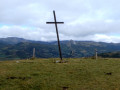
(11) Once at the summit, head down towards the Chapelle du Cantal, which is clearly visible below. Make your way to the chapel.
GR® 465
(12) Carry on for a few metres past the chapel to leave theGR® 400 and join theGR® 465 on the right. This follows a downhill track that is almost perfectly straight. Once you’ve passed the Puy de Bâne on the left, the track turns right and then reaches a junction of tracks.
Unmarked
(13) Leave theGR® 465 by taking a track to the right which leads to the Burons de Bâne (Montagnes de Bâne on the map). Head downhill and pass the last buron, which is in poor condition. You will then reach a path that follows the contour line.
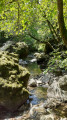
(14) Take this path on the right, heading due north, which crosses the Ruisseau du Goul before climbing gently up the opposite slope. This brings you back to the junction you passed on the way out.
(2) Turn left to reach the Buron de la Tuillière.
(1) Stop at the buron for a well-deserved drink break (!), then walk the 500 m up the road to reach the car park (S/E).

 Visorando Member
 Moderate
 Easy
Easy