Thiézac – Mandailles

Stage3 of theGR®400, clockwise.
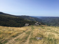
A fairly peaceful stage with a short climb up the Elancèze, offering a stunning view of the peaks and the previous day’s route.

This walk is part of a multi-day hike: Tour du volcan Cantalien par le GR®400 dans le sens horaire

Details

2219376
Creation:
Last update:
Last review:
  • Walking
    Activity: Walking
  • ↔
    Distance: 8.43 mi
  • ◔
    Average duration: 6h 20 
  • ▲
    Difficulty: Moderate

  • ⚐
    Back to start: No
  • ↗
    Ascent: + 2,802 ft
  • ↘
    Descent: - 2,379 ft

  • ▲
    Highest point: 5,131 ft
  • ▼
    Lowest point: 2,628 ft

Photos

Description of the walk

(S) After the church, continue along the main road until you reach a junction. Turn right, then immediately left to reach a Y-junction.

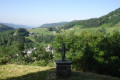
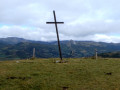
(1) Follow the signs for Notre-Dame de Consolation; the path is marked by a Way of the Cross and leads quickly to the Chapel of Notre-Dame de Consolation. Beautiful view. In front of the chapel, the path veers northwards and arrives at a cave known as the Grotte des Ermites.
The climb continues fairly steeply and rapidly but levels off as you reach the hillock where the Trielle lodge is situated. Cross the field below the farm, following the wooden markers, and you’ll emerge in front of the farm.

(2) Take the small road on the right, which continues on level ground to the hamlet of Le Clou.

(3) In the hamlet, take a path on the left that climbs through the woodland. Heading south-west, it then turns north as it approaches the high-altitude meadows. Continue climbing after a few bends towards the Vacherie de la Poche. Follow the track leading to the Vacherie until you reach a gate.

(4) Turn right onto a faint track that climbs gradually up to the Puy de la Poche. Follow the boundary of the pasture; do not take the track that branches off to the left on the ascent. Reach the summit of the Puy de la Poche.

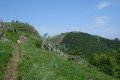
(5) Keep to the left along the ridge, alternating between ascents and descents. Then continue down a steep descent to reach a small pass at the foot of the Elancèze.

(6) Take the path on the left to reach the summit of the Élancèze.

(7) Return to the previous junction.

(6) Turn left to descend easily to the Col du Pertus, a junction of footpaths and roads.

(8) Cross the road and continue straight on, staying on theGR® towards Puy Griou. You’ll soon come to a Y-junction on theGR®, where the path splits into two branches.

(9) Take the left-hand branch, leaving the Puy Griou path. Head down through the woods and, after a hairpin bend, join a small road leading to the hamlet of Biguet.

(10) Turn off this road immediately to the right. Continue the descent, following the clearly visibleGR® signposts. You’ll reach another junction of paths near the Ruisseau du Luc.

(11) Turn left twice to reach a small road leading to the main road serving the village of Mandailles, today’s destination (E).

Waypoints

  1. S : mi 0 - alt. 2,628 ft - Thiézac
  2. 1 : mi 0.2 - alt. 2,723 ft - Ascent towards the - Chapelle Notre-Dame de Consolation
  3. 2 : mi 0.88 - alt. 3,563 ft - Trielle
  4. 3 : mi 1.76 - alt. 3,661 ft - Le Clou
  5. 4 : mi 3.1 - alt. 4,541 ft - Barrier after the Poche cattle shed
  6. 5 : mi 3.58 - alt. 4,859 ft - Puy de la Poche
  7. 6 : mi 4.31 - alt. 4,895 ft - Junction for both out-and-back routes. Left/A – Left/R
  8. 7 : mi 4.55 - alt. 5,115 ft - l'Élancèze
  9. 8 : mi 5.53 - alt. 4,295 ft - Col du Pertus
  10. 9 : mi 5.71 - alt. 4,357 ft - Junction towards Mandailles
  11. 10 : mi 6.65 - alt. 4,016 ft - Narrow road and viewpoint
  12. 11 : mi 7.34 - alt. 3,550 ft - Turn left twice
  13. E : mi 8.43 - alt. 3,054 ft - Mandailles - Jordanne (rivière)

Notes

- Water and cold drinks in Trielle.
- No water thereafter until you reach a few drinking fountains below the Col du Pertus.
- Hotel and lodge in Mandailles. Grocery shop adjoining the Les Genêts d’Or hotel.

Worth a visit

- Notre-Dame de Consolation Chapel:17th-century frescoes, well worth seeing. The key is at the Hôtel l’Élancèze in Thiézac.
- (9) Options to extend the route towards the Puy de l’Usclade and/or the Puy Griou, but this significantly lengthens the day’s walk.
(E) Accommodation available at

Always be cautious and plan ahead when you're outdoors. Visorando and the author of this route cannot be held responsible for any accidents occurring on this route.

The GR® and PR® markings are the intellectual property of the Fédération Française de Randonnée Pédestre.

Reviews and comments

4.4 / 5
Based on 3 reviews

Reliability of the description
4.3 / 5
Ease of following the route
4.3 / 5
Route interest
4.7 / 5
Jacqed
Jacqed

Overall rating : 5 / 5

Date of your route : Jun 19, 2026
Reliability of the description : ★★★★★ Very good
Ease of following the route : ★★★★★ Very good
Route interest : ★★★★★ Very good
Very busy route : No

Stage 3 of our tour of the Cantal Volcano on the GR400
A short transitional stage between two valleys. A pleasant route, partly along the ridges and through the forest. A superb view from L’Elancéze. The lovely village of Mandailles is well-equipped for walkers, with a hotel, lodge or camping spot by the water.
Signposting is consistently excellent.

Machine-translated

Le Col de la Molède à Cheval

Hello,
Can this route be done on a donkey or on horseback (in the opposite direction), bearing in mind that they cannot pass through the crossbars and need gates that open?

Machine-translated

danielrollet
danielrollet

Overall rating : 4.3 / 5

Date of your route : Jun 16, 2021
Reliability of the description : ★★★★☆ Good
Ease of following the route : ★★★★☆ Good
Route interest : ★★★★★ Very good
Very busy route : No

No particular problems, but the descents from Elancèze and the Marias valley should be tackled with caution.

Machine-translated

bernardgemenos
bernardgemenos

Overall rating : 4 / 5

Date of your route : Jun 13, 2021
Reliability of the description : ★★★★☆ Good
Ease of following the route : ★★★★☆ Good
Route interest : ★★★★☆ Good
Very busy route : No

This section was walked in the opposite direction to that described, as far as the Lafon lodge. No particular difficulties; a lovely climb up to the Col du Pertus,
followed by a fairly short walk along the ridge before descending to Thiezac.

Machine-translated

Other walks in the area

For more walks, use our search engine .

The GPS track and description are the property of this route's author. Please do not copy them without permission.