


 Country:

 City:
City:


Start from the Pas de Cère car park along the N122. If you’re coming from Thiézac, as shown on the route map here, the car park is on the right-hand side of the road
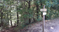
(S/E) A tunnel allows you to pass under the road. Immediately after the tunnel, turn right onto the small path that runs alongside the N122 and head to the start of the trail (signposted ‘Waterfall of Roucolle / Gorges du Pas de Cère PR® Yellow’). If you’re coming from Vic, the car park on the Vic to Thiézac side provides direct access to the trail.
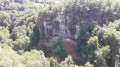
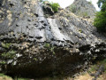
(1) Follow the path down to the left to the viewing point at the Cascade de la Roucolle (information board explaining the geological origins of the site).
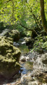
(2) Continue left along the well-marked path. In several places, you can get close to the bed of the River Cère: the views of the river here are very beautiful.
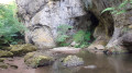
(3) Shortly after the ‘flora and fauna’ information board, turn left at the fork to stay alongside the River Cère. Walk to the entrance to the gorges.
(4) The gorges continue as far as the bridge over the Cère.
(5) Turn back after the bridge and follow the path in the opposite direction back to the car park (S/E).
Note: the path continues along the River Cère beyond the bridge; allow 7 to 8 km in total for a return trip to Vic.> User comment on 28 August 2026 => Please note: the extension of the “Les Gorges du Pas de Cère” walk towards Vic has been impassable since the summer of 2025; it crosses private land where the owner has withdrawn the right of way following disruptive behaviour towards livestock by inconsiderate walkers.



 Visorando Member
 Moderate
 Difficult
