Mandailles – Le Fau

Stage4 of theGR®400, clockwise.
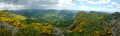
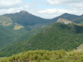
A long day: the track at the end seems to go on for ages and you have to climb back up to the Fau lodge. A magnificent ridge walk before and after Puy Chavaroche.

This walk is part of a multi-day hike: Circuit of the Cantalien volcano via the GR®400, clockwise

Details

n°1936470
Creation:
Last update:
Last review:
  • Walking
    Activity: Walking
  • ↔
    Distance: 14.56 mi
  • ◔
    Average duration: 10h 00 
  • ▲
    Difficulty: Difficult

  • ⚐
    Back to start: No
  • ↗
    Ascent: + 3,819 ft
  • ↘
    Descent: - 3,583 ft

  • ▲
    Highest point: 5,692 ft
  • ▼
    Lowest point: 2,933 ft

Photos

Description of the walk

(S) From the main road through the village, turn left after the river, then immediately right onto a small street that curves to the left. Continue along the path at the end of the street.
TheGR® follows the hillside, slightly above the Jordanne valley, and comes to a small road.

(1) Follow it straight on for about 100 m, then, at the next junction, take the road on the left leading towards Saint-Julien-de-Jordanne. Then turn right onto the D246 without crossing the bridge.

(2) Turn right towards Lavaissière, leaving the D246. The small road climbs towards the hamlet, then turns into a track and follows the contour line.

(3) When you reach a building, ignore the grassy path branching off to the right and carry on straight ahead until you reach the access track to the burons of La Reveilladie.

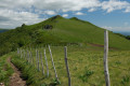
(4) Turn right onto the road for about sixty metres, then leave it to take a path on the right which heads north into a steep-sided valley and crosses the Aubusson stream (cattle gate). Follow the signposting carefully and do not take the paths that climb to the right before the stream.
The track winds along the hillside then turns southwards to reach a reservoir on a ridge offering a fine view.

(5) At the reservoir, the route heads north-west and climbs the ridge, dominated by the Puy de Bassierou. It enters the woods, passes a fountain and continues, after a wide bend, to the pass at an altitude of 1,332 metres.

(6) Turn right (north) to climb the grassy slope beneath the Puy de Bassierou, which you will skirt to the west.
The path coming from La Vacherie de Legal joins theGR® about 400 m beyond the pass.
After skirting the Puy, you’ll spot the ruins of a buron on the slope opposite (a lovely spot for a picnic).
Continue along this ridge, which becomes steeper, and go round the small peak of Cabrespine to the south. The GR® then climbs up the ridge itself, which is very open, and reaches a pass after turning left.

(7) Carry on straight ahead to make the obvious ascent to Puy Chavaroche (very large cairn).

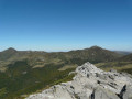
Enjoy the splendid view, then carry on on the other side of the summit along the GR® to the Col de Redondet.

(8) Take in the splendid view, then continue on the other side of the summit along the GR® to the Col de Redondet.

(9) Do not follow theGR® to the right towards Puy Mary, but turn left onto the broad ridge heading towards Roche Taillade and Roc d’Hozières.

(10) At the bottom of the descent (altitude 1554), veer left beneath the Roche Taillade, which you skirt along the side. You can also probably climb up into the large, clearly visible hollow between the Roche Taillade and the Roc d’Hozières: there is a fairly obvious path which joins theGR® further on.

Cross the shoulder of the Roche Taillade and, from there, head northwards up the side of a fairly steep slope.

(11) Below the Roc d’Hozières, theGR® turns broadly westwards and descends the vast cirque. When the slope levels off, you pass the ruins of Chavaspre; the path then enters the forest and, near a waterfall, joins a track. Follow it steadily downhill to the barrier blocking access to motor vehicles. This descent may seem a little long before you reach the hamlet of La Bastide.

(12) Head straight on and carry on straight ahead to the village of Le Fau (E).

Waypoints

  1. S : mi 0 - alt. 3,028 ft - Mandailles. Cross the - Jordanne (rivière)
  2. 1 : mi 0.71 - alt. 3,074 ft - Small road after Mandailles
  3. 2 : mi 1.36 - alt. 2,946 ft - Junction towards Lavaissière
  4. 3 : mi 1.99 - alt. 3,238 ft - Building, straight ahead
  5. 4 : mi 2.59 - alt. 3,241 ft - La Reveilladie
  6. 5 : mi 4.07 - alt. 3,412 ft - Reservoir
  7. 6 : mi 5.17 - alt. 4,370 ft - Pass below the Puy de Bassériou
  8. 7 : mi 8.35 - alt. 5,089 ft - Pass below Puy Chavaroche
  9. 8 : mi 9.15 - alt. 5,692 ft - Puy Chavaroche (1739m)
  10. 9 : mi 9.8 - alt. 5,374 ft - Col de Redondet (1686m)
  11. 10 : mi 10.39 - alt. 5,089 ft - Junction before Roche Taillade
  12. 11 : mi 11.23 - alt. 4,974 ft - Descent below the Roc d’Hozières
  13. 12 : mi 13.94 - alt. 3,087 ft - La Bastide
  14. E : mi 14.56 - alt. 3,264 ft - Le Fau

Notes

Shelter before Cabrespine.
Water on the ascent below the Puy de Basseriou, then on the descent from the Roc d’Hozières.
Please note: these ridges are very exposed to thunderstorms.

(7) Alternative route: the path on the right leads back down towards Mandailles. Those wishing to shorten the stage can climb directly from Mandailles to this pass.

Always be cautious and plan ahead when you're outdoors. Visorando and the author of this route cannot be held responsible for any accidents occurring on this route.

The GR® and PR® markings are the intellectual property of the Fédération Française de Randonnée Pédestre.

Reviews and comments

4.3 / 5
Based on 2 reviews

Reliability of the description
4 / 5
Ease of following the route
4 / 5
Route interest
5 / 5
danielrollet
danielrollet

Overall rating : 4.5 / 5

Date of your route : Jun 17, 2021
Reliability of the description : ★★★★☆ Good
Ease of following the route : Not used / Not applicable
Route interest : ★★★★★ Very good
Very busy route : No

Set off in the fog.
Took the alternative route (5 km and 100 m less elevation gain) via Felgeadou above St Julien de Jordanne, a route which joins the GR400 at Le Piquet, but it was a mistake; I regret not having completed the circular route. Markings were poor or even non-existent up to the 1178-metre mark, where there is another alternative route; from this point onwards, the route was altered, with a lack of clarity at the junction.
A very beautiful ridge walk, quite windy.

Machine-translated

bernardgemenos
bernardgemenos

Overall rating : 4.3 / 5

Date of your route : Jun 12, 2021
Reliability of the description : ★★★★☆ Good
Ease of following the route : ★★★★☆ Good
Route interest : ★★★★★ Very good
Very busy route : No

This section was completed in fine weather, walking in the opposite direction to the description. After a long walk along a forest track, the path climbs up to the ridges and stays there for much of the day. The walk then becomes magnificent, with views across the entire mountain range; it is perhaps the most beautiful section of the GR 400, but it is long and challenging due to the elevation gain.
Please note: at the end of the forest road, the unclear markings suggest you should take the first track on the right, whereas the GR is actually the second path. We came across several groups of hikers who had lost their way, which is a real shame when you’ve got such a challenging stage ahead of you.

Machine-translated

Other walks in the area

For more walks, use our search engine .

The GPS track and description are the property of this route's author. Please do not copy them without permission.