Country:

 City:
City:


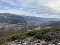
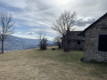
(S/E) From the small chapel (car park), take the tarmac road that climbs past the last houses in the hamlet. About 100 metres from the start, a wide path leads up to the right and a sign indicates the route. The gently ascending dirt track offers some lovely views of the Cère valley below and the Plomb du Cantal on the other side of the valley. After three hairpin bends, this track joins another which branches off to the right towards Font de Cère. This track is also used as a cross-country ski trail.
(1) Continue to the left (signpost). The track winds its way across an open ridge (offering lovely views of the surrounding area) before entering a beautiful deciduous forest (mainly beech trees) until it reaches another junction where a signpost lies on the ground.
(2) Take the right-hand branch, which climbs more steeply. After three hairpin bends, you’ll emerge onto a meadow covered in broom just below the Vacherie du Griou.
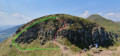
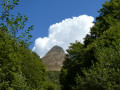
(3) Continue towards the Vacherie, taking a short detour to the right: an ideal spot for a break with sunshine, stone benches, views, etc. Climb a little way to find the route sign again, without following the obvious track that heads off up the hillside to the left. Take a narrow path that climbs through the broom and heads towards the pass beneath the Griou between two cattle fences, following green markings—partly faded—painted on the rocks.
Please note: frequent use by walkers has created several distinct paths. Keep heading for the pass to the right of the puy as you climb, and choose the easiest routes through the scree.
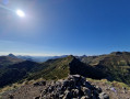
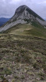
(4) Once at the pass, there are lovely views over the Cère and Jordanne valleys and the surrounding hills. On your way back down, look for the path, now also marked in red and white (GR®400), following a designated route designed to protect natural areas without crossing the reforestation zones. Turn left about a hundred metres further on to resume the route round Puy Griou. The descent through the mountain pastures continues, keeping the peak on your left at all times, and leads to a first fork at the edge of the forest.
(5) Keep to the left to stay on the red and white markings (GR®400). Continue along a track through a magnificent beech forest.
(6) At the next fork, leave theGR® 400 – which continues along the ridge to the right – and take a track that climbs to the left (signposted for Font de Cère). Follow this track, which takes you back towards La Vacherie du Griou.
(3) Turn right and retrace your steps along the ascent route in the opposite direction to return to the hamlet of Les Chazes (S/E).


 Visorando Member
 Difficult