


Refine your search for walks in Châtelaudren
Châtelaudren walks
 The Leff in the town and the surrounding area of Châtelaudren
 Visorando Member
 4.83 mi
 +233 ft
 -210 ft
 2h 25
 Easy
 Departure from Plélo (Côtes-d'Armor)
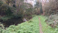
The River Leff, which rises north of Quintin, flows away from the town and heads northwards. Châtelaudren is the first village it flows through. It is inextricably linked to the history of this ancient town: tragedies caused by devastating floods in times gone by, a source of energy for the paper mills of *Le Petit Écho de la Mode* in more modern times, and recreational activities on and around the reservoir today. This route invites you to discover these different aspects: it takes you round the reservoir, along the river and to its waterfall. At the end of the route, it winds through the old streets lined with stone buildings in this small village, which has been designated a ‘Petite Cité de Caractère’.
The ‘Two Bell Towers’ route from Lantic
7.20 mi
+420 ft
-430 ft
3h 40
 Moderate
Departure from Lantic (Côtes-d'Armor)
Just a stone’s throw from the Goëlo coast, this walk through time will introduce you to a rich and varied heritage. As you make your way through woods along narrow, winding and sometimes damp paths, you’ll learn about the history of the watercourses that have always been so important to the local people. This route, which is circular in nature and covers the north and south of the town, will take you from the 15th-century Chapel of Notre-Dame de la Cour to Saint-Oswald’s Church, on to the ponds, and then to the Sentier des Trois Fontaines.
Route du Bois de la Salle from Lantic
5.13 mi
+66 ft
-66 ft
2h 25
Easy
Departure from Lantic (Côtes-d'Armor)
Forest paths, often damp; intriguing and mysterious woodland that surely conceals ancient tales; secluded meadows; a fountain. This is a walk in the heart of nature that passes very close to the site of the old Cour, which has not yet revealed all its secrets, and a little further on, ‘la Maison de la Terre’, an educational centre dedicated to environmental protection.
The completely flat and very accessible route will take you to the Chapel of Pabu in the neighbouring commune of Tréguidel and back via the Bois de la Salle, ending at the Chapel of Notre-Dame-de-la-Cour.
Country walk in Goudelin
 5.59 mi
+240 ft
-249 ft
2h 45
Easy
Departure from Goudelin (Côtes-d'Armor)
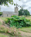
Starting from the Notre-Dame-de-l'Isle Chapel, walk through the countryside towards Leff.
A relatively easy walk which, as you pass through woodland and along rivers and streams, will allow you to discover the typical Breton countryside.
Tro Vras circuit in the Bois d'Avaugour and Bois Meur
16.89 mi
+942 ft
-958 ft
8h 35
 Very difficult
Departure from Lanrodec (Côtes-d'Armor)
The Bois d'Avaugour and Meur offer a mix of gravel tracks and footpaths. The Tro Vras route follows the western circular loop, featuring beautiful paths through heathland, along the Avaugour (which reveals its beauty in winter, when the vegetation clears) and forest tracks. The transition to the eastern circular loop is challenging (with mud in winter) but offers sections passing by some very beautiful trees. The eastern circular loop, pleasant at the start, is less interesting on the return leg, except for the last three kilometres of descent, initially amongst tree stumps in a fir forest.
Circular route around Trémuson via Les Mines
6.40 mi
+587 ft
-600 ft
3h 25
Moderate
Departure from Plérin (Côtes-d'Armor)
This circular route around the village of Trémuson will first take you along the outskirts of the village via major tarmac roads, then dirt tracks and forest paths will guide you alongside streams and the Gouët, eventually leading you higher up to the site of the old mines.
Route around Trévenais
 4.78 mi
+404 ft
-374 ft
2h 35
Moderate
Departure from Lantic (Côtes-d'Armor)
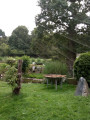
Set apart from the main roads, the village centre and its church, the chapel and its shops, lies the ‘village’ of Trévenais, which is home to nearly half of Lantic’s population. This route invites you to walk around it, without actually entering the centre. Featuring a few steep ascents and descents, narrow and winding paths, wooded sunken lanes and local tracks, this circular route will introduce you to the legend of the Chaise menhir, the history of the Fontaine aux Moines and the origins of the village’s ponds. A lovely circular route that partly overlooks the meandering course of the River Ic in the heart of the Lantic countryside.
In the Bois Meur
 4.84 mi
+230 ft
-230 ft
2h 25
Easy
Departure from Lanrodec (Côtes-d'Armor)
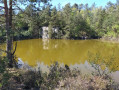
A walk almost entirely in the forest with sections along sunken paths. This route leads to a disused quarry that is now a pond (see photo).
The Méaugon circular around Lac du Gouet
 4.44 mi
+364 ft
-387 ft
2h 20
Easy
Departure from La Méaugon (Côtes-d'Armor)
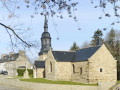
A walk starting from the small and charming village of La Méaugon, through the woods on wide paths accessible all year round. You will have a constant view of the Gouet reservoir with viewpoints offering multiple photo opportunities.
Route from the dam to Lake Saint-Barthélémy from Ploufragan
 Tourist office
 4.32 mi
+308 ft
-331 ft
2h 15
Moderate
Departure from Ploufragan (Côtes-d'Armor)
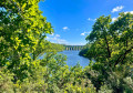
Stretching across 81 hectares, Lake Saint-Barthélémy is flanked by a path that winds through woodland and along the edges of fields. As you wander through this beautiful countryside, imposing structures come into view: the 45-metre-high Gouët Dam and the majestic viaduct of the Paris-Brest railway line.
The older village of La Méaugon boasts a wealth of picturesque architecture. The lake also conceals treasures from days gone by. Today, it is a delight for anglers and recreational boaters alike.
The Charcoal Burners’ Route in the Bois d’Avougour
 4.54 mi
+167 ft
-138 ft
2h 15
Easy
Departure from Saint-Péver (Côtes-d'Armor)
You won’t see any charcoal burners. However, as you enjoy this gentle walk, which can be done in any season, you’ll be able to imagine their lives in this forest of majestic trees. There’s no need to worry about getting lost – the route is clearly signposted.
Through moors, woods and cliffs in the Goelo region
 8.20 mi
+413 ft
-417 ft
4h 10
Moderate
Departure from Plourhan (Côtes-d'Armor)
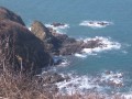
A lovely walk through the countryside and along the coast.
Stop off at the lovely Palus Beach for a refreshing swim and a delicious, energising crêpe!
From the village of Ploumagoar to the Kerlosquer viaduct
 6.21 mi
+315 ft
-312 ft
3h 10
Easy
Departure from Ploumagoar (Côtes-d'Armor)
A walk through the western part of this commune. Walking along quiet country lanes, you’ll reach the banks of the Trieux to discover a structure as unusual as it is spectacular: the viaduct of the former Guingamp–Saint-Nicolas-du-Pélem railway line.
Circular loop along the River Ic
 12.77 mi
+830 ft
-830 ft
6h 35
 Difficult
Departure from Binic (Côtes-d'Armor)
The Ic is a small river, 17 km long, which flows into the English Channel at Binic. After a short climb up the cliffs at the harbour exit, you reach a tributary of the Ic at Lantic, and rejoin the river at Notre-Dame de La Cour, from where it takes you back to Binic. Along the way, you’ll discover two tourist attractions: the Lantic Adventure Park and Trégomeur Zoo. This route takes you through the hinterland of South Goëlo.
From Plourhan to the sea
 7.02 mi
+371 ft
-371 ft
3h 35
Moderate
Departure from Plourhan (Côtes-d'Armor)
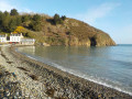
Apart from a few unavoidable sections on tarmac roads, most of the walk follows farm tracks, sometimes through woodland. The reward for this approach route is the walk along Palus Beach, followed by theGR®34 trail.
A somewhat steep route offering views of the cliffs at Plouha and the Pointe de Bec de Vir.
Circular route from Saint-Hernin to the Kerlosquer viaduct along the banks of the Trieux
6.34 mi
+505 ft
-486 ft
3h 20
Moderate
Departure from Ploumagoar (Côtes-d'Armor)
Just a stone’s throw from Guingamp, explore the south-western countryside of Ploumagoar, starting from Saint-Hernin. From wild valleys to country lanes, make your way to the right bank of the Trieux, where the river is still somewhat torrential, then visit the Kerlosquer Viaduct, which bears a passing resemblance to the ‘Bridge on the River Kwai’. Then enjoy the centre of Saint-Hernin with its beautifully restored heritage.You’ll have no trouble at all on this route, which combines all sorts of paths and offers you, by turns, lovely shelter beneath the canopy of trees and completely unobstructed views of the surrounding countryside.
The Washing-House Trail in Pabu and Saint-Agathon
 5.75 mi
+479 ft
-469 ft
3h 05
Moderate
Departure from Pabu (Côtes-d'Armor)
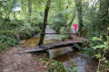
A circular route starting from Pabu, the majority of which is within the municipality of Saint-Agathon. It has been accredited by the French Hiking Federation.
Route du Trieux to Pabu
 4.40 mi
+210 ft
-197 ft
2h 10
Moderate
Departure from Pabu (Côtes-d'Armor)
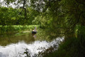
A walking route that runs partly alongside the Trieux and offers views of two old mills once used for flax scutching. This route, of which I am one of the authors, was created by the municipality of Pabu and accredited by the French Hiking Federation. Trail marked in yellow.
Danse Macabre Route
 Association / Club / Walk leader
 6.06 mi
+131 ft
-131 ft
2h 55
Easy
Departure from Pludual (Côtes-d'Armor)
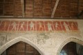
A walk through the Pludual countryside: chapels, woods, fields, orchards, wash houses, fountains, etc. – there’s plenty of variety to be found everywhere.
Pludual countryside route
 5.30 mi
+66 ft
-66 ft
2h 30
Easy
Departure from Pludual (Côtes-d'Armor)
A short walk through the Pludual countryside, crossing a wetland known as Le Lan. A pleasant family walk.
The Chaos du Gouët
 6.47 mi
+561 ft
-561 ft
3h 30
Moderate
Departure from Plaine-Haute (Côtes-d'Armor)
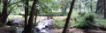
Historically dedicated to Marc Faucon (a pioneer of hiking in the Côtes d'Armor), this hike will allow nature lovers to explore the foothills of the Gouët and the wooded hills of the surrounding countryside.
Hollow ways and villages in Plouha
 3.95 mi
+138 ft
-164 ft
1h 55
Easy
Departure from Plouha (Côtes-d'Armor)
Plouha is home to the highest cliffs in Brittany. You can explore them on theGR®®34. Very close to the village centre, starting from the town centre, the first half of this short route follows beautiful sunken paths typical of the Goëlo region and then passes through a few villages with lovely stone houses. Along the route, there are several granite wayside crosses.
Saint-Jean Chapel in Plouha
3.14 mi
+108 ft
-115 ft
1h 30
Easy
Departure from Plouha (Côtes-d'Armor)
Leave the village of Plouha and head for Saint-Jean Chapel along the country lanes. These are tarmac-surfaced, except for a short stretch which is a farm track but is easily passable.
Circular from Tréveneuc to Pointe du Bec de Vir
 4.50 mi
+407 ft
-407 ft
2h 25
Easy
Departure from Tréveneuc (Côtes-d'Armor)
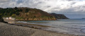
A short walk that allows you to discover the village of Tréveneuc and its coastline via the customs officers' path.
Circular route between Saint-Quay and Binic
 11.86 mi
+1,020 ft
-1,007 ft
6h 20
Difficult
Departure from Saint-Quay-Portrieux (Côtes-d'Armor)
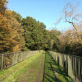
A short stretch on theGR®34at the start of the walk offers a glimpse of the pleasure of rediscovering these magnificent seascapes at the end of the route, which change with the tides. In between, the path takes you a little further inland, along small coastal rivers or following the old railway line of the Côtes du Nord narrow-gauge railway. A few examples of built heritage enhance this route: a mill, a wayside shrine, railway viaducts, a chapel and seaside villas.
An unusual discovery in Saint-Quay-Portrieux
 3.55 mi
+207 ft
-180 ft
1h 50
Easy
Departure from Saint-Quay-Portrieux (Côtes-d'Armor)
This route reveals a little-known side of Saint-Quay-Portrieux.The narrow streets, lined with old buildings or modern villas, link three monuments that have had their moments of glory: the Saint-Michel windmill, the circular Notre-Dame de la Garde Chapel and the Saint-Quay Fountain, which is said to be the origin of the town’s founding.Two parks offer a chance to take a break: the Parc de la Duchesse Anne and the Parc des Druides, where you’ll find yourself immersed in a setting steeped in legend.Superb views from theGR®®34.
Circular route starting from Saint-Quay-Portrieux
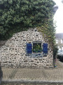 4.83 mi
+315 ft
-312 ft
2h 30
Easy
Departure from Saint-Quay-Portrieux (Côtes-d'Armor)
A hike to enjoy the sea views, but also the unique trails of the Breton countryside.
From Kermaria to Bréhec
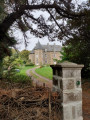 4.41 mi
+82 ft
-282 ft
2h 05
Easy
Departure from Plouha (Côtes-d'Armor)
A short, easy walk that takes you through the Goelo countryside and gently down to Bréhec beach.The only requirement is to have two cars. Best undertaken with friends.
Keregal and the Corzic Valley
 3.15 mi
+266 ft
-246 ft
1h 40
Moderate
Departure from Plouha (Côtes-d'Armor)
This route was used for the second edition of the Plouha 24-hour sports event. Starting from the superb Palus beach, it leads to Keregal Chapel and ends along the small coastal river of Plouhatin, the Corzic, which takes us back to the sea. The route is mainly through woodland.
From the Saint-Jacques Chapel to Bois Gelin along the Kerguidoué
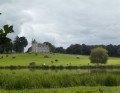 4.60 mi
+341 ft
-348 ft
2h 25
Easy
Departure from Tréméven (Côtes-d'Armor)
A walk mainly through woodland that leads from the Saint-Jacques Chapel to the heart of the Bois Gelin estate. Partially signposted walk.
Best undertaken from April to October as sections can be muddy in winter.
Circular from Saint-Jacques Chapel via Lanleff Temple
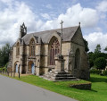 5.10 mi
+476 ft
-479 ft
2h 45
Easy
Departure from Tréméven (Côtes-d'Armor)
This rural route in Goëlo, along a hilly route, half of which is in the woods, offers the chance to discover elements of heritage of great historical interest, such as the Saint-Jacques Chapel and the Lanleff Temple.Please note that from Crec'h Lanleff onwards, the route is not signposted, so it is essential to use the Visorando app with its GPS pin.
This walk is best done between May and October as the route can be very muddy.
Sunken paths and cliffs in Plouha
 3.21 mi
+436 ft
-430 ft
1h 50
Easy
Departure from Plouha (Côtes-d'Armor)
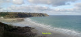
This route was used for the first edition of the 24h du Sport de Plouha. Starting from the superb Plage du Palus, it runs alongside Le Corzic and climbs gently up an old sunken path to Pointe de Plouha. From there, the view is magnificent. You then descend back to Palus via theGR®34.
Circular route in Plouha, from Palus to Gwin Zégal
5.18 mi
+817 ft
-820 ft
3h 05
Easy
Departure from Plouha (Côtes-d'Armor)
A lovely hike starting from Palus Beach, which will take you along the customs officers' path to the Port of Gwin Zégal with its distinctive mooring posts, which are almost unique in the region. The passage through Pointe de Plouha and Le Pommier offers magnificent views of the coast and the highest coastal cliffs in Brittany. The return journey is along rural roads through various typical hamlets and beautiful forest paths.
Circular of Palus via Pointe de Plouha
 5.46 mi
+545 ft
-535 ft
3h 00
Moderate
Departure from Plouha (Côtes-d'Armor)
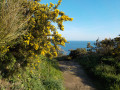
A hike that begins with a gentle climb on a tarmac road, allowing you to warm up before following the GR®34, which is more rugged. The last third of the hike offers breathtaking views of the sea as you pass by Pointe de Plouha (the highest cliff in Brittany).
Like any circular, it can also be done in the opposite direction, thus avoiding a descent down stairs that may be considered problematic. In this case, you will need to make a significant effort from the outset.
The four woods and the Pointe du Bec de Vir in Tréveneuc
 3.75 mi
+276 ft
-259 ft
2h 00
Easy
Departure from Tréveneuc (Côtes-d'Armor)
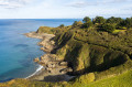
From Port Goret, follow the coastal path along the heights of the Goëlo coast. From the top of the steep cliff, breathe in the sea mist and the scents of unspoilt nature. Nestled between land and sea, the heart of the village, with its recent developments, retains its old-world charm. As you walk along the route, its old stones echo a calm and serene way of life, woven with local tales and legends.
Circular route between La Trinité and Le Palus
 6.33 mi
+699 ft
-715 ft
3h 30
Moderate
Departure from Plouha (Côtes-d'Armor)
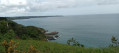
From the Chapel of La Trinité, the route quickly reaches the cliffs. It then follows theGR®34along a fairly rugged section, but with unobstructed views (from Bréhat to Saint-Quay) and numerous possible stopping points. At the lowest point, the beaches of Port Moguer and Gwin zegal are particularly enjoyable. You leave theGR®34before reaching Palus beach, and old sunken paths lead back to small roads that pass through pretty villages to return to the starting point.
Country route in Saint-Clet
 4.82 mi
+354 ft
-331 ft
2h 30
Moderate
Departure from Saint-Clet (Côtes-d'Armor)
This is a magnificent route through the Breton countryside, with everything we love: short steep climbs, sunken paths, undergrowth and a sublime riverside.
Bois des Mauriers towards the Chaos du Gouët from Plaintel
13.68 mi
+968 ft
-958 ft
7h 10
Difficult
Departure from Plaintel (Côtes-d'Armor)
One of the most beautiful walks in the department, passing through the Bois des Mauriers and the Chaos du Gouët. A mixed walk, a third on roads, the rest on paths and trails. The route is well signposted in yellow on posts. The route can be tricky after heavy rain. Firstly, there is the charm of the names of the paths and trails indicated on the signs. Then there is the vegetation and its variety, as you cross the departmental forest: the Bois des Mauriers. Finally, there are the Chaos du Gouët, a spectacular pile of rocks on the Rivière du Gouët, which you skirt around.
More walks in Châtelaudren
Select a point of interest below: