In the Bois Meur

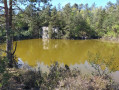
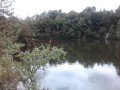
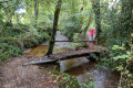
A walk almost entirely in the forest with sections along sunken paths. This route leads to a disused quarry that is now a pond (see photo).

Details

313197
Creation:
Last update:
Last review:
  • Walking
    Activity: Walking
  • ↔
    Distance: 4.84 mi
  • ◔
    Average duration: 2h 25 
  • ▲
    Difficulty: Easy

  • ⚐
    Back to start: Yes
  • ↗
    Ascent: + 230 ft
  • ↘
    Descent: - 230 ft

  • ▲
    Highest point: 833 ft
  • ▼
    Lowest point: 600 ft
  • ⚐ Country: France
  • ⚐ City: Lanrodec (22170)
  • ⚑
    Start/End: N 48.478907° / W 3.06654°
  • ❏
    IGN map(s): Ref. 0816SB
  • Hour-by-hour weather

Photos

Description of the walk

(S/E) From the car park, take the forest path behind the shelter. After the pond, turn left and continue through the undergrowth for 300m.
Go up the path on the right, then follow the forest lane on the left.

(1) Cross the D24 and follow it to the left on the stony shoulder. After 150m, enter the undergrowth on the right.
At the Hêtraie crossroads, turn right.

(2) At the Moulin de Kerbol crossroads, cross the road and continue straight ahead for 500 metres.
Continue straight ahead.

(3) Cross the D4, continue to the left and then climb to the right. At the fork, turn right.

(4) At the next crossroads, turn right (be careful, there is no sign), after a slope, turn left.
Walk along the quarry. Take the sandy path on the left for 70 metres, turn right and take the forest path on the left.

(5) At the crossroads of the Roman roads, go down to the right. Take the Grande Allée on the left for 400 metres.

(6) Turn right. At the crossroads, continue straight ahead. At the fork, turn left, then turn right (chicanes) into the sunken lane. Pass a house on the left, behind the trees.

(7) Turn right, cross the stream and follow the embankment. Take the sunken lane on the right.
Cross the D4, continue straight ahead along the grassy path (panoramic view), turn right then left and head for the Bois-Meur farm (S/E).

Waypoints

  1. S/E : mi 0 - alt. 620 ft - Bois-Meur farm
  2. 1 : mi 0.69 - alt. 653 ft - D24 on the left
  3. 2 : mi 1.21 - alt. 620 ft - Moulin de Kerbol crossroads
  4. 3 : mi 2.07 - alt. 712 ft - Crossing the D4
  5. 4 : mi 2.33 - alt. 833 ft - At the crossroads, turn right.
  6. 5 : mi 2.85 - alt. 817 ft - Crossroads of Roman roads, on the right
  7. 6 : mi 3.41 - alt. 725 ft - On the right
  8. 7 : mi 4.16 - alt. 676 ft - On the right
  9. S/E : mi 4.84 - alt. 620 ft - Bois-Meur farm

Notes

The entire route is marked with yellow signs (Les Carrières 8km). The only sign missing is at (4).
It is taken from the booklet "Promenades et Randonnées" (Walks and Hikes) in the guidebook "Les Côtes d'Armor à pied" (The Côtes d'Armor on foot).

Worth a visit

Bois-Meur: shelter, picnic area, children's playground.

Quarry, pond.

Forest: natural areas, sunken paths.

Reviews and comments

4.5 / 5
Based on 7 reviews

Reliability of the description
4.6 / 5
Ease of following the route
4.1 / 5
Route interest
4.7 / 5
Marie Annick Guillaume

Overall rating : 5 / 5

Date of your route : Apr 22, 2024
Reliability of the description : ★★★★★ Very good
Ease of following the route : ★★★★★ Very good
Route interest : ★★★★★ Very good
Very busy route : No

A beautiful hike with excellent signage, this is an easy route that takes you around the quarries, a place that is well worth seeing.
Enjoyed on a pleasant day with birdsong in the air.

Machine-translated

jeant-22
jeant-22

Overall rating : 5 / 5

Date of your route : Nov 28, 2022
Reliability of the description : ★★★★★ Very good
Ease of following the route : ★★★★★ Very good
Route interest : ★★★★★ Very good
Very busy route : No

Travelled on a beautiful winter afternoon.
The description of the route, the estimated duration and the GPX track are entirely consistent with the terrain.
We set off too late and finished in the early November dusk. Fortunately, we had lights!
The sunken paths were spongy, so we can imagine how muddy they must be on rainy days...
A very, very quiet trail. Apart from three young deer in a meadow, we didn't see anyone!

Machine-translated

coco68@
coco68@

Overall rating : 5 / 5

Date of your route : Jul 18, 2021
Reliability of the description : ★★★★★ Very good
Ease of following the route : ★★★★★ Very good
Route interest : ★★★★★ Very good
Very busy route : No

A very beautiful hike...!!!
We thoroughly enjoyed ourselves.
We enjoyed the coolness of the undergrowth and the sunken paths.
Indeed, at point "4" after the water point at the quarry, there are no signs, but you have to turn left onto the large forest path.
Everything is very well explained, and we had no difficulty finding our way.

We will probably return, as there are other hikes to do in the area.

Machine-translated

ols
ols

Overall rating : 5 / 5

Date of your route : Mar 04, 2019
Reliability of the description : ★★★★★ Very good
Ease of following the route : ★★★★★ Very good
Route interest : ★★★★★ Very good

My route in Bois Meur (quarry trail) was made easy by the excellent signposting from the start at the Bois Meur farm.
The Bois Meur farm is also the starting point for several routes (Bois Meur + Bois d'Avaugour), each clearly marked with different colours. It's one of the best signage systems I've seen for a natural, entirely wooded site.
Enjoy your walks, everyone.
Best regards, Thank you to the Visorando team.

Machine-translated

maripol22
maripol22

Overall rating : 4 / 5

Date of your route : Aug 13, 2018
Reliability of the description : ★★★★☆ Good
Ease of following the route : ★★★★☆ Good
Route interest : ★★★★☆ Good

Small issue with the route at the end of the trail. Different signage.

Machine-translated

oive
oive

Overall rating : 3 / 5

Date of your route : Jan 01, 1970
Reliability of the description : ★★★☆☆ Average
Ease of following the route : ★☆☆☆☆ Very disappointing
Route interest : ★★★★★ Very good

It was impossible to find certain elements described, such as the crossroads at Hetraie. I consider the quality and scale of the map to be essential; the scale of the map here is insufficient to recognise the terrain; moreover, certain parts that are essential for identifying the route are hidden by the markers. As I could not recognise the elements described, I got lost. As a solo hiker with a compass, I found my way back by using the Azimut Brutal method to estimate my position using the terrain. Contour lines and cadastral data are only visible on a detailed scale map, so I use screenshots showing the cadastre and contour lines at a scale of approximately 1:10,000. Cadastral surveys allow me to find landscape features on Napoleonic cadastral maps, which I print out.

Machine-translated

Lulu29
Lulu29

Overall rating : 4.3 / 5

Date of your route : Mar 12, 2017
Reliability of the description : ★★★★★ Very good
Ease of following the route : ★★★★☆ Good
Route interest : ★★★★☆ Good

Great place with several possible routes

Machine-translated

Other walks in the area

For more walks, use our search engine .

The GPS track and description are the property of this route's author. Please do not copy them without permission.