Route around Trévenais

Set apart from the main roads, the village centre and its church, the chapel and its shops, lies the ‘village’ of Trévenais, which is home to nearly half of Lantic’s population. This route invites you to walk around it, without actually entering the centre. Featuring a few steep ascents and descents, narrow and winding paths, wooded sunken lanes and local tracks, this circular route will introduce you to the legend of the Chaise menhir, the history of the Fontaine aux Moines and the origins of the village’s ponds. A lovely circular route that partly overlooks the meandering course of the River Ic in the heart of the Lantic countryside.

Details

49650979
Creation:
Last update:
Last review:
  • Walking
    Activity: Walking
  • ↔
    Distance: 4.78 mi
  • ◔
    Average duration: 2h 35 
  • ▲
    Difficulty: Moderate

  • ⚐
    Back to start: Yes
  • ↗
    Ascent: + 404 ft
  • ↘
    Descent: - 374 ft

  • ▲
    Highest point: 299 ft
  • ▼
    Lowest point: 46 ft
  • ⚐ Country: France
  • ⚐ City: Lantic (22410)
  • ⚑
    Start/End: N 48.606284° / W 2.870976°
  • ❏
    IGN map(s): Ref. 0916OT
  • Hour-by-hour weather

Photos

Description of the walk

Take the D4 from Binic towards Lantic. The starting point is 3 km further on at the entrance to a car park, just above the ponds that run alongside the departmental road: look for the sign for ‘Étangs de Lantic’. The walk starts from the Étangs de Lantic information point: follow the ‘blue butterfly’ markings on the directional signs.

(S/E) Take the path to the left of the pond, running alongside the departmental road. Cross the embankment separating the two Lantic ponds. At the end of the embankment, take the path on the left which runs alongside the second pond, then continue along the track that climbs to the right and goes round the campsite. You’ll come to a road.

(1) Head down this road to the left until you reach the main entrance to the campsite, then take the path just to the right. At the end of the path, head down the road to the left until you reach the Saint-Gilles bridge.

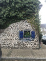
(2) Take the path that starts to the right of the bridge. Pass the hairpin bend to discover ‘La Bonnette du Paradis’, which climbs up to the Menhir de la Chaise Saint-Gilles.

(3) Follow the path overlooking the River Ic and its meanders, whilst staying parallel to the RD47.

(4) Cross the road leading to Ville Méron and continue along the path opposite, which is slightly set back and leads further on to a farm track. Follow this track uphill to the right. When you reach the first house in La Toise, take the path on the left. At the end of this path, head down the road to the left.

(5) Take the sharp right-hand bend to join Rue de Doualan. Pass the mill on your left and the fountain on your right, then continue left along a path that climbs through the woodland. Carry on straight ahead to the end of the path until you reach a junction between two houses.

(6) Take a short detour to the right to see the Fontaine aux Moines.

(7) Turn back.

(6) Take the path on the right, which continues from the one you arrived on. At the four-way junction, turn left onto the Chemin des Justices and head up to the highest point.

(8) Enjoy the panoramic view and carry on until you reach the road leading to Les Landes and its wayside shrine. Follow it, turning right.

(9) Turn right and carry on until you reach the junction with another road. First turn left then right, to join the D4.

(10) At the stop sign, do not cross the departmental road, but head down the forest track which descends immediately to the right. At the next junction, cross over to find the track opposite which leads down into a meadow; then cross the stream via a wooden footbridge at the end of the meadow and return to the starting car park (S/E).

Waypoints

  1. S/E : mi 0 - alt. 115 ft - Lantic Ponds information point
  2. 1 : mi 0.44 - alt. 121 ft - Road, on the left
  3. 2 : mi 1.11 - alt. 52 ft - Saint-Gilles Bridge
  4. 3 : mi 1.18 - alt. 121 ft - Menhir at La Chaise
  5. 4 : mi 1.51 - alt. 62 ft - Crossing the road
  6. 5 : mi 2.37 - alt. 82 ft - Rue de Doualan
  7. 6 : mi 2.75 - alt. 203 ft - Junction for the Fontaine aux Moines
  8. 7 : mi 2.79 - alt. 194 ft - Fontaine aux Moines
  9. 8 : mi 3.1 - alt. 299 ft - Viewpoint
  10. 9 : mi 3.37 - alt. 256 ft - Croix des Landes
  11. 10 : mi 4.02 - alt. 226 ft - D4
  12. S/E : mi 4.78 - alt. 115 ft - Lantic Ponds Information Point

Worth a visit

Reviews and comments

4 / 5
Based on 3 reviews

Reliability of the description
4 / 5
Ease of following the route
4.7 / 5
Route interest
3.3 / 5
User 19417368

Overall rating : 3.7 / 5

Date of your route : May 02, 2026
Reliability of the description : ★★★★☆ Good
Ease of following the route : ★★★★☆ Good
Route interest : ★★★☆☆ Average
Very busy route : Yes

A walk in the countryside with a few hills; highlights include the legend of the Chaise menhir, the Monks’ Fountain, and a return route past the ponds – a lovely discovery.

Machine-translated

J VUADELLE
J VUADELLE

Overall rating : 4 / 5

Date of your route : Feb 24, 2025
Reliability of the description : ★★★★☆ Good
Ease of following the route : ★★★★★ Very good
Route interest : ★★★☆☆ Average
Very busy route : No

This route features two really tricky sections through woodland, with some very steep stretches. I regretted not having a walking stick. Apart from that, it was a lovely, enjoyable walk with some stunning views.

Machine-translated

enroutetapasmal
enroutetapasmal

Overall rating : 4.3 / 5

Date of your route : May 22, 2024
Reliability of the description : ★★★★☆ Good
Ease of following the route : ★★★★★ Very good
Route interest : ★★★★☆ Good
Very busy route : No

A route described as ‘easy’ but quite challenging in places, with some steep climbs
Completed on 20 May, with the path still overgrown with tall grass (it is cleared in June and October) but not impassable
The signposting with butterflies (blue and red) is original and very visible
A lovely outing for us, even as older people

Machine-translated

Other walks in the area

For more walks, use our search engine .

The GPS track and description are the property of this route's author. Please do not copy them without permission.