Country:
 City:


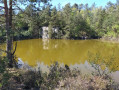
Park in the post office car park, at the northern tip of the Étang de Châtelaudren.
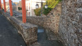
(S/E) Head towards the pond and climb the staircase of large stones on the left. Walk along the left-hand side of the pond. Cross a small garden. After the motorhome area, continue to the bridge and turn right just before the bridge to walk alongside the River Leff.
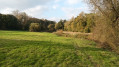
(1) After 50 m, turn right at a right angle. Do not enter the meadow (no entry sign) and walk along the edge of a field on a slightly bumpy path until you reach a small road. Turn right onto the road. You can see the agricultural co-operative’s silos in the distance. Stay on the road, carry on straight ahead, and follow the agricultural co-operative and the railway line until you reach the motorway bridge (N12) which spans the railway line.
(2) Turn left just before this bridge, onto a lovely path that runs below the expressway (a bit noisy). Turn left as soon as you can. (The first path is off-limits – private; you’ll find it again a little further on to the left, leading out of the property – still off-limits).
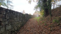
(3) Cross a small wooden bridge over the River Leff and, shortly after the bridge, turn right onto a path that climbs quite steeply. This path runs alongside a stone wall and leads to a group of well-restored houses. At the end of the path, continue left onto the small road, then left again at the next junction. Walk past the “Moulin à Fouler” on your right and cross a bridge. You can see the silos in the distance once again
(4). Turn right onto a grassy path (you’ll see farm buildings on the left a little further on), cross the River Leff via a footbridge and reach the pond at the bridge.
Continue along the right-hand side of the pond. Walk past a children’s playground, take a narrow path under an arbour and turn right onto Rue de Kergario. Don’t be tempted by a lovely path leading uphill to the right; stay on the tarmac. Walk past a beautiful manor house on the left and another group of buildings to reach a road.
(5) Follow it to the right, then 250 m further on, take a sharp left-hand bend towards the water tower. Walk alongside the football pitch, and before reaching the main road, turn left towards Maison Neuve. Walk along the grass verge on the left and continue on the pavement. Turn left onto Rue du Kerello into a housing estate. After 30 m, take the dirt track on the left until you reach a road.
(6) Then turn sharply right into a cul-de-sac; at the end, head slightly left along a path beside a wall to leave the housing estate. Walk back down this path. Be careful: the slope is quite steep and it can be slippery on the grassy section. This path ends with a few steps. Turn left onto the road and cross it to reach the post office.
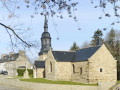
(7) Go round the post office on the left, pass the Salle des Fêtes and walk along the Place du Général de Gaulle until you reach Rue de Corlay. Turn right (Café Chez Georgette), then left under a portico, and left again into Rue Saint-Magloire to go round the church, which you can visit
(8) Carry on straight ahead, skirting Place de la République until you reach a narrow alleyway on the left at the far end of the square.
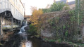
(9) Walk up and down the alleyway to a waterfall. As you come out of the alleyway, turn left. Cross the bridge over the Leff, quickly leave the main road, and continue straight on along Rue Aribart. The route then climbs towards Notre Dame du Tertre (signposted). Continue along Rue Notre-Dame,
(10) Turn left after the chapel and join Rue des Écoles.
(11) Follow it to the left, going round the former secondary school, now the headquarters of the company Le DU. After joining Rue Aribart, turn right, then immediately left, and very quickly take a small pedestrian passage on the right which leads back down to the main road. Cross it at a pedestrian crossing. Immediately go up the ramp on the right. Please note: this is a road, so keep to the right. Follow it and head right towards Le Petit Écho de la Mode, where the Tourist Office is located. Walk through this building under a porch, pass the first flight of steps on your left, cross the Esplanade du Château overlooking the lake, and reach the La Poste car park by going down a flight of steps on the left (S/E).
 Visorando Member
 Moderate

 Very difficult