Country:
 City:
City:



Estran car park near the cultural centre of the same name, also served by BreizhGo bus line 1, Estran stop (Paimpol–Saint-Brieuc route).
(S/E) Leave the car park heading north and make your way towards the Tourist Office on Place Le Pommelec. At the left-hand corner of this square, walk along the side of the Tourist Office to reach Rue des Moulins, which actually follows the old course of the River Ic. Cross the road and take the small path directly opposite, which climbs steeply up the cliff.
At a crossroads, turn right and continue along Rue du Château d’Eau after crossing a small square featuring a water tower. Walk a few metres to the right along Rue des Écoles, then go down a small flight of steps and turn right into Rue des Fontaines. Then turn sharply left into Rue Poincaré and immediately take the path on the right opposite, running alongside a wall. Starting as a grassy track and then turning to earth, it continues along the lane known as Sentier des Merles.
(1) At Ville Garnier, first turn right then left, walk 200 m along Rue Francis Kerautret, and take the first left into Rue de l’Etouble. Continue straight ahead, keeping to the right, after a sharp left-hand bend, and carry on along Chemin du Lièvre, a pleasant little dirt track. Cross Rue Bellevue and Allée des Bouvreuils, then head back up the track to a high point where you can see the sea above the houses.
(2) Follow Rue de Beaumont to the left for 200 m. Cross Rue de Bel Air and head straight ahead, slightly to the left, into Rue des Prés Calans, which ends in a small grassy area between buildings. Cross this and turn left onto Chemin des Prés Calans.
Yellow PR® signposting
(3) Cross Boulevard Charles de Gaulle at the pedestrian crossing with a traffic island. Opposite, take the tarmac cycle path, veering left to join Rue des Perrières. Cross the road towards Étables-sur-Mer via a small roundabout, and continue straight ahead into Rue des Perrières.
First turn right then left onto Impasse des Fontaines Gicquel and, almost at the end of it, turn right at a right angle onto a sunken lane. At the end of this lane, continue along a small road (the path on the right shown on maps is no longer permitted).
(4) Turn right onto Rue de la Pierre Couchée, then right again onto Rue de la Ville Even, then take the first lane on the left, which quickly becomes a farm track. At the crossroads, take the right-hand fork, then cross a small road. Leave the beautiful, tempting sunken lane on your right and continue straight ahead along a farm track. This track climbs gently and offers lovely views of the coast at the top (you’ll need to turn round).
(5) At La Villemain, first turn right then left onto small roads. Ignore the first dirt track on the left and take the second one, also on the left, just after it. Cross the D47, continue for 50 m along the small road opposite
(6) Turn right onto the first dirt track and head towards a road junction.
No signposting
(7) Cross the D4 and turn left onto the road towards the Camping des Étangs and go round it. After 250 m, take the first path on the right. Follow the wooden fence of the campsite and, at the paintball field, turn left to follow a tributary of the Ic. Cross the Lantic Adventure Park. At the end of the reservoirs, take a small footbridge and arrive at the D4.
(8) Cross it and follow the path (not very visible at first) which heads off to the right along a stream in a wide valley and joins a crossroads.
(9) Cross a small tributary, continue along the valley of the original stream and head up a small road, keeping to the left. A little further on, you’ll reach the D51; cross it and take the path opposite, which leads further on to another road (Rue du Pont de Bouillon).
(10) Follow it to the left as far as Lantic Church. Go round the church, keeping it on your right, and take a dirt track on the right after the cemetery. Continue along this track, which runs alongside the stream, then crosses it and joins the D121 at a place called La Mare Merpault.
(11) Cross it and turn right, then immediately take a path on the left. Further on, you’ll come to a small road; follow it to the left until you reach the Chapel of Notre-Dame de la Tour.
(12) Cross the D4 again behind the chapel, continue straight ahead into Rue Saint-Laurent and, after 50 m, enter the Bois de Bourgogne via a wide bridle path. Cross another path, continue straight on and, at the end of the long straight stretch, when you see a chapel (which is private), turn left.
(13) Cross Rue des Bassières to join Rue de Bourgogne. After 100 m, turn right into a cul-de-sac to reach a sunken path that occasionally runs alongside a stream bed. This sunken path leads at a right angle to the fence of Trégomeur Zoo, crossed by the Ic.
(14) Turn left to walk alongside the zoo.
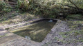
(15) After 1 km, follow the path up to the left, then turn left again at the end of this path to reach the Fontaine aux Moines. Turn right onto Rue de la Fontaine aux Moines, pass the wash house, and continue right onto Rue de l’Ancienne Ècole. Cross Rue de l’Ic and continue straight ahead onto Chemin des Merles, leaving another path on your right.
(16) A few metres before heading back down Rue de l’Ic, turn left onto a hillside path. This path runs parallel to the road, following it at varying distances. At a place called La Ville Méron, cross the small road and rejoin it on the other side. Then climb steeply up to the Menhir Saint-Gilles. Descend back down to the D4 (small car park): two paths lead down here, but the first one on the right is steeper.
Yellow PR® markings
(17) Cross the road and take the path opposite, which soon branches off to the right and climbs. Take a short detour to the left to visit the Saint-Gilles Chapel, then rejoin the route and reach a junction marked by a large wooden cross.
(18) Head down to the right to Rue de l’Ic. Cross the road, follow it to the right for 100 m and turn left onto a small road. Cross a bridge, pass Moulin Menguy on your right and follow a path uphill for 50 m.
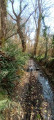
(19) Turn left onto a path that follows the course of the Ic to Binic. Keep as close as possible to the river on the right bank, following the PR®® signposts.
(20) At this fork, keep left and continue to Rue de l’Ic.
(21) Keep left without entering the street. Cross the motorhome site and, immediately after, cross a small wooden bridge on the left. Continue past the buildings (leisure centre, retirement home) to reach the Estran car park (S/E).

 Visorando Member
 Moderate
 Tourist office
 Easy
Easy