


jlfaure

 Association / Club / Walk leader
 Premium user
 Sign up:
Published route(s)
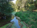
 La vallée de l'Autise à Xanton
 3.20 mi
 +33 ft
 -33 ft
 1h 30
1h 30
 Easy
Easy
 Departure from Xanton-Chassenon (Vendée)
Une petite boucle sans difficulté avec des sentiers et des chemins qui traversent des prairies en longeant l'Autise jusqu'à Denant puis retour par une piste cyclable à travers les champs.
Around the Ruisseau des Fougères
 6.36 mi
+377 ft
-377 ft
3h 15
6.36 mi
+377 ft
-377 ft
3h 15
 Moderate
Departure from Le Busseau (Deux-Sèvres)
Moderate
Departure from Le Busseau (Deux-Sèvres)
A walk along the paths through the countryside around Le Busseau, a rural village situated on the Niort–Cholet road (D744) on the border with the Vendée department, equidistant from Niort, Parthenay and Bressuire.
From Benet to Port d’Aziré
 5.60 mi
+138 ft
-138 ft
2h 40
Easy
Departure from Benet (Vendée)
5.60 mi
+138 ft
-138 ft
2h 40
Easy
Departure from Benet (Vendée)
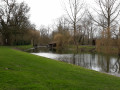
Starting from the Champ de Foire car park, near the Salle Polyvalente, you’ll climb up to the heights of Benet before reaching Port d’Aziré via a small road offering panoramic views over the cereal fields, then return via the Plaine de Pierre Plate and the hamlet of Villeneuve.
Chemin de la Mine and Bas de Soie
 6.52 mi
+249 ft
-262 ft
3h 15
Easy
Departure from Faymoreau (Vendée)
6.52 mi
+249 ft
-262 ft
3h 15
Easy
Departure from Faymoreau (Vendée)
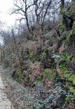
Starting from the Faymoreau Mining Centre, this route follows the mine path (an old railway line) and then continues through the countryside and orchards to reach the national forest (to be avoided during the hunting season).
The Père de Montfort Cave in the Mervent Forest
 6.25 mi
+554 ft
-558 ft
3h 20
Moderate
Departure from Pissotte (Vendée)
6.25 mi
+554 ft
-558 ft
3h 20
Moderate
Departure from Pissotte (Vendée)
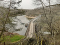
From the Saint-Luc roundabout, you will walk along long forest paths to a trail overlooking the Vergnes stream and leading to the Pierre Brune dam. You will then climb stone steps to the Grotte du Père de Montfort and finish the ascent via a wooden staircase. You will then walk along the Mère to the Diet Bridge and join theGR® de Pays de Mélusine, which will take you back to your starting point.
From Hermenault to the Bois de Saint-Maixent
 4.88 mi
+279 ft
-253 ft
2h 30
Moderate
Departure from L'Hermenault (Vendée)
4.88 mi
+279 ft
-253 ft
2h 30
Moderate
Departure from L'Hermenault (Vendée)
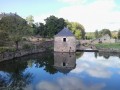
A very pleasant walk in the Hermenault countryside, offering a variety of landscapes ranging from plains to undergrowth and bocage.
The Claires Fontaines Trail
 5.84 mi
+213 ft
-217 ft
2h 50
Easy
Departure from Saint-Hilaire-de-Voust (Vendée)
5.84 mi
+213 ft
-217 ft
2h 50
Easy
Departure from Saint-Hilaire-de-Voust (Vendée)
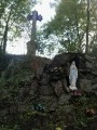
This walk along the banks of the Gâtine, amongst oak, ash and chestnut trees throughout the ‘Vendée’ valley – which at this stage is merely a stream fed by numerous springs – will also treat you, in its second half, to magnificent panoramic views of the bocage.
La Vergne Trail
 4.71 mi
+236 ft
-236 ft
2h 20
Easy
Departure from Saint-Hilaire-des-Loges (Vendée)
4.71 mi
+236 ft
-236 ft
2h 20
Easy
Departure from Saint-Hilaire-des-Loges (Vendée)
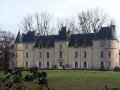
A walk that follows theGR® de Pays de Mélusine and theGR® de Pays Sud Gâtine to the Bois de la Vergne and returns to Saint-Hilaire-des-Loges, offering unobstructed panoramic views.
Please note that this route has been altered and shortened via the D3 following a ban on access to the Bois de la Vergne
Paths to wash houses and fountains around Ardin
 7.84 mi
+574 ft
-587 ft
4h 05
Moderate
Departure from Ardin (Deux-Sèvres)
7.84 mi
+574 ft
-587 ft
4h 05
Moderate
Departure from Ardin (Deux-Sèvres)
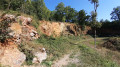
During this hike, you will discover numerous fountains and wash houses, of course, but also the castle and park of Dilay, the Doré, Saumort and Autize valleys, the Pouzay house and dovecote, the Chaillot arboretum and perhaps... La Galipote.
Boucle de Mairé
 7.27 mi
+69 ft
-66 ft
3h 25
Moderate
Departure from Aiffres (Deux-Sèvres)
7.27 mi
+69 ft
-66 ft
3h 25
Moderate
Departure from Aiffres (Deux-Sèvres)
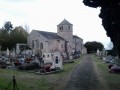
This route allows you to discover: the church of the former parish of Mairé, the porch of an old farm in Haut-Mairé, the old wash house in Bas-Mairé, the Motte Saint-Denis, the Saint-Pierre church and the 12th-century Hosannière Cross. All this while travelling through the countryside on pleasant flat paths that cross the Guirande (a tributary of the Sèvre Niortaise).
Marshlands and wash houses of Saint-Georges-de-Rex
 7.26 mi
+26 ft
-26 ft
3h 20
Easy
Departure from Saint-Georges-de-Rex (Deux-Sèvres)
7.26 mi
+26 ft
-26 ft
3h 20
Easy
Departure from Saint-Georges-de-Rex (Deux-Sèvres)
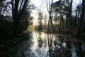
This route will allow you to discover the rich flora and fauna of the marshes along the white paths, as well as the small protected and restored rural heritage in the heart of the village of Saint-Georges-de-Rex.
In Niort on the banks of the Sèvre Niortaise
 6.76 mi
+13 ft
-13 ft
3h 05
Moderate
Departure from Niort (Deux-Sèvres)
6.76 mi
+13 ft
-13 ft
3h 05
Moderate
Departure from Niort (Deux-Sèvres)
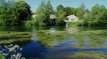
Taking the cycle paths and theGR®36via Belle Île, you will follow the banks of the Sèvre Niortaise and the Noron lake. Numerous vegetable gardens and beautiful residences line part of this route.
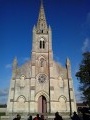
In the developed Marais Poitevin
 6.90 mi
+46 ft
-46 ft
3h 15
Easy
Departure from Le Vanneau-Irleau (Deux-Sèvres)
6.90 mi
+46 ft
-46 ft
3h 15
Easy
Departure from Le Vanneau-Irleau (Deux-Sèvres)
The villages of Vanneau and Irleau are situated in the heart of the Marais Poitevin Interregional Park, within a site designated a “Grand Site de France”. The Marais Poitevin, developed by humans since the 12th century, is one of the richest wetlands on the Atlantic coast.
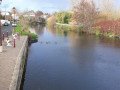
Between the Sèvre Niortaise and the marshes in Magné
 8.26 mi
+112 ft
-112 ft
3h 55
Easy
Departure from Coulon (Deux-Sèvres)
8.26 mi
+112 ft
-112 ft
3h 55
Easy
Departure from Coulon (Deux-Sèvres)
Starting from Coulon, you will walk along the banks of the Sèvre Niortaise for more than 5 km to reach the village of Magné, which you will cross to reach the Epineaux marsh and return to your starting point.
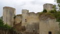
On the banks of the Sèvre Niortaise in Échiré
 7.32 mi
+177 ft
-161 ft
3h 30
Moderate
Departure from Échiré (Deux-Sèvres)
7.32 mi
+177 ft
-161 ft
3h 30
Moderate
Departure from Échiré (Deux-Sèvres)
Mélusine accompanies you near her castle in Coudray-Salbart, along the peaceful banks of the Sèvre Niortaise, towards old hamlets and ancient dwellings with imposing dovecotes.
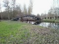
Route des Grandes Mottines
 3.65 mi
+43 ft
-43 ft
1h 45
Easy
Departure from Le Vanneau-Irleau (Deux-Sèvres)
3.65 mi
+43 ft
-43 ft
1h 45
Easy
Departure from Le Vanneau-Irleau (Deux-Sèvres)
A short walk along dirt tracks through the marshes and their nutria.
In the wet marshland of Saint-Hilaire-la-Palud
 7.04 mi
+13 ft
-13 ft
3h 15
Moderate
Departure from Saint-Hilaire-la-Palud (Deux-Sèvres)
7.04 mi
+13 ft
-13 ft
3h 15
Moderate
Departure from Saint-Hilaire-la-Palud (Deux-Sèvres)
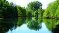
As you follow this route through the wet marsh, you will discover its unique features, such as the trous de bris (former clay extraction sites used for tile manufacturing until the 1980s), poplar groves and a wide variety of plants and animals.
Suiré Chalusson Circular Loop
 6.62 mi
+213 ft
-240 ft
3h 15
Moderate
Departure from Saint-Gelais (Deux-Sèvres)
6.62 mi
+213 ft
-240 ft
3h 15
Moderate
Departure from Saint-Gelais (Deux-Sèvres)
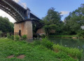
This walk will take you to the Couvent des Lucs and the Château de Suiré, near the banks of the Sèvre Niortaise. You will then walk along farm tracks to the A83, before returning via a shaded path through the Guignefolle Valley to reach the picturesque village of Chalusson. A metal footbridge installed in the 19th century beneath the railway bridge will allow you to cross the Sèvre once more to reach the upper part of the village of Saint-Gelais.
Around the Jeune Autise in Maillezais
 6.94 mi
+46 ft
-46 ft
3h 15
Moderate
Departure from Maillezais (Vendée)
6.94 mi
+46 ft
-46 ft
3h 15
Moderate
Departure from Maillezais (Vendée)
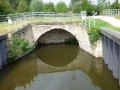
This path between the "wet" and "dry" marshes, passing by a characteristic feature of the marsh (the Aqueduct), will take you from the Romanesque church to the majestic Abbey of Saint-Pierre de Maillezais.
From Port d'Aziré to Marais des Nattes
 5.89 mi
+7 ft
-7 ft
2h 45
Moderate
Departure from Benet (Vendée)
5.89 mi
+7 ft
-7 ft
2h 45
Moderate
Departure from Benet (Vendée)
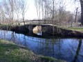
Walking along the Rigole d'Aziré to the Courdault canal, then returning via the Marais des Nattes, you may spot some nutria, purple herons or lapwings, and perhaps even a deer or two.
From the church at Xaintray to the Logis de Pichenin
 6.53 mi
+410 ft
-410 ft
3h 20
Moderate
Departure from Xaintray (Deux-Sèvres)
6.53 mi
+410 ft
-410 ft
3h 20
Moderate
Departure from Xaintray (Deux-Sèvres)
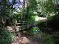
A circular route that takes you from sunny country lanes to shaded paths and tracks on either side of the Autize valley.
The footbridge known as the ‘planche de la route’, which spans the Autize at the bottom of the Rousillon woods, has been swept away by the floods of recent weeks.
Xaintray Town Hall (20 March 2024)
Jean dôs Bois Trail
 7.45 mi
+535 ft
-554 ft
3h 55
Moderate
Departure from Saint-Michel-le-Cloucq (Vendée)
7.45 mi
+535 ft
-554 ft
3h 55
Moderate
Departure from Saint-Michel-le-Cloucq (Vendée)
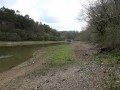
Starting from Saint-Michel-le-Cloucq, 5 km north of Fontenay-le-Comte, you will first walk along shaded paths around the Vendée and its tributary, the Ruisseau de la Cornelière. (difficult section, uneven path) then, passing by the Fontaine à l'Ermite, you will cross part of the Mervent forest and reach Saint-Michel via quiet paths and small roads, with beautiful panoramic views.
The Racounette Wash House
 5.80 mi
+302 ft
-276 ft
2h 55
Easy
Departure from Xaintray (Deux-Sèvres)
5.80 mi
+302 ft
-276 ft
2h 55
Easy
Departure from Xaintray (Deux-Sèvres)
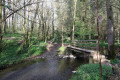
Beautiful views and a few wash houses enhance this route, the first part of which is shared with the Logis de Pichenin trail.
At the sources of Gâtine
 6.72 mi
+653 ft
-666 ft
3h 40
Moderate
Departure from Le Beugnon (Deux-Sèvres)
6.72 mi
+653 ft
-666 ft
3h 40
Moderate
Departure from Le Beugnon (Deux-Sèvres)
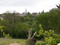
A route through hills, hedgerows, forests, streams and green valleys with numerous views of the "little Switzerland" of Beugnon.
La Cornelière
 6.50 mi
+102 ft
-131 ft
3h 05
Moderate
Departure from Mervent (Vendée)
6.50 mi
+102 ft
-131 ft
3h 05
Moderate
Departure from Mervent (Vendée)
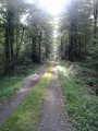
Covering an area of 5,518 hectares, the Mervent-Vouvant forest complex includes a 2,530-hectare state-owned forest. It is home to a rich variety of plant species. The most common species, the sessile oak, can reach a height of 35 metres at 200 years of age.
The suggested route follows paths and forest lanes in the north-eastern part of the forest.
The multitude of existing paths allows you to extend or shorten this walk as you wish.
The Hermitain and Sèvre Niortaise valleys
 5.05 mi
+354 ft
-351 ft
2h 40
Easy
Departure from Sainte-Néomaye (Deux-Sèvres)
5.05 mi
+354 ft
-351 ft
2h 40
Easy
Departure from Sainte-Néomaye (Deux-Sèvres)
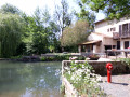
A route along shaded paths, between mossy stone walls and on white paths or small, quiet roads, around the Hermitain stream and the Sèvre Niortaise. Stone footbridges, a 12th-century bridge, renovated old mills and many other points of interest make this hike well worth the effort.
This route, marked in yellow, has been modified and shortened due to the closure of the Grand Moulin footbridge, which is awaiting restoration.
From Orbrie along the Vendée
 6.96 mi
+577 ft
-597 ft
3h 40
Moderate
Departure from L'Orbrie (Vendée)
6.96 mi
+577 ft
-597 ft
3h 40
Moderate
Departure from L'Orbrie (Vendée)
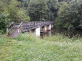
A lovely circular walk along the River Vendée and through the Mervent Forest. This circular walk will take you to the Mervent Dam, following part of the Mélusine GRP®.
Chemin des digitales in the Secondigny forest
 5.98 mi
+371 ft
-374 ft
3h 05
Easy
Departure from Le Retail (Deux-Sèvres)
5.98 mi
+371 ft
-374 ft
3h 05
Easy
Departure from Le Retail (Deux-Sèvres)
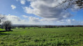
A hike in the Secondigny National Forest, dotted with foxgloves and ending with magnificent views of the Pays de Gâtine.
Walk at Port d'Aziré
 1.29 mi
+7 ft
-7 ft
0h 35
Easy
Departure from Benet (Vendée)
1.29 mi
+7 ft
-7 ft
0h 35
Easy
Departure from Benet (Vendée)
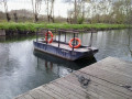
This is an easy, short walk that allows you to discover the wild side of the Green Venice. In the heart of nature, you will always be close to the water, in the shade of pollarded ash trees and poplars. And you may even be lucky enough to spot some nutria or deer.
Le Gué Verdon
 6.95 mi
+240 ft
-230 ft
3h 25
Moderate
Departure from Saint-Michel-le-Cloucq (Vendée)
6.95 mi
+240 ft
-230 ft
3h 25
Moderate
Departure from Saint-Michel-le-Cloucq (Vendée)
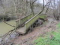
At the start, quiet country lanes with panoramic views of Fontenay-le-Comte and the surrounding countryside; then, after passing through the village of Meilleraie, shaded paths and tracks running alongside the Vendée river not far from the Albert dam, before climbing up to Saint-Michel-le-Cloucq.
The three valleys from François
8.22 mi
+344 ft
-318 ft
4h 05
Moderate
Departure from François (Deux-Sèvres)
This hike will take you along the meandering Chambon, Musson and Sèvre Niortaise rivers, passing through villages with beautifully restored stone houses and paths that cross vast plains of cereal crops stretching as far as the eye can see.
Around the Château de Coudray-Salbart
 6.30 mi
+249 ft
-240 ft
3h 05
Moderate
Departure from Échiré (Deux-Sèvres)
6.30 mi
+249 ft
-240 ft
3h 05
Moderate
Departure from Échiré (Deux-Sèvres)
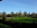
You will first follow the right bank of the Sèvre Niortaise to the Pont de Gué Moreau. There, you will take theGR®36, which will lead you back to the Château de Coudray-Salbard. Following a shaded path, you will climb up behind the château to the hamlet of Le Peu, reaching the Fontaine Braye. Continuing along theGR®, you will walk through a cool, lush valley. As you climb back up onto the plateau, you will leave theGR® and return to Ternanteuil to reach the car park where you started.
Around Auchay-sur-Vendée
 7.19 mi
+92 ft
-92 ft
3h 25
Moderate
Departure from Auzay (Vendée)
7.19 mi
+92 ft
-92 ft
3h 25
Moderate
Departure from Auzay (Vendée)
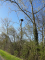
Starting from the Eiffel-style bridge linking Auzay to Chaix (now merged into the commune of Auchay-sur-Vendée).
This route through lush countryside (steep, wooded hillsides, vast fields and meadows) will take you to the Moulin de la Boissière (in the commune of Velluire-sur-Vendée) before reaching the banks of the Vendée at the Massigny Dam.
The Hermit's Fountain Trail
 3.67 mi
+184 ft
-180 ft
1h 50
3.67 mi
+184 ft
-180 ft
1h 50
 Difficult
Departure from L'Orbrie (Vendée)
Difficult
Departure from L'Orbrie (Vendée)
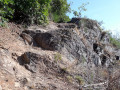
Starting from the Fontaine-à-l’Ermite roundabout, the path leads to the lakeshore and then follows the course of the Vendée river along the left bank as far as the Perrure bridge, before climbing up to the Allée de la Fontaine à l’Ermite, which will take you back to the starting point.Please note: this is a rugged trail involving rock climbing along the entire stretch of the Vendée.
The Mervent Dam
 6.78 mi
+486 ft
-476 ft
3h 30
Moderate
Departure from L'Orbrie (Vendée)
6.78 mi
+486 ft
-476 ft
3h 30
Moderate
Departure from L'Orbrie (Vendée)
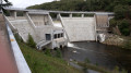
Circular route through the forest, passing through rolling meadows, then along the Vendée to the dam and the lake shore, on paths and trails that are sometimes a little steep but pleasant in all seasons.
Le Bois des Touches
 5.67 mi
+69 ft
-82 ft
2h 40
Easy
Departure from Vallans (Deux-Sèvres)
5.67 mi
+69 ft
-82 ft
2h 40
Easy
Departure from Vallans (Deux-Sèvres)
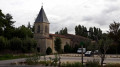
During this route, you will discover the village of Vallans and its 11th- and 19th-century Notre-Dame church, the hamlet of Le Petit Village with its fountains, the Château d’Allerit (private) and its dovecote, the hamlet of Fougerit, the Bois des Touches, watered by the Courance, leats, streams, wash houses and fountains.
Les Peux and the Chemin du Lisier
 3.48 mi
+115 ft
-115 ft
1h 40
Easy
Departure from Benet (Vendée)
3.48 mi
+115 ft
-115 ft
1h 40
Easy
Departure from Benet (Vendée)
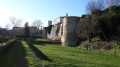
From the ruins of the old fortified castle, passing by the Church of Sainte-Eulalie (a listed historic monument), follow the Peux, a network of small footpaths with evocative names: Peu des Demoiselles, Peu des Ânesses, Peu de chez Gognar, Peu de Gâte-Bourse… you will discover the village of Benet, which stretches across two hills crossed by Rue de la Combe, beneath which flows the Vrizon.
Forêt de l’Absie and Bois des Gâts
 6.90 mi
+243 ft
-246 ft
3h 25
Moderate
Departure from L'Absie (Deux-Sèvres)
6.90 mi
+243 ft
-246 ft
3h 25
Moderate
Departure from L'Absie (Deux-Sèvres)
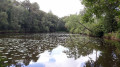
Despite a few sections on small tarmac roads, you’ll enjoy the shade and coolness of this route, which mostly follows paths and sunken lanes through forests of centuries-old trees.
Circular loops around Saint-Projet
 6.90 mi
+338 ft
-338 ft
3h 30
Moderate
Departure from La Chapelle-Bâton (Deux-Sèvres)
6.90 mi
+338 ft
-338 ft
3h 30
Moderate
Departure from La Chapelle-Bâton (Deux-Sèvres)
This route consists of three circular loops that are linked, allowing you to adjust the length of the walk as you wish. In a delightfully undulating landscape, dotted with fountains and wash houses, you’ll walk along paths that are more or less overgrown with grass and small country lanes passing through villages with beautifully restored old houses.
The Path of Françoise d'Aubigné
 5.75 mi
+240 ft
-256 ft
2h 50
Easy
Departure from Sciecq (Deux-Sèvres)
5.75 mi
+240 ft
-256 ft
2h 50
Easy
Departure from Sciecq (Deux-Sèvres)
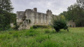
You can admire the Romanesque church at Sciecq before crossing the Sèvre Niortaise on a cable ferry. You will then see Mursay Castle, where Françoise d’Aubigné was brought up, before continuing along a shaded path overlooking the river. In the village of Surimeau, you’ll cross the Sèvre again at the Moulin d’Âne and, via the Chemin des Pêcheurs between the Sèvre and the Bois des Touches, you’ll reach the Moulin de Compéré before heading up towards Chantemerle and returning to the starting point.
Dilay and the headwaters of the Doré
 7.85 mi
+367 ft
-358 ft
3h 55
Moderate
Departure from Ardin (Deux-Sèvres)
7.85 mi
+367 ft
-358 ft
3h 55
Moderate
Departure from Ardin (Deux-Sèvres)
A circular route along little-used paths that will take you through fields, wooded countryside and meadows, to the source of the Doré via the village of Dilay, with its narrow streets, castle and wash house.
The Autise and the Xanton dolmens
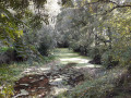 6.49 mi
+217 ft
-187 ft
3h 10
Moderate
Departure from Xanton-Chassenon (Vendée)
6.49 mi
+217 ft
-187 ft
3h 10
Moderate
Departure from Xanton-Chassenon (Vendée)
This route offers a wide variety of landscapes. A circular route through the fields on the heights of Xanton, with a 360° panoramic view, joins theGRP® Tour du Pays de Mélusine, which runs alongside rolling meadows before descending back towards the valley. It then joins the signposted Vallée de l’Autise route.
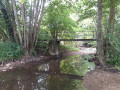
The Autise and Saumort valleys via Roc Cervelle
 5.84 mi
+486 ft
-499 ft
3h 05
Moderate
Departure from Béceleuf (Deux-Sèvres)
5.84 mi
+486 ft
-499 ft
3h 05
Moderate
Departure from Béceleuf (Deux-Sèvres)
This route follows paths that run alongside the Autise and Saumort rivers in the heart of unspoilt countryside. Very pleasant in fine weather, some sections of these paths can sometimes be flooded or difficult in wet weather.
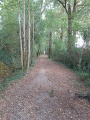
La Cressonnière and the Chemin des Wagons
 6.07 mi
+128 ft
-112 ft
2h 55
Easy
Departure from Cezais (Vendée)
6.07 mi
+128 ft
-112 ft
2h 55
Easy
Departure from Cezais (Vendée)
An 11th-century church, a stately home, a wash house, a communal lake, the ‘Chemin des Wagons’ and the Château de la Cressonnière… These are just some of the sights you’ll discover as you walk along paths that follow the route of old railway lines or hedgerow-lined tracks through the fields or deep within the Bois des Rochettes. An easy route that can be shortened, extended or altered as you wish. Ideal for families.
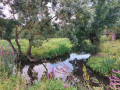
The marsh between La Garette and Le Vanneau
 6.46 mi
+23 ft
-20 ft
3h 00
Moderate
Departure from Sansais (Deux-Sèvres)
6.46 mi
+23 ft
-20 ft
3h 00
Moderate
Departure from Sansais (Deux-Sèvres)
Starting from the Garette Leisure Park, you will walk through the heart of the Marais Poitevin, mostly on dirt tracks, to Le Vanneau. After the port of this village, you will cross magnificent vegetable gardens and return to your starting point along creeks, canals and ditches crossed by beautiful, sturdy footbridges. There's no reason why you can't do this route by bike.
Around the Autize via Les Moulières and Tourteron
 6.67 mi
+390 ft
-413 ft
3h 25
Moderate
Departure from Saint-Pompain (Deux-Sèvres)
6.67 mi
+390 ft
-413 ft
3h 25
Moderate
Departure from Saint-Pompain (Deux-Sèvres)
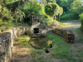
A route that follows the River Autize, passes near Château des Moulières, then takes a footpath and reaches the village of Tourteron via agricultural tracks. After a detour to the fountain and wash house in Tourteron, the walk continues across the plain dotted with wind turbines, then follows or runs alongside an old railway line, passes under a viaduct and returns along the meadows bordering the Autize to the Moulin de Dray before climbing back up to Saint-Pompain.
Le Jaulard and La Fontaine à l'Ermite in the Mervent Forest
5.89 mi
+459 ft
-453 ft
3h 05
Moderate
Departure from L'Orbrie (Vendée)
A circular route that takes you off the beaten track in the heart of the Mervent State Forest, suitable for all seasons. Shortcuts are possible. The GPX track can be very useful.
The Brangeard Valley, starting from the Cherveux-Saint-Christophe pond
 6.03 mi
+325 ft
-341 ft
3h 05
Easy
Departure from Saint-Christophe-sur-Roc (Deux-Sèvres)
6.03 mi
+325 ft
-341 ft
3h 05
Easy
Departure from Saint-Christophe-sur-Roc (Deux-Sèvres)
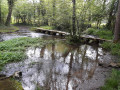
Setting off from the Cherveux-Saint-Christophe lake, you’ll reach the water tower, the highest point on the route, surrounded by countryside stretching as far as the eye can see, then a shaded path will lead you to the hamlet of Lussais. You’ll then enjoy the lush greenery of the Brangeard, Musson and Marcusson valleys as you follow a circular route along small roads, footpaths and grassy tracks that will take you back to the lake where you started.
The Mervent Forest from Chevalement d'Épagne
 6.49 mi
+295 ft
-266 ft
3h 15
Moderate
Departure from Saint-Maurice-des-Noues (Vendée)
6.49 mi
+295 ft
-266 ft
3h 15
Moderate
Departure from Saint-Maurice-des-Noues (Vendée)
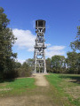
Circular route in the Mervent-Vouvant Forest starting from Chevalement Saint-Michel in Épagne.
Circular between La Roussille and Magné
 5.61 mi
+39 ft
-43 ft
2h 35
Easy
Departure from Niort (Deux-Sèvres)
5.61 mi
+39 ft
-43 ft
2h 35
Easy
Departure from Niort (Deux-Sèvres)
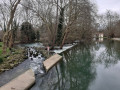
This route follows the cycle path along the Sèvre Niortaise, from La Roussille to Magné, then returns via the Marais de Peigland and Marais de Saint-Rémy to the village of La Tiffardière, near the starting point.