The Autise and the Xanton dolmens

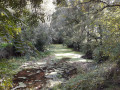
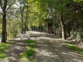
This route offers a wide variety of landscapes. A circular route through the fields on the heights of Xanton, with a 360° panoramic view, joins theGRP® Tour du Pays de Mélusine, which runs alongside rolling meadows before descending back towards the valley. It then joins the signposted Vallée de l’Autise route.

Details

19014243
Creation:
Last update:
Last review:
  • Walking
    Activity: Walking
  • ↔
    Distance: 6.49 mi
  • ◔
    Average duration: 3h 10 
  • ▲
    Difficulty: Moderate

  • ⚐
    Back to start: Yes
  • ↗
    Ascent: + 217 ft
  • ↘
    Descent: - 187 ft

  • ▲
    Highest point: 207 ft
  • ▼
    Lowest point: 33 ft

Photos

Description of the walk

Park in the car park on Rue de l’Église.

(S/E) Return to the D15 by continuing to the end of Rue de l’Église. Turn right and, after about 150 m, cross the road to turn left onto Rue des Ors and, immediately afterwards, turn right at the three-way junction onto the uphill road called Chemin de la Pierre Virante (dolmen). Walk past the dolmen and turn left at the next junction.

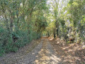
(1) Turn right. A little further on, at the highest point of the walk, you can enjoy the 360° panoramic view. A little further on, cross the small road and continue straight ahead along a grassy path which joins another stony path that crosses and runs alongside a stream – which is dry in summer – a little further on.

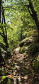
(2) Turn right onto theGR® de Pays Tour du Pays de Mélusine, marked in yellow and red. Cross the junction and continue straight on along a small road. At the next left-hand bend, leave the road and head straight on along a path, then straight on again at the next bend. The path descends to the bottom of the valley, crosses a stream and joins a small road leading towards Saint-Hilaire-des-Loges.

(3) Leave theGRP® by turning right onto the small road that climbs and, 300 metres further on, before the farm, take the path that branches off to the left before a solitary ash tree. 100 metres further on, turn right onto a grassy agricultural access path.

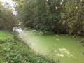
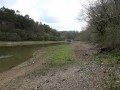
(4) Continue left onto a small road that descends towards the valley. Cross the D15 with care, turn right and then immediately left to join the cycle path, leading to the Moulin de Guissais. Turn right, staying on the cycle path that runs alongside the Autise.

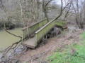
(5) Leave the cycle path by turning left and head towards the River Autise. Take the path on the left before reaching the river and cross the concrete footbridge.

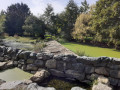
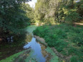
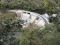
(6) Enter a meadow on the right through a log fence forming a chicane and walk along the left-hand side of the meadow. Pass a recently restored cottage and, after a second chicane, continue along a shaded path which ends at a third chicane and leads out onto a small meadow. When you reach the dam on the Autise, which has been fitted with a fish ladder, look out for the Moulin de Xanton on the opposite bank. Carry on past a final fence and continue along the track that runs alongside the Autise.

(7) Take the D104 on the right and walk carefully along the road. Cross the bridges over the two branches of the Autise.

(8) Turn right towards the hamlet of La Vallée and continue along the track, which is closed to motorised vehicles.

(9) Carefully follow the D15 to the right. Turn right again onto Rue de l’Église after the town hall (note the small wash house) to reach the car park (S/E).

Waypoints

  1. S/E : mi 0 - alt. 59 ft - Car park on Rue de l’Église
  2. 1 : mi 0.79 - alt. 177 ft - T-junction, take the path on the right
  3. 2 : mi 1.65 - alt. 157 ft - Turn right onto the GRP Tour du Pays de Mélusine
  4. 3 : mi 2.37 - alt. 131 ft - Turn right onto the tarmac road
  5. 4 : mi 2.87 - alt. 187 ft - Turn left onto a small road
  6. 5 : mi 3.72 - alt. 46 ft - Crossroads – Path on the left towards the - Autise (rivière)
  7. 6 : mi 3.85 - alt. 46 ft - Wooden chicane
  8. 7 : mi 4.98 - alt. 43 ft - D104 – Turn right
  9. 8 : mi 5.33 - alt. 49 ft - La Vallée – To the right
  10. 9 : mi 6.22 - alt. 89 ft - D15 – Right
  11. S/E : mi 6.49 - alt. 59 ft - Car park on Rue de l’Église

Notes

  • Toilets and picnic area on Rue de l’Église (S/E)
  • Picnic tables near the Moulin de Guissais.
  • Between points (2) and (3), the route is signposted in yellow and red (GRP® Tour du Pays de Mélusine)
  • From point (5), the route is signposted in yellow by the Sud-Vendée Marais Poitevin Tourist Office: ‘Circuit de la Vallée de l’Autise à Xanton’.

(5) Shortcut back to (S/E) by going straight on.

  • There are sometimes cows grazing beyond the point (6). If you wish to avoid the section between (6) and (7) or if it is impassable due to flooding, continue straight ahead and, after 200 m, turn right onto the road. Walk for about 1.5 km. After the high-voltage power line, at Denant, turn right and rejoin the route at point (7).

Worth a visit

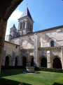
(S/E) The Church of Saint-Pierre in Xanton is listed as a historic monument. Its foundations date from the 10th century and the entrance porch from the 11th century.

The dolmen known as ‘La Pierre Virante’: a megalithic monument carbon-dated to be nearly 5,000 years old.
For more information: https://fr.wikipedia.org/wiki/Pierre-Vir....

Note the magnificent panoramic view as you reach the highest point of the route between waypoints (1) and (2) (alt. 61 m), and also after waypoint (4). You can see the bell tower of Saint-Hilaire-des-Loges amongst the wind turbines and other water towers.

The Autize (in the Deux-Sèvres) or Autise (in the Vendée) flows through the departments of Deux-Sèvres and Vendée. It is a tributary of the Sèvre Niortaise.
Find out more: https://fr.wikipedia.org/wiki/Autize

Very close to Xanton, the Abbey of Saint-Vincent in Nieul-sur-l’Autise and the Maison de la Meunerie are well worth a visit.

Xanton-Chassenon local authority website: https://xantonchassenon.fr/

Always be cautious and plan ahead when you're outdoors. Visorando and the author of this route cannot be held responsible for any accidents occurring on this route.

The GR® and PR® markings are the intellectual property of the Fédération Française de Randonnée Pédestre.

Reviews and comments

4 / 5
Based on 4 reviews

Reliability of the description
4 / 5
Ease of following the route
4.3 / 5
Route interest
3.8 / 5
Ullus
Ullus

The hike isn't fresh enough in my memory.

Machine-translated

alleole17
alleole17

Overall rating : 4 / 5

Date of your route : Nov 17, 2025
Reliability of the description : ★★★★☆ Good
Ease of following the route : ★★★★☆ Good
Route interest : ★★★★☆ Good
Very busy route : No

A few minor difficulties following the route at the beginning, but otherwise very well signposted.

Machine-translated

MARTDomi
MARTDomi

Overall rating : 3.7 / 5

Date of your route : Aug 28, 2024
Reliability of the description : ★★★★☆ Good
Ease of following the route : ★★★★☆ Good
Route interest : ★★★☆☆ Average
Very busy route : No

A lovely, rustic circular loop.
No particular difficulties

Machine-translated

Ullus
Ullus

Overall rating : 4.3 / 5

Date of your route : Oct 13, 2023
Reliability of the description : ★★★★☆ Good
Ease of following the route : ★★★★★ Very good
Route interest : ★★★★☆ Good
Very busy route : No

An interesting hike. A few lovely routes through the forest. The view at the *start* of the hike is well worth the
it. It’s a shame that down in the valley a wind turbine construction site is

wind turbine *construction site is under way

way

Machine-translated

philouis
philouis

Overall rating : 4 / 5

Date of your route : Jan 30, 2023
Reliability of the description : ★★★★☆ Good
Ease of following the route : ★★★★☆ Good
Route interest : ★★★★☆ Good
Very busy route : No

An easy walk in the first half, but rather disappointing in terms of scenery (and the weather was grey that day, too). The second section along the Autize is more interesting, even if it was quite damp. It’s a shame that when there are animals in the meadows, you have to skip part of the route.

Machine-translated

Other walks in the area

For more walks, use our search engine .

The GPS track and description are the property of this route's author. Please do not copy them without permission.