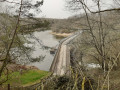
La Cressonnière and the Chemin des Wagons

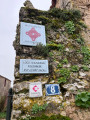
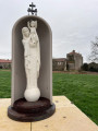
An 11th-century church, a stately home, a wash house, a communal lake, the ‘Chemin des Wagons’ and the Château de la Cressonnière… These are just some of the sights you’ll discover as you walk along paths that follow the route of old railway lines or hedgerow-lined tracks through the fields or deep within the Bois des Rochettes. An easy route that can be shortened, extended or altered as you wish. Ideal for families.

Details

22809444
Creation:
Last update:
Last review:
  • Walking
    Activity: Walking
  • ↔
    Distance: 6.07 mi
  • ◔
    Average duration: 2h 55 
  • ▲
    Difficulty: Easy

  • ⚐
    Back to start: Yes
  • ↗
    Ascent: + 128 ft
  • ↘
    Descent: - 112 ft

  • ▲
    Highest point: 331 ft
  • ▼
    Lowest point: 226 ft
  • ⚐ Country: France
  • ⚐ City: Cezais (85410)
  • ⚑
    Start/End: N 46.591133° / W 0.816146°
  • ❏
    IGN map(s): Ref. 1427SB
  • Hour-by-hour weather

Photos

Description of the walk

Park in the cemetery car park located on the left after the lake when coming from the D31.

(S/E) Leave the car park via the small wooden footbridge spanning the ditch at the top right and continue straight on along Rue des Acacias. After a right-hand bend, you’ll reach Rue de la Forge; turn left onto it, with your back to the town hall.

(1) Walk alongside the church car park, staying on this street.

(2) Turn right onto Rue du Logis and then right again onto Rue de l’Église to return to the bend in Rue de la Forge.

(1) Head down to the left into Rue du Lavoir, then veer to the right after the washhouse to head back up Rue de la Forge. Continue straight on, passing the town hall.

(3) Leave the road and take the path on the left. After about 150 m, leave the path and head towards the pond. Walk alongside it until you reach the picnic area.

(4) Cross the D63a road and head up the path opposite, which follows the route of the old railway line.

(5) Turn slightly left onto the grassy path running parallel to the road. Facing the D89, turn right onto one of the paths between the rows of trees.

(6) Turn right onto a grassy path lined with hedges until you reach a junction.

(7) Turn left onto the stony path. After about 500 m, turn left again. After crossing a small stream, continue to the left along a sunken path on the edge of the Bois des Rochettes.

(8) Ignore the path leading off to the right towards the hamlet of La Gare; instead, turn left and walk past the football pitch. Continue along a stony path until you reach the D31.

(9) Cross the road carefully and continue past the Ferme des Gazelles until you reach the path on the left (GR® de Pays de Mélusine – former railway line). A little further on, veer right to join the road at the hamlet of La Cressonière. Continue straight on, passing the château, and you’ll reach the D63a.

(10) Turn left and, at the junction 100 metres further on, turn left again onto the track (note: the signposting turns right and indicates the route of a different walk). Cross the D89 and then the D31 with care .

(5) At the junction with the start of the route, carry on straight ahead along the small road.

(7) At the next junction, which you have already passed on the way out, turn right onto the road and, after about 200 m, at the left-hand bend, go straight on to enter a shaded path and arrive at the cemetery car park (S/E).


Waypoints

  1. S/E : mi 0 - alt. 246 ft - Cemetery car park
  2. 1 : mi 0.3 - alt. 236 ft - Junction of the first circular loop
  3. 2 : mi 0.37 - alt. 240 ft - Rue du Logis
  4. 3 : mi 0.69 - alt. 243 ft - Path on the left
  5. 4 : mi 1.02 - alt. 262 ft - Crossing the road
  6. 5 : mi 1.47 - alt. 285 ft - Junction of the 2nd circular loop
  7. 6 : mi 1.69 - alt. 305 ft - Junction on a grassy path
  8. 7 : mi 2.04 - alt. 285 ft - Junction of the 3rd circular loop
  9. 8 : mi 3.15 - alt. 331 ft - Junction towards the football pitch
  10. 9 : mi 3.56 - alt. 299 ft - Crossing the D31
  11. 10 : mi 4.62 - alt. 266 ft - Junction after the castle
  12. S/E : mi 6.07 - alt. 246 ft - Cemetery car park

Notes

Before point (4), there is a picnic area with tables, a shelter, toilets and a boules court.

In winter, at point (6), to avoid the sunken track near the Bois des Rochettes – which can be very muddy – head straight to point (9) by continuing along the D31.

This trail is signposted in yellow by the Vendée-Pays de la Châtaigneraie Tourist Office.

Worth a visit

- Saint-Hilaire Church (listed as a Historic Monument), built in the 11th century on the site of an older church.
- The seigneurial manor house and its dovecote at point (2) (listed as a historic monument). This manor house dates back to the early 15th century and was extended in the 16th and then the 18th centuries, before finally becoming the centre of a farm in the 19th century.
- The wash house at (1)
- The village lake and its leisure area, at (4).
- The Chemin des Wagons (between points (4) and (6) and also on theGR® du Pays trail after LD les Gazelles).
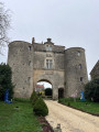
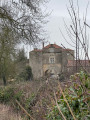
- The Château de la Cressonnière (15th and 16th centuries) at point (10)

Always be cautious and plan ahead when you're outdoors. Visorando and the author of this route cannot be held responsible for any accidents occurring on this route.

The GR® and PR® markings are the intellectual property of the Fédération Française de Randonnée Pédestre.

Reviews and comments

4.3 / 5
Based on 3 reviews

Reliability of the description
4.3 / 5
Ease of following the route
4.3 / 5
Route interest
4.3 / 5
Michael Leleux
Michael Leleux

Overall rating : 4.7 / 5

Date of your route : Feb 09, 2025
Reliability of the description : ★★★★★ Very good
Ease of following the route : ★★★★★ Very good
Route interest : ★★★★☆ Good
Very busy route : No

A lovely walk – watch out for the muddy section after a spell of rain.

Machine-translated

LucieCze
LucieCze

Overall rating : 4.7 / 5

Date of your route : Feb 18, 2024
Reliability of the description : ★★★★★ Very good
Ease of following the route : ★★★★★ Very good
Route interest : ★★★★☆ Good
Very busy route : No

Starting from Cezais, a very pleasant walk, mainly along well-marked paths.

Machine-translated

Fresyl
Fresyl

Overall rating : 3.7 / 5

Date of your route : Dec 31, 2022
Reliability of the description : ★★★☆☆ Average
Ease of following the route : ★★★☆☆ Average
Route interest : ★★★★★ Very good
Very busy route : No

A brilliant walk – I’d say 90 per cent of it’s through woodland

Machine-translated

Other walks in the area

For more walks, use our search engine .

The GPS track and description are the property of this route's author. Please do not copy them without permission.