Country:
 City:
City:



Park in the car park of the Chaillot village hall, Rue de Vrigne aux Bois in Ardin
(S/E). Leave the car park, head left and then immediately right into Allée des Frênes. Just before reaching the end of the cul-de-sac, turn right at the corner by the transformer onto the shaded path leading uphill. After about 40 metres, continue left at the corner of a boundary wall. Further on, the path descends to the left and joins Rue Alphonse Lavoix. Take this road, heading uphill to the right, and walk past the school.
Climb the few steps on the right that cut across the corner to join Rue Jean-Joseph Tonnet.
(1) After a left-hand bend, head up to Rue Jean de Saint-Goars. Turn right and, 50 metres further on, turn left into Rue du Chevalier Gaspard. After the houses, the tarmac ends and gives way to a shaded, downhill path.
(2) Turn left, cross the Doré and set off up the stony path. On the climb, ignore a path branching off to the left. At the top, continue straight on along Rue du Chatonnet, and head for the junction near the D745.
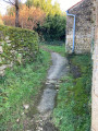
(3) Turn right opposite the wayside cross. Walk for about 100 m and turn right at the three-way junction towards Gâte-Bourse. In the hamlet, continue to the left after the duck pond along the shaded path. (It is possible to take the path leading down to the right, but only in dry weather, as the path is often flooded near the stream).
(4) Turn right onto the path that descends towards the forest. After a steep descent, cross the Doré and head back up towards the village of Dilay. (Note the fountain and the drinking trough along the rock on your left). Turn right onto Rue de l’Abreuvoir.
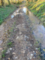
(5) Take the small path on the left which winds between the stone walls and joins the Impasse du Bois Roquet. Walk up to the Rue du Château, turn left then right, before the bus shelter, onto the Rue de la Noue Girard. Walk past the first farm building. After a left-hand bend, before the entrance gate to the farm, turn right onto the often muddy track.
(6) Alternative route available (see Practical Information).
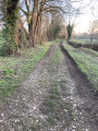
Continue to the left along the track which runs alongside the farm buildings and heads out into the countryside, then passes under a high-voltage power line. Ignore the track leading into the woods on the right and continue alongside the high-voltage power line, then turn right a little further on.
(7) Turn left onto the path lined with hedges. After the Fontaine de Périgny, turn right onto a similar path until you reach a small road.
(8) Turn right onto the road. Walk past the Fontaine du Chiron and, at the Gaconnière crossroads, take the path on the right for about 150 m.
(9) Turn onto the path on the left, pass under the high-voltage power line and continue to the T-junction with another path. Turn right and pass under the high-voltage power line again.
(10) Cross the small road and continue the route along the track opposite (former marble quarry on the right). After passing under the high-voltage power line once more, you’ll reach the D129 road. Turn and keep carefullyto the right for about 50 m.
(11) Take the track on the right and pass under the high-voltage power line once more. A little further down, pass under another high-voltage power line and join Rue de la Petite Vergne. Follow the boundary wall of the castle grounds and arrive at the wash house and fountain situated on the left at the bend in the road. Continue carefully, heading straight up the road.
(12) Turn right onto Rue de la Grande Vergne. After the hamlet, the street becomes a grassy track and continues through the valley, following the meandering course of the Doré.
(2) Turn left onto the path leading uphill; at the top, first turn right then left to join the small road (building with yellow cladding) and arrive at a junction opposite the football pitch.
(13) Turn right onto Rue Armand Barlet, then turn left down Rue de Vrigne aux Bois, pass the stadium and head for the village hall car park (S/E).

 Association / Club / Walk leader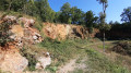

 Visorando Member
 Easy
Easy