The Brangeard Valley, starting from the Cherveux-Saint-Christophe pond

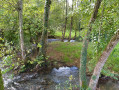
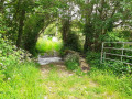
Setting off from the Cherveux-Saint-Christophe lake, you’ll reach the water tower, the highest point on the route, surrounded by countryside stretching as far as the eye can see, then a shaded path will lead you to the hamlet of Lussais. You’ll then enjoy the lush greenery of the Brangeard, Musson and Marcusson valleys as you follow a circular route along small roads, footpaths and grassy tracks that will take you back to the lake where you started.

Details

26991000
Creation:
Last update:
Last review:
  • Walking
    Activity: Walking
  • ↔
    Distance: 6.03 mi
  • ◔
    Average duration: 3h 05 
  • ▲
    Difficulty: Easy

  • ⚐
    Back to start: Yes
  • ↗
    Ascent: + 325 ft
  • ↘
    Descent: - 341 ft

  • ▲
    Highest point: 381 ft
  • ▼
    Lowest point: 187 ft

Photos

Description of the walk

Park in the car park at the Cherveux – Saint-Christophe lake – Access signposted from the D743 (between Niort and Parthenay).

(S/E) Head down towards the lake’s beach and turn right. Shortly after the footbridge, leave the path around the lake and continue uphill to the right. Ignore the path leading off to the left and carry on, turning left a little further along the path that descends towards the pumping station. Walk past the riding centre and turn right onto the road. 100 m further on, leave the road and take the path on the left to reach the next junction.

(1) Turn left and carry on straight ahead for about 800 m until you reach the D122. Turn right onto this road, then turn left a little further on towards the water tower and carry on straight ahead.

(2) At the bend to the right in the road, turn onto the track on the left and, 50 metres further on, carry straight on along the narrow path. Continue left onto the Route de Lussais.

(3) In the village, turn right onto the Chemin de Casse Échine. About 300 m further on, after the house on the left-hand side of the road, take the small, shaded path that winds down to the left.

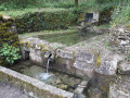
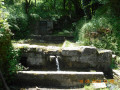
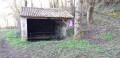
(4) When you reach the wash house and the Source de Trousse-Chemise (not shown on maps), turn right onto the small road and carry on until you reach another road. Head right until you reach the D8.

(5) Turn left and, after the second bridge, turn left again. Walk past the Brangeard picnic area and continue along this path which runs alongside the Marcusson. When you reach a road, turn left and take the path on the right after the bridge over the Marcusson, ignoring the path that climbs just after it.

(6) Just before the road, leave the valley and head left up the hairpin bend, which curves right further up; turn left about 500 m further on at the four-way junction, then head towards the edge of the woodland.

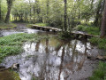
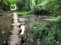
(7) Do not enter the woodland but take the path on the right. Follow the fields on your right-hand side, then, at the crossroads, turn left (note the large ash tree on the left). Once at the bottom, cross the Brangeard via the small bridge made of flat stones.

(4) Turn right onto the small road, not far from the Trousse-Chemise washhouse seen on the way out, and reach a T-junction at the corner of a house on your right.

(8) Turn left, then right onto Chemin Porte Pierre, at the top of the hill. (Note, a little further on to the left, behind a stone wall, a Protestant cemetery overgrown with wild vegetation).
After a right-hand bend, the road reaches the junction of Chemin de la Logette and Chemin de Canquenmaille.

(9) Continue straight on along the small road that leads downhill. At the Grand Moulin, cross the Ruisseau de Brangeard and head back up to the Route du Plan d’Eau. Turn left onto the road, then right towards the lake, go through the barrier and arrive at the car park (S/E).

Waypoints

  1. S/E : mi 0 - alt. 289 ft - Car park - Etang de Cherveux - St-Christophe
  2. 1 : mi 0.9 - alt. 361 ft - Plaine des Chirons junction
  3. 2 : mi 1.81 - alt. 364 ft - Start of the trail
  4. 3 : mi 2.19 - alt. 266 ft - Chemin de Casse-Échine
  5. 4 : mi 2.45 - alt. 213 ft - Trousse-Chemise wash house
  6. 5 : mi 2.91 - alt. 194 ft - D8 road
  7. 6 : mi 3.65 - alt. 223 ft - Junction - Marcusson (cours d'eau) - Affluent de la Sèvre Niortaise
  8. 7 : mi 4.16 - alt. 243 ft - Junction
  9. 8 : mi 4.89 - alt. 210 ft - The Lussais Mill
  10. 9 : mi 5.45 - alt. 292 ft - Chemin de Canquenmaille
  11. S/E : mi 6.03 - alt. 289 ft - Car park - Etang de Cherveux - St-Christophe

Worth a visit

(S/E) Large car park, campsite, supervised swimming area during July and August from 1 pm to 7 pm. Water slide (under parental supervision). A wide range of activities on offer, such as water ski lift, stand-up paddleboarding, water slide, treetop adventure course, children’s play areas, pétanque and Category1fishing.
Free entry.

La Croix de Coquet equestrian centre, not far from the Cherveux-Saint-Christophe lake.

Other walking routes are available starting from Cherveux and Saint-Christophe-sur-Roc.

Reviews and comments

4.4 / 5
Based on 3 reviews

Reliability of the description
4.5 / 5
Ease of following the route
4.7 / 5
Route interest
4 / 5
lemarcheur65
lemarcheur65 ★
User 28059915
• Edited:

Hello
It used to work, but it doesn’t work anymore.
I used to receive the link by email. I’d go to Visorando, find the route and click ‘Start the walk’.
It’s not working any more; when I go to Visorando, I’m shown all the walks available in the area.
Please could you get in touch with me?
Kind regards,
Evelyne.

Machine-translated

Gaillard Jacques
Gaillard Jacques

Overall rating : 4.7 / 5

Date of your route : Jun 22, 2025
Reliability of the description : ★★★★★ Very good
Ease of following the route : ★★★★★ Very good
Route interest : ★★★★☆ Good
Very busy route : No

A lovely walk, with some lovely, shady sunken paths and picnic areas along the route. We followed the route on our mobile. On our return, we walked round the lake to complete the walk, bringing the total distance to 11 km. We really enjoyed this walk.

Machine-translated

TINO1779
TINO1779

Overall rating : 4.5 / 5

Date of your route : Jul 25, 2024
Reliability of the description : Not used / Not applicable
Ease of following the route : ★★★★★ Very good
Route interest : ★★★★☆ Good
Very busy route : No

A superb walk, even in the heat, but the route is very shaded so it was perfect.
The footpaths and trails are in good condition, with very little road walking...
An added bonus would be to bring your swimming costume so you can have a dip in the pond (if it’s open to the public).

Machine-translated

philouis
philouis

Overall rating : 4 / 5

Date of your route : Jan 09, 2023
Reliability of the description : ★★★★☆ Good
Ease of following the route : ★★★★☆ Good
Route interest : ★★★★☆ Good
Very busy route : No

A lovely walk. Quite a few very muddy sections, but nothing out of the ordinary for January. Quite a few familiar paths, but ones we always enjoy walking along.

Machine-translated

Other walks in the area

For more walks, use our search engine .

The GPS track and description are the property of this route's author. Please do not copy them without permission.