Circular route around the Sèvre between La Roussille and Saint-Liguaire

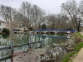
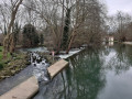
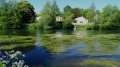
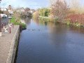
A short circular route that follows a cycle path along part ofthe GR®36, heading up the Sèvre Niortaise to the bridge on Boulevard Willy Brandt, and returning to the Roussille lock via the opposite bank and then through the village of Saint-Liguaire.

Details

31775894
Creation:
Last update:
Last review:
  • Walking
    Activity: Walking
  • ↔
    Distance: 3.60 mi
  • ◔
    Average duration: 1h 40 
  • ▲
    Difficulty: Easy

  • ⚐
    Back to start: Yes
  • ↗
    Ascent: + 30 ft
  • ↘
    Descent: - 30 ft

  • ▲
    Highest point: 59 ft
  • ▼
    Lowest point: 26 ft

Photos

Description of the walk

Park at the hamlet of La Roussille, known for its gourmet inn.

(S/E) With your back to the bridge, take the cycle path (towpath) that runs along the right bank of the Sèvre.

(1) Ignore the path leading off to the left towards the Chey farm and continue along the Sèvre.

(2) Go under the bridge and climb the steps on the left to cross the river, safely following the cycle and footpath which is separated from motor traffic. After the bridge, go down another flight of steps to reach the opposite bank.

(3) Turn left onto the path that runs along the riverbank (Impasse de la Plante). Further on, the path moves away from the river and heads up Avenue de l’Espérance.

(4) Turn right onto this avenue, carefully following the pavement, which is separated from the road by a cycle path.

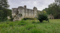
(5) Go round the Antonin Proust roundabout and continue along Avenue de l’Espérance. Pass to the right behind the Church of Sainte-Marie-Madeleine in Saint-Liguaire.

(6) Leave the street by continuing straight on into Impasse de l’Abbaye, which joins Venelle des Écoliers after 50 metres. At the end of the alley, go down a few steps and turn right into Rue du Moulin, which, after a left-hand bend, continues for about 700 metres and ends in a cul-de-sac.

(7) Cross a footbridge, then the lock opposite the Auberge de la Roussille, and finally the bridge on the right to reach the La Roussille car park (S/E)

Waypoints

  1. S/E : mi 0 - alt. 30 ft - Car park at the hamlet of La Roussille - Sèvre Niortaise (fleuve)
  2. 1 : mi 1.12 - alt. 30 ft - Chemin de la Ferme de Chey – straight ahead
  3. 2 : mi 1.63 - alt. 30 ft - Stairs leading up to the bridge
  4. 3 : mi 1.74 - alt. 30 ft - Stairs leading down to the left bank
  5. 4 : mi 2.39 - alt. 39 ft - Avenue de l’Espérance – turn right
  6. 5 : mi 2.78 - alt. 49 ft - Antonin Proust Roundabout
  7. 6 : mi 2.96 - alt. 52 ft - Impasse de l’Abbaye
  8. 7 : mi 3.49 - alt. 26 ft - Footbridge leading to the La Roussille lock
  9. S/E : mi 3.6 - alt. 30 ft - Car park at the hamlet of La Roussille - Sèvre Niortaise (fleuve)

Notes

The Sèvre Niortaise towpath is often very busy during the holidays, at weekends and on public holidays. It can be difficult to find a parking space at La Roussille. Several other starting points are available.

  1. Large car park at the Ferme de Chey. A path joins the route at point (1) (approx. 500 m)
  2. A small car park near the bridge on Boulevard Willy Brandt (point (2))
  3. Car park at the Saint-Liguaire stadium, near the Antonin Proust roundabout at point (5) (full on match days).
  4. Small car park in Saint-Liguaire before the Roussille footbridge at point (7) (often full).

Worth a visit

Always be cautious and plan ahead when you're outdoors. Visorando and the author of this route cannot be held responsible for any accidents occurring on this route.

The GR® and PR® markings are the intellectual property of the Fédération Française de Randonnée Pédestre.

Reviews and comments

5 / 5
Based on 2 reviews

Reliability of the description
5 / 5
Ease of following the route
5 / 5
Route interest
5 / 5
fredalex13
fredalex13

Overall rating : 5 / 5

Date of your route : Jun 16, 2025
Reliability of the description : ★★★★★ Very good
Ease of following the route : ★★★★★ Very good
Route interest : ★★★★★ Very good
Very busy route : No

Not very busy during the week. However, be careful on weekends and public holidays.
Very pleasant shade and sunshine along the Sèvres river.

Machine-translated

Amé_rando
Amé_rando

Overall rating : 5 / 5

Date of your route : Aug 05, 2024
Reliability of the description : ★★★★★ Very good
Ease of following the route : ★★★★★ Very good
Route interest : ★★★★★ Very good
Very busy route : No

A lovely walk along a riverside path. Very easy to follow. The final section through the town is less pleasant.

Machine-translated

Other walks in the area

For more walks, use our search engine .

The GPS track and description are the property of this route's author. Please do not copy them without permission.