Country:

 City:
City:


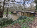
You can park inside the Parc du Vignaud, located at 8, Rue du Moulin in Nieul-sur-l’Autise.
Turn left after the park’s entrance gate, leave the motorhome-only car park on your left, and park just after it on the right or left under the trees.
(S/E) Head towards the far end of the park along the tarmac path, turn left after the Vignaud Visitor Centre building and cross the footbridge over the Autise.
Follow the path running alongside the Autise; further on, ignore the chain-operated ferry on the right which allows you to cross the river and reach the road.
(1) Turn right onto the road and continue straight on to reach the hamlet of Les Vignes. Turn right onto the D104. Follow this road and cross carefully before the bend.
(2) Turn left onto Rue de la Vallée and continue along the track closed to motorised vehicles to reach the end of Chemin du Bois Gazeau in Xanton.
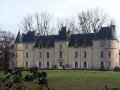
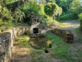
(3) Turn right and follow the D15 with care. (Note the Priory on the right). After the Town Hall, turn right down Rue de l’Église St-Pierre. (Note the wash house)
(4) After the picnic area, Rue de l’Église rejoins Rue Gabriel Marsaud (D15). Turn right onto the footpath, then right again onto Chemin des Villardières, which soon becomes a cycle path.
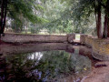
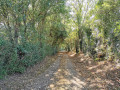
(5) Leave Chemin des Villardières by turning right onto a stony track (sometimes flooded) and head towards the Autise. A small, overhanging path on the left leads to a concrete footbridge crossing the river.
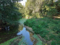
(6) Enter a meadow on the right through a log gate forming a chicane and walk along the left-hand side of the meadow. Pass several chicanes and join a shaded path; at the end of the last meadow, go through the fence to take a track suitable for vehicles that runs alongside the Autise and walk to the hamlet of Denant.
(There may be cows grazing in one of the meadows. Don’t panic – they’re used to seeing walkers, and the route is signposted. Otherwise, see the alternative route suggested in the ‘Practical Information’ section)
(7) Turn left onto Rue de l’Huilerie and, further up, right onto Rue de Maigre Alouette. At the end, turn left to head up Rue de l’Horloge. Continue straight on to the highest point at altitude 37.
(8) Turn right onto the agricultural right-of-way. After a steep climb, continue along a small tarmac road through large agricultural fields, until you reach the village of Nieul-sur-l’Autise.
(Do not take the shortcut on the right as it crosses private property)
(9) Turn right onto Rue de la Croix Perrine.
(10) Carefully follow Rue Olivier Sabouraud (D104) to the right. After the cemetery, at the Y-junction, turn left.
(11) Then immediately turn left onto a path nestled between two drystone walls, known as Les Mottes des Pâtureaux. (In the event of flooding, return to Rue Olivier Sabouraud to reach the car park.) Turn slightly right after the shed and continue along the river to reach the Parc du Vignaud (S/E)

 Association / Club / Walk leader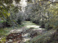

 Easy
Easy  Visorando Member