Forêt de l’Absie and Bois des Gâts

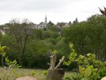
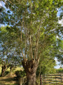
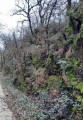
Despite a few sections on small tarmac roads, you’ll enjoy the shade and coolness of this route, which mostly follows paths and sunken lanes through forests of centuries-old trees.

Details

3465254
Creation:
Last update:
Last review:
  • Walking
    Activity: Walking
  • ↔
    Distance: 6.90 mi
  • ◔
    Average duration: 3h 25 
  • ▲
    Difficulty: Moderate

  • ⚐
    Back to start: Yes
  • ↗
    Ascent: + 243 ft
  • ↘
    Descent: - 246 ft

  • ▲
    Highest point: 787 ft
  • ▼
    Lowest point: 574 ft
  • ⚐ Country: France
  • ⚐ City: L'Absie (79240)
  • ⚑
    Start/End: N 46.633991° / W 0.575825°
  • ❏
    IGN map(s): Ref. 1526SB
  • Hour-by-hour weather

Photos

Description of the walk

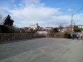
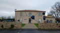
Park at Place de l’Église, opposite the former abbey.

(S/E) Return to the crossroads and take Rue de Plaisance, then turn immediately right onto Rue de l’Audonnerie (GR®364, marked in red and white). Follow the road and, at the Audonnerie crossroads, carry on straight ahead.

(1) Just before reaching the junction with the D136, turn left onto the path leading into the forest (still on theGR®364). Carry on, ignoring the paths branching off to the right and left.

(2) Ignore a final path on the right and, just after crossing the stream (which is often dry), leave theGR® by heading straight up the hill. Ignore the path branching off to the right. Follow the yellow markings.
Join the D179 road, turn right onto it, pass the Grolière junction and continue to the next junction.

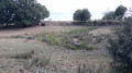
(3) Turn right onto the unpaved track. A little further on, the track is blocked. Take the path on the right. Stay on this path, ignoring the signposts, until you emerge from the forest by crossing the Ruisseau du Moulin. Continue along the path as it begins to curve, passing in front of a reservoir and heading back up to the junction near the hamlet of La Prévézalière. (Note the large granite boulders dotted across the meadows)

(4) Ignore the signposting and turn right onto the road. Further on, enter the Forêt de l’Absie and continue along the road until you come to a path on the left.

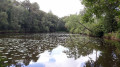
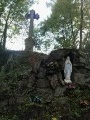
(5) Turn left onto a path which first crosses a conifer plantation before heading deeper into the forest. Walk past a pond and join the D136 road. Cross it (note the memorial stone in the left-hand corner of the junction) then continue straight on for about 200 metres.

(6) Just before the three-way junction, take the path on the right and continue until you reach a small road leading to the village of Le Grand Freigné. (The route is marked in yellow again)

(7) Leave the road in the village and take a path that descends to the left between the houses. A little further on, turn right onto a grassy track. When you reach Petit Freigné, turn right, then left, and then right again towards La Jolinière.

(8) Turn left at the crossroads and join the D136; turn left and then immediately right, and walk carefully along the pavement alongside the 949bis for about 200 m.

(9) Turn right onto Rue de la Bergerie, then enter the Jardin des Abiès park. Head slightly to the right, take the footbridge crossing a small pond and continue to Place de l’Église (S/E).

Waypoints

  1. S/E : mi 0 - alt. 761 ft - Place de l’Église
  2. 1 : mi 0.83 - alt. 686 ft - Take the path on the left before the crossroads
  3. 2 : mi 1.47 - alt. 620 ft - Straight ahead on the yellow-marked path
  4. 3 : mi 2.32 - alt. 610 ft - Dirt track on the right
  5. 4 : mi 3.67 - alt. 636 ft - Turn right onto the road
  6. 5 : mi 4.55 - alt. 640 ft - Path on the left into the forest
  7. 6 : mi 5.01 - alt. 650 ft - Path on the right before the junction of the roads
  8. 7 : mi 5.85 - alt. 689 ft - The village of Grand Freigné
  9. 8 : mi 6.36 - alt. 738 ft - Turn left at the Jolinière junction
  10. 9 : mi 6.64 - alt. 781 ft - On the right: Rue de la Bergerie
  11. S/E : mi 6.9 - alt. 761 ft - Place de l’Église

Notes

This route follows part ofthe GR® 364, marked in red and white, as well as sections of the Circuit des Bois des Hauts de Gâtine (marked in yellow – route description published by the Deux-Sèvres General Council)

This walk does not present any particular difficulties. However, please exercise caution on the sections that follow parts of roads, even though they are very quiet.
Also, be aware of the risk of falling dead branches in the woods in wet and/or windy weather.

Worth a visit

L’Absie, at an altitude of 259 metres, is the highest village in the Deux-Sèvres.

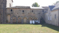
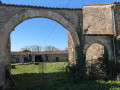
The Royal Abbey of Notre-Dame de l’Absie, whose former monastery dates back to 1120.

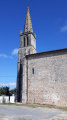
The church as it stands today was altered in thesecond half of the 15th century. It still retains traces of earlier construction phases. It is listed as a historic monument. It is the only surviving structure from this period, alongside the abbey’s chapter house. Of particular note are the murals in the church, which are thought to date from the 15th century.

The villages of Les Freigné appear to have been the first areas of the market town of L’Absie to be inhabited outside the Abbey.

(Source: Hiking guide ‘Route des Bois des Hauts de Gâtine’ published by the Deux-Sèvres General Council)

Always be cautious and plan ahead when you're outdoors. Visorando and the author of this route cannot be held responsible for any accidents occurring on this route.

The GR® and PR® markings are the intellectual property of the Fédération Française de Randonnée Pédestre.

Reviews and comments

4.7 / 5
Based on 2 reviews

Reliability of the description
5 / 5
Ease of following the route
4.5 / 5
Route interest
4.5 / 5
brdeps
brdeps

Overall rating : 4.7 / 5

Date of your route : Jan 05, 2025
Reliability of the description : ★★★★★ Very good
Ease of following the route : ★★★★☆ Good
Route interest : ★★★★★ Very good
Very busy route : No

Great route. There are a few stretches of road, but it’s fine as there isn’t much traffic. However, you normally follow the yellow signposts, except for one point where you need to take the other road. Please correct this if possible.

Machine-translated

philouis
philouis

Overall rating : 4.7 / 5

Date of your route : Sep 03, 2022
Reliability of the description : ★★★★★ Very good
Ease of following the route : ★★★★★ Very good
Route interest : ★★★★☆ Good
Very busy route : No

A lovely walk, mostly in the shade, which takes us through the woods around L’Absie, across the meadows dotted with screes, and, sadly, past streams that have run dry at the end of summer.
I’d highly recommend it.

Machine-translated

Other walks in the area

For more walks, use our search engine .

The GPS track and description are the property of this route's author. Please do not copy them without permission.