The Saumort Valley

This route is a shorter alternative to the ‘Around the Saumort Valley’ route.

Details

n°2619535
Creation:
Last update:
Last review:
  • Walking
    Activity: Walking
  • ↔
    Distance: 6.54 mi
  • ◔
    Average duration: 3h 20 
  • ▲
    Difficulty: Moderate

  • ⚐
    Back to start: Yes
  • ↗
    Ascent: + 354 ft
  • ↘
    Descent: - 325 ft

  • ▲
    Highest point: 413 ft
  • ▼
    Lowest point: 240 ft

Photos

Description of the walk

Start from the car park at Fenioux Town Hall, situated on the right at the roundabout at the entrance to the village when coming from Coulonges-sur-l’Autize.

(S/E) Return to the road and head towards the centre of Fenioux. Cross over to reach the Place de la Bascule opposite. At the top, turn left onto Rue du Calvaire.

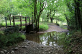
(1) Carry on straight ahead along the D133 until you come to a grassy track on the left after the pond. Take this track and cross the first road. Please note: after heavy rain, this track is completely flooded (see alternative route in ‘Practical Information’).

(2) At the second road, turn left then take the first right. When you reach a small road, pass La Bernadière farm on your right and turn left.

(3) Turn right and, 100 metres further on, turn right again. A little further on, turn left towards the hamlet of Lambert.

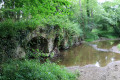
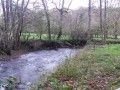
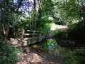
(4) Head down into the hamlet to the right (ruined buildings) to join the path which crosses the Ruisseau du Saumort (Romanesque bridge) and continues alongside the Ruisseau de Brelouze.

(5) Turn right, leaving the stream behind, and continue straight up the hill to take the second path on the left.

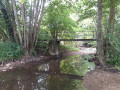
(6) Take the path on the right and walk to the footbridge crossing the Saumort, then continue along the small road.

(7) Carry on along the road as it climbs, ignoring the path leading into the woods on the right.

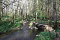
(8) Turn onto the path on the right. Two footbridges allow you to cross the Ruisseau du Plessis. After the stream, the rather muddy path climbs up to La Mingotière and becomes a tarmac road. After 100 metres, turn left, then right onto the D133. Follow it carefully for about a hundred metres and turn left. Follow this winding road carefully until you reach the next junction.

(9) Leave the road and take the path on the right, continuing to the cemetery. Walk along the right-hand side of the cemetery and go down the street to the cross.

(1) When you reach Rue du Calvaire, turn left onto it, then turn right to return to the starting car park (S/E).

Waypoints

  1. S/E : mi 0 - alt. 315 ft - Car park: Place de la Mairie
  2. 1 : mi 0.18 - alt. 348 ft - Crossroads at the end of the circular loop
  3. 2 : mi 1.18 - alt. 361 ft - Junction with the cross-country road
  4. 3 : mi 1.76 - alt. 387 ft - Junction
  5. 4 : mi 2.51 - alt. 259 ft - Lambert hamlet. Towards the - Saumort (rivière) - Affluent de l'Autise
  6. 5 : mi 2.98 - alt. 315 ft - Junction
  7. 6 : mi 3.65 - alt. 322 ft - Junction: Markings cease
  8. 7 : mi 4 - alt. 285 ft - Lunardière, uphill road
  9. 8 : mi 4.58 - alt. 361 ft - Fork in the path
  10. 9 : mi 5.31 - alt. 400 ft - Fork in the path
  11. S/E : mi 6.54 - alt. 315 ft - Car park: Place de la Mairie

Notes

Always wear suitable footwear.
In winter or after heavy rain, avoid the path that leaves the D133 at the start of the route, unless you are wearing wellington boots.
Alternative route: After point (1), continue straight on at the bend towards La Julinière. Turn right after the hamlet to rejoin the route on the path to the left, approximately 300 metres further on.

If you are walking this route with dogs, please take care, as at the entrance to the hamlet of Lambert at point (4), a sign warns walkers that the locals’ dogs may be aggressive towards other dogs.

Worth a visit

(4) The Romanesque bridge at Lambert.
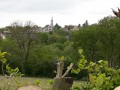
St Peter’s Church and its octagonal bell tower in Fenioux (12th century).
The Hosanna Cross in the cemetery. Standing on its pedestal, this 5-metre-high column commemorates the tradition of Palm Sunday processions. Boxwood is known as ‘Bois d’Hosanne’ in the Gâtine region.

Further information

Reviews and comments

5 / 5
Based on 1 review

Reliability of the description
Not used
Ease of following the route
5 / 5
Route interest
5 / 5
RASSELET
RASSELET

Overall rating : 5 / 5

Date of your route : Jun 10, 2022
Reliability of the description : Not used / Not applicable
Ease of following the route : ★★★★★ Very good
Route interest : ★★★★★ Very good
Very busy route : No

This route isn’t particularly of interest to tourists, but it is a good walk for getting some exercise. We did this walk in June, which is certainly a dry time of year – especially this year – and it’s true that in some places, good, high-top, waterproof shoes are a must.I can therefore confirm the comment in the description advising against visiting during winter or rainy periods. Thanks to Visorando for this useful advice!

Machine-translated

Other walks in the area

For more walks, use our search engine .

The GPS track and description are the property of this route's author. Please do not copy them without permission.