Country:
 City:
City:


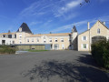
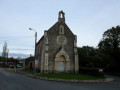
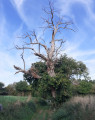
Park on Rue des Écoles, on the outskirts of Cherveux on the D8, between the Protestant church and the sports ground.
Yellow signposting
(S/E) Cross the D8, head back towards Cherveux and turn right at the corner of No. 3 onto the Chemin de la Pingauderie; there is a view of the castle on the left and a family cemetery on the right.
At the end of the path, pass the “Le lavoir de Trousse Chemise” route on your right and turn left towards the village, then right after 100 metres. The long stony path, with your back to the castle, leads you close to the Seneuil farmhouse. Turn right onto the D122 and you’ll soon come to a stony path on the left.
(1) Follow this path and continue straight on; further on, along a grassy track, you’ll notice old, hundred-year-old chestnut trees, then turn left and join the D7. Cross carefully and follow it to the right, facing the traffic.
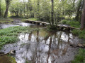
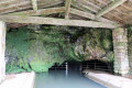
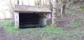
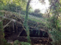
(2) Walk past the Château de la Carte, built in the 15th century, then turn left onto Rue de la Gare. Just past the next bend, on the left below you, you’ll see a covered washhouse and its spring, now overgrown with vegetation. Further on, turn left, then right after the level crossing. Walk alongside the small reservoir on your left, then veer right to go round the Roche Cantin estate. Look out for the bamboo behind a low dry-stone wall, then follow Chemin de Jaunay to the left until you reach the end.
(3) Turn right, then, after 50 metres, left onto a path lined with hedges. After about 500 metres, turn left onto the small Route de Vieilles Vignes. First turn right then left, heading towards Guignefolle. Cross the level crossing, continue straight on along Chemin de la Chevrie and, at the next T-junction, turn right until you reach the D122.
(4) Continue straight ahead with care along the departmental road. A short detour to the right along the D122 allows you to view the Logis des Francs from the outside; it is currently a convalescent home.
After about 300 m, take the sunken track on the right at the bend, known as Chemin des Ramées, the old pilgrims’ route to Santiago de Compostela.
After about 600 m, cross the road and continue straight on along a dirt track; leave this 150 m further on and turn left onto a grassy path, with views of the village and the castle. Continue along the road until you reach thefirst path on the left.
(5) Turn left, pass through the hamlet of Bois Vert and take the path on the left which leads back to Cherveux. At the road, turn right. Cross the D8, then walk alongside the cemetery on your left. Go round the stadium changing rooms and cross the car park towards the exit.
(6) Turn left onto the Chemin de la Gotterie, which is lined with dry-stone walls. Walk past the care home on your left and, after a bend to the left and another to the right, you’ll reach the Grand’Rue. Take this to the left, then turn right onto Rue des Artisans, and turn left onto Place de l’Église, where you’ll have a view of the castle; you can enter the courtyard if the gate is open.
(7) Take the alleyway to the right of the village hall (former market hall), then the Venelle de la Petite Volène, which leads down to the D8 (Rue des Écoles). Turn left and walk back; after 300 metres, you’ll reach the car park behind the Protestant church (S/E).

 Visorando Member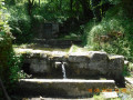
 Moderate
 Association / Club / Walk leader