The Claires Fontaines Trail

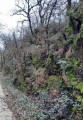
This walk along the banks of the Gâtine, amongst oak, ash and chestnut trees throughout the ‘Vendée’ valley – which at this stage is merely a stream fed by numerous springs – will also treat you, in its second half, to magnificent panoramic views of the bocage.

Details

n°819160
Creation:
Last update:
Last review:
  • Walking
    Activity: Walking
  • ↔
    Distance: 5.84 mi
  • ◔
    Average duration: 2h 50 
  • ▲
    Difficulty: Easy

  • ⚐
    Back to start: Yes
  • ↗
    Ascent: + 213 ft
  • ↘
    Descent: - 217 ft

  • ▲
    Highest point: 443 ft
  • ▼
    Lowest point: 262 ft

Photos

Description of the walk

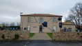
Car park at the Espace Beauchesne multi-purpose hall on Rue de la Mairie, on the right at the entrance to Saint-Hilaire-de-Voust on the D19 when approaching from the south.

(Out and back) Head to the start of the path at the cross. From the road, follow the path to Rue de l’École and turn left.
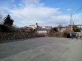
View of the bell tower overlooking the village of Saint-Hilaire.

(1) Turn right after the thuja hedge to enter the sports ground. Walk behind the changing rooms and head for the road opposite. Turn left, then, after 50 m, turn right into the housing estate on Rue du Parquet.
At the end of the street, take the grassy path that starts between two oak trees. Go round the log fence.

Carry on straight ahead, cross the road to reach the street opposite and enter the hamlet of La Maison Neuve.
At the end of the street, go round the house with a canopy over the entrance on the left.

(2) Behind the house, take a path on the left before the small building (this path is not shown on the map) and head down into the woods. Once you reach the river, turn right, leaving the footbridge on your left.

(3) After about 300 m, enter the meadow on the left via a very narrow passage at the foot of a cherry tree. Walk along the edge of the meadow, cross the stream (ford with concrete slabs) and turn left. Follow the edge, keeping to the trees alongside the stream, until you reach the zigzagging gap in the fence which leads to a path through the woods. This section crosses private property. There is no marked path on the maps, but a yellow mark on the trunk of the cherry tree at the entrance to the meadow clearly indicates this direction.

Once on the path, continue straight ahead. A little further on, ignore the path on the left that leads towards the river.
Take in the meandering course of the Vendée river as it winds through the valley. When you reach the road, turn left, cross the bridge over the Vendée (Pont Ricard) and head up the hill.

(4) Turn right at the top of the hill and, when you reach the hamlet of Crépeau, turn right past the house with a veranda and walk through the farmyard.
Continue along the path under the chestnut trees and enter the forest (a short section not marked on maps). When you reach the farm, take the tarmac road to the right and continue for about 800 m.

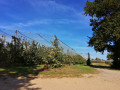
(5) At the top of the hill, turn left and walk for about 1 km to the Hommère farm. A small tarmac road with a grassy central strip. A splendid view of the surrounding countryside.

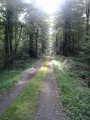
(6) After the farm, at the end of the green wire fence running alongside the road on the right-hand side, take the tree-lined path on the left as it curves round. The path runs through a narrow valley between two hedges, occasionally offering glimpses of a magnificent landscape to the left.

(7) The signposts indicate turning right, which would take you straight back onto the road, depriving you of a pleasant little shaded path. So, turn left and, when you reach the house, veer to the right to go down a small path through the woods to the Route de Barbelay, where you should continue straight on. Once you reach the road at the top of the hill, turn left towards Saint-Hilaire-de-Voust to reach the hamlet of “Le Tudé”.

(8) At the bend, by the electricity pole, turn left onto the grassy path that leads downhill and joins the small road heading towards Le Rocher, which we passed earlier. Carry on straight ahead.

(9) At the D19 county road, turn right and then immediately left at the cross. After the hamlet of La Favrie, turn left, pass the sewage treatment plant and continue to the D49.

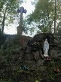
(10) At the road, note the replica of the Grotto of Lourdes opposite, then turn left and cross the Pont Bert.

Then take the first street on the right towards La Jaumarière. After about 150 m, turn left onto the Chemin des Quarante Sous, which joins the Rue de Mairie, opposite the cross, the starting point.

Cross the road to reach the Town Hall car park (S/E).

Waypoints

  1. S/E : mi 0 - alt. 295 ft - Espace Beauchesne car park
  2. 1 : mi 0.3 - alt. 315 ft - Turn right towards the stadium
  3. 2 : mi 0.76 - alt. 295 ft - Path on the left
  4. 3 : mi 0.98 - alt. 285 ft - Narrow passage on the left
  5. 4 : mi 1.9 - alt. 381 ft - Turn right towards Crépeau
  6. 5 : mi 3.01 - alt. 436 ft - To the left
  7. 6 : mi 3.79 - alt. 420 ft - Path on the left
  8. 7 : mi 4.2 - alt. 387 ft - To the left
  9. 8 : mi 4.77 - alt. 305 ft - Path leading down to the left
  10. 9 : mi 4.95 - alt. 279 ft - Turn right, then immediately left
  11. 10 : mi 5.52 - alt. 269 ft - On the left: D49 - Vendée (rivière)
  12. S/E : mi 5.84 - alt. 295 ft - Espace Beauchesne car park

Notes

This route is marked in yellow, but the markings are old and not always visible.
The paths are well maintained, but some sections – such as those crossing meadows or grassy tracks – require waterproof footwear in wet weather.

Worth a visit

- Calvary at the start and finish points.
- Calvary near (9).
- Replica of the Grotto of Massabielle in Lourdes at (10).
- Nearby: the Faymoreau Mining Centre

Reviews and comments

3.3 / 5
Based on 4 reviews

Reliability of the description
3.3 / 5
Ease of following the route
3 / 5
Route interest
3.5 / 5
Gérard Soulard
Gérard Soulard

Overall rating : 3.7 / 5

Date of your route : Apr 27, 2026
Reliability of the description : ★★★★☆ Good
Ease of following the route : ★★★☆☆ Average
Route interest : ★★★★☆ Good
Very busy route : No

The path offers lovely views of the countryside and there are some lovely shaded sections. However, there’s a lot of tarmac towards the end of the route, which is frustrating. We felt that going round the village added nothing. On the other hand, there’s a bar that might be worth a visit on hot days.
We might even consider reversing the circular loop.
Thank you all the same for suggesting this route.

Machine-translated

TINO1779
TINO1779

Overall rating : 4.7 / 5

Date of your route : Feb 08, 2023
Reliability of the description : ★★★★★ Very good
Ease of following the route : ★★★★★ Very good
Route interest : ★★★★☆ Good
Very busy route : No

Hello

A big thank you for this walk.....
It was really lovely and peaceful – the dogs barking in the hamlets, the birdsong, the sound of the wind and the sound of my shoes on the path... That’s all...
Lovely scenery....
The only downside is the signposting; it might be normal at this time of year, but it could do with a bit of a review.
Personally, I use the GPX tracks... so.

Machine-translated

Ericochets
Ericochets

Overall rating : 5 / 5

Date of your route : Mar 14, 2021
Reliability of the description : Not used / Not applicable
Ease of following the route : Not used / Not applicable
Route interest : ★★★★★ Very good
Very busy route : No

We’ve just completed this lovely route, which was easy going as it’s quite well signposted!
It was only when I wanted to post it on Visorando that I realised it already existed...

Machine-translated

jlfaure
jlfaure

Hello,
This walk description has been compiled with the utmost care. (Verified and approved by the site’s moderators.) I have just re-read it and haven’t spotted any errors. However, to improve it further, please could you point out exactly which parts are unclear to you, particularly where there is confusion between right and left.
The route was mapped using Visorando’s GPS tool, then checked and adjusted against the IGN map. (It’s hard to do any better than that…)
There is an information board describing the route at the start, opposite the wayside cross, which, it’s true, isn’t visible from the car park, and the route is signposted in yellow (apart from a small detour at point (7), as specified in the description)
I’m sorry if the description of this route may have misled you, and I’m happy to provide any further details or make any changes that might be useful to future walkers.
Kind regards.

Machine-translated

fbach1
fbach1

Overall rating : 1 / 5

Date of your route : Jul 19, 2019
Reliability of the description : ★☆☆☆☆ Very disappointing
Ease of following the route : ★☆☆☆☆ Very disappointing
Route interest : ★☆☆☆☆ Very disappointing

We’d chosen this walk so we could take our dogs along, but unfortunately the starting point was very difficult to find – there were several roads to cross, and the directions were unclear as the person who suggested the walk mixed up right and left. We managed, as best we could, to follow the path with the help of the map and signposts, though we sometimes had to turn back. In the end, having wasted a lot of time, we crossed a field where it was very difficult to walk rather than following a road...
However, the walk is pleasant in summer as it’s often shaded. The description needs improving.

Machine-translated

Other walks in the area

For more walks, use our search engine .

The GPS track and description are the property of this route's author. Please do not copy them without permission.