Around the Autize via Les Moulières and Tourteron

A route that follows the River Autize, passes near Château des Moulières, then takes a footpath and reaches the village of Tourteron via agricultural tracks. After a detour to the fountain and wash house in Tourteron, the walk continues across the plain dotted with wind turbines, then follows or runs alongside an old railway line, passes under a viaduct and returns along the meadows bordering the Autize to the Moulin de Dray before climbing back up to Saint-Pompain.

Details

24764565
Creation:
Last update:
Last review:
  • Walking
    Activity: Walking
  • ↔
    Distance: 6.67 mi
  • ◔
    Average duration: 3h 25 
  • ▲
    Difficulty: Moderate

  • ⚐
    Back to start: Yes
  • ↗
    Ascent: + 390 ft
  • ↘
    Descent: - 413 ft

  • ▲
    Highest point: 230 ft
  • ▼
    Lowest point: 82 ft

Photos

Description of the walk

Park at Place de l’Espéranto, located on the right as you leave Saint-Pompain after the church, heading towards Coulonges on the D1.

(S/E) Cross the road and head straight towards a wooden barrier. Go through it and descend the path that winds between two low walls to the road. Go through a wooden gate and carefully follow the road on the left-hand side to the bend (note the spring in the embankment).

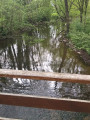
(1) Just before the bridge, go straight on along the path. Follow the Autize to the end of the path, then climb the path that winds up to the left through the woods. Once you reach the flat ground, continue straight on until you reach a crossroads with four paths.

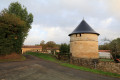
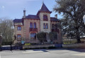
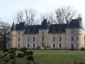
(2) Turn right, walk to the road and take it to the right. Ignore the road leading left towards the tower and the Moulières farm, and continue downhill, keeping to the left of a large retaining wall belonging to the castle grounds. (You can just make out the castle towering above the trees in the background) Pass the old mill, cross the Autize and continue carefully alongthe small road as it climbs.

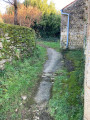
(3) At the bend to the left of the road, turn right onto a path leading towards the meadow (footpath marked by an old wooden sign). Go round the barrier via a zigzag passage on the left and continue along the meadow on a narrow path, sometimes winding between zigzags of wooden stakes. Further on, the path leaves the meadows and climbs through the trees, overlooking the Autize, which can be seen below through lush vegetation. After a small bamboo grove, the path leads to a small trapezoidal wash house fed by an inexhaustible spring (not shown on any map).

(4) Turn left onto a small road and reach the top of the hill, at the crossroads in the hamlet of Rochefort. Continue to the right and reach the start, on the right, on a farm track.

(5) Follow this path and, after crossing the plain between the farmland, the path descends towards the valley, crosses a stream that flows into the Autize and climbs towards Tourteron. When you reach the road, take it to the left and pass in front of the fountain.

(6) Just before the left-hand bend, leave the road and head down a path on the right which joins Impasse de Badorit, passes in front of a covered wash house and climbs towards the T-junction with Rue de Badorit. Turn right onto this street and follow it to the end.

(7) Turn left, then cross the D1 with care and continue straight ahead into Rue de la Pierre Blanche. Go straight on at the next junction (walnut tree) and continue along a small road through the fields.

(8) At the corner of the copse, turn right between the hedges onto the old railway line or, just after that, onto the parallel path running alongside the field. Further on, cross the road and continue along the path opposite until the next fork.

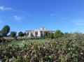
(9) Take the path on the right and cross the bridge over the old railway line. Ignore the path branching off to the right just after and continue to the T-junction at the corner of a vineyard(panoramic view of the village of Saint-Pompain). Turn left to rejoin the old railway line.

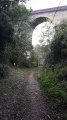
(10) Just before the viaduct, head down to the left onto the steep, winding path through the vegetation to the riverbank (caution! risk of slipping). Pass under the viaduct and continue along the grassy path to the next crossroads.

(11) Turn left, cross the three footbridges over the Autize behind the Moulin de Dray and head up the small road. At the top of the hill, ignore the small road branching off to the left and, 100 m further on, opposite the road leading down to the right towards the Thorange picnic area, turn onto a path climbing to the left. 20 metres further on, ignore the path branching off to the left and join Rue de la Vallée (view of the north façade of the church) to arrive at Place de l’Espéranto (S/E).


Waypoints

  1. S/E : mi 0 - alt. 164 ft - Place de l'Espéranto
  2. 1 : mi 0.15 - alt. 105 ft - Path before the bridge
  3. 2 : mi 0.76 - alt. 197 ft - Crossroads
  4. 3 : mi 1.28 - alt. 98 ft - Footpath on the right
  5. 4 : mi 1.71 - alt. 98 ft - End of the trail after the fountain
  6. 5 : mi 2.05 - alt. 177 ft - Farm track
  7. 6 : mi 3.05 - alt. 180 ft - Junction on the path
  8. 7 : mi 3.26 - alt. 180 ft - Crossroads
  9. 8 : mi 3.85 - alt. 223 ft - Path or old railway track on the right
  10. 9 : mi 4.84 - alt. 197 ft - Junction towards the bridge
  11. 10 : mi 5.3 - alt. 180 ft - Junction on the path
  12. 11 : mi 5.92 - alt. 102 ft - Crossroads
  13. S/E : mi 6.67 - alt. 164 ft - Place de l'Espéranto

Notes

  • At Tourteron, the covered wash house can serve as a shelter.
  • The water flowing from the fountains may not be safe to drink; it is not recommended to drink it.
  • It is always necessary to wear suitable footwear for hiking.
  • One or two walking poles may be necessary for the sections that are sometimes slippery and steep. Between (1) and (2), the path climbs steeply, as does the section descending from the railway line at the foot of the viaduct at (10).

Worth a visit

During this route, you will discover:

  • Moulières Castle and the old mill on the Autize,
  • A small trapezoidal wash house and its fountain (Chemin des Plantes (4)),
  • The village of Tourteron, its bucket pump and its wash houses,
  • The La Roche Viaduct,
  • The Dray Mill, its causeway and bridges.

The name of the river Autize can be spelled with an S or a Z depending on whether you are in the Vendée or Deux-Sèvres department.
This route is not signposted. However, it follows sections of a signposted route (Autize Valley – Tourteron). Please disregard these signs.

Reviews and comments

4.9 / 5
Based on 4 reviews

Reliability of the description
5 / 5
Ease of following the route
5 / 5
Route interest
4.8 / 5
User 21530545

Overall rating : 5 / 5

Date of your route : Jan 13, 2026
Reliability of the description : ★★★★★ Very good
Ease of following the route : ★★★★★ Very good
Route interest : ★★★★★ Very good
Very busy route : No

A very pleasant route with varied landscapes.

Machine-translated

Valouj
Valouj

Overall rating : 5 / 5

Date of your route : Feb 13, 2023
Reliability of the description : ★★★★★ Very good
Ease of following the route : ★★★★★ Very good
Route interest : ★★★★★ Very good
Very busy route : No

A lovely walk... But right at the start of the route, we were stopped by someone who (politely) warned us that we were on private property... There were no signs to that effect... We carried on with our walk... No problem...
However, according to what they said, it’s highly likely that signs will be put up soon... We’ll have to see

Machine-translated

RASSELET
RASSELET

Overall rating : 4.5 / 5

Date of your route : Oct 03, 2022
Reliability of the description : Not used / Not applicable
Ease of following the route : ★★★★★ Very good
Route interest : ★★★★☆ Good
Very busy route : No

Enjoy the walk, but be careful: when the author mentions steep sections, they really are very steep and tricky when the ground is wet from rain or morning dew – you’ll need good shoes! As for the elevation gain, my tracking app shows 168 metres uphill and 177 metres downhill… to be checked.

Machine-translated

jlfaure
jlfaure

Hello,
Thank you for your comment. I also think that 53 m is a bit low. 140 m seems closer to the mark.
Here is a link to a very informative article on "randonnermalin.com", including the comments.

https://www.randonner-malin.com/le-deniv...

Machine-translated

mifo10
mifo10

Overall rating : 5 / 5

Date of your route : Oct 02, 2022
Reliability of the description : ★★★★★ Very good
Ease of following the route : ★★★★★ Very good
Route interest : ★★★★★ Very good
Very busy route : No

Personally, I clocked up 140 metres of elevation gain and loss, but it was a lovely walk with varied scenery. I highly recommend it.

Machine-translated

Other walks in the area

For more walks, use our search engine .

The GPS track and description are the property of this route's author. Please do not copy them without permission.